Country:

 City:
City:


The starting point is in Cuges-les-Pins, at the “Cuges Libération” bus stop, opposite the Tabac Presse.
It can be reached via lines 11 and 11s of the free Pays d’Aubagne et de l’Etoile transport network.
For those travelling by car, there are plenty of parking spaces available in the town centre.
(S) Walk up the street between the Tabac-Presse and the grocery shop towards the fountain (Place de la Libération).
On the left, a plaque commemorates Victor Hugo’s visit in 1839; he dined there with Juliette Drouet, and the menu is listed on the plaque.
A little further on, the street becomes Rue du Docteur A. Gastinel. Pass a street on your left leading towards the church. Carry straight on.
(1) Follow the yellow and red/yellow signposts
Turn right onto Chemin de la Ribassée. There are boules courts on the left.
When you reach Espace Fortuné Jayne, keep right onto Chemin de Sainte Madeleine. Pass Chemin de Sainte Croix on your right. Continue straight ahead. There’s a campsite on your left. Further on, you’ll come to a reservoir. Go round it, keeping to the left.
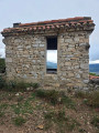
Further on, pass the Dausserand borehole. At a hairpin bend to the right, let a path branch off to the left. Steep climb. After another hairpin bend (to the left), you’ll catch sight of the Pic de Bertagne and its radome (white sphere). Let a path branch off to the right and carry on straight ahead. Ruined hut on the right.
(2) At a hairpin bend to the left, take the path branching off to the right. Reach a track; take it to the right.
(3) Go through a gate and take the track to the left (marker SB105). Ignore a track branching off to the right.
Take a path to the right (still marked yellow and red/yellow). The path crosses the track several times (a shortcut through the fields) and then reaches a junction.
(4) Ignore the track marked SB209 on the right and take the SB105 track straight ahead. Pass under a high-voltage power line. Reach a large crossroads with a water tank.
(5) Cross the track and take the path opposite that leads uphill (towards the Jas de Sylvain). Leave the track marked SB105 on your left. 20 metres after this junction, take a small path, marked on the ground with red and yellow markings, which heads uphill to the right. Please note: the path is also signposted towards Jas de Sylvain. Take the one that climbs to the right.
A little further on, turn right. At a hairpin bend to the right, ignore the path that branches off to the left.
(6) Leave the red and yellow markings here; at the next junction, there are signposts. Follow the signs for “Crêtes de la Sainte Baume – Point 1001 / Col du Saint Pilon”. Continue following the yellow markings until you reach your destination. You’ll pass a small shelter in good condition with a table, a few chairs and a fireplace.
Carry on to the ridge (antennae).
(7) Carry on to the right, along the ridge, on theGR®98, following the white/red markings, until you reach the Chapelle Saint-Pilon.
(8) Turn left (east), following the large cairns to reach the Col du Saint-Pilon, recognisable by its oratory where a bas-relief depicts Mary Magdalene and three figures in a boat.
(9) Take the path on the left which descends along the northern side of the cliff. Here, leave the red/white markings, which continue along the ridge, and follow the yellow markings instead. You will reach the Chapelle des Parisiens.
(10) Continue westwards until you reach a crossroads with a wayside shrine bearing the inscription ‘You are seeking Jesus of Nazareth; the crucified one has risen’.
(11) Keep to the left and immediately you’ll come to a second Fork in the road where you must keep left again and climb a very steep concrete path towards the grotto. A little further on, take the path on the left, which has a handrail. Stairs. A little further up is the gate to the Monastery of the Grotto of Saint Mary Magdalene.
(12) Return via the same route. Go down the steps. Follow the path with the handrail, then turn right as you descend. Take care on the steep concrete descent.
(11) Turn left, towards “Nans Les Pins”. You’ll come to an obelisk.
(13) Carry on straight ahead. Picnic table. Turn right. A little further on, take the small wooden bridge on the left. Walk alongside a large field until you reach a car park.
(14) Beautiful cedar trees. On the left, the terrace bar. The Hostellerie de la Sainte-Baume (E)


 Visorando Member
 Moderate
 Association / Club / Walk leader