The coastline between Six-Fours and Sanary

This easy route will take you to Bonnegrâce Beach and the wild coastline of Sanary, as well as offering a glimpse into the history of this cradle of underwater exploration.

Details

33301904
Creation:
Last update:
Last review:
  • Walking
    Activity: Walking
  • ↔
    Distance: 6.27 mi
  • ◔
    Average duration: 3h 15 
  • ▲
    Difficulty: Moderate

  • ⚐
    Back to start: No
  • ↗
    Ascent: + 453 ft
  • ↘
    Descent: - 374 ft

  • ▲
    Highest point: 135 ft
  • ▼
    Lowest point: 0 ft

Photos

Description of the walk

Head to Six-Fours, Chemin des Hoirs, a small street that starts opposite Port Méditerranée, and park near number 232: there’s a small herringbone-style car park, perfect if you’re travelling in a single car.

(S) Take the path that runs alongside the Ruisseau Le Pontillot (entirely canalised), towards the coast, and emerges near the Chapelle Sainte-Thérèse.

(1) You’ll come out onto the Corniche de Sauviou; cross it and head down towards Port Méditerranée, walk round it and head towards Bonnegrâce Beach.
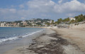
Walk the length of the beach as far as the Reppe estuary, which the Promenade Charles de Gaulle crosses via a bridge.

(2) On the Sanary side, walk past the Comex Diving Tower, painted red, and continue alongside the Sanary market, along the boulevard d’Estienne d’Orves. Walk past a pond in a lovely tree-lined park, and continue towards the harbour.

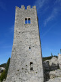
(3) When you reach the end of Quai Charles de Gaulle, join the street and walk past the entrance to the Tour de Sanary; a little further on, turn left onto Rue Lauzet Ainé, walk past the Frédéric Dumas Museum, and carry on towards the harbour. Walk along Quai Wilson, past the shipyard, then along the Corniche des Baux, alongside beautiful buildings set against the cliff.

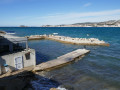
(4) At the end of the Corniche, head down to the left onto the coastal path and follow the rocky coastline to the UCPA boat launch. Carry on straight ahead to find the continuation of the path, which climbs to the top of the cliffs, crosses a rocky cove, runs alongside the UCPA grounds and eventually joins a road; turn left onto this road (Chemin de la Pointe Grise).

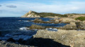
(5) At the end of the street, look for the entrance to a path leading to Pointe Grise (or Pointe de Portissol). Take a stroll around this headland to admire the rugged rocks, then return and head back towards Portissol Beach. Walk down to the beach, pass the cafés and restaurants, and head back up the steps towards Avenue Frédéric Mistral. Follow this avenue to Parc Victorin Blanc, turn left onto Avenue de la Corniche and follow it to the entrance to Cap de la Cride. Cross it via the pedestrian access to the right of the gate, and head straight down towards Fort de la Cride. At the bend in the road, turn left onto the path that winds its way through the ganivelles and leads to the calanque.

(6) Head down towards the small calanque via a small flight of steps. To the east, you can see a distinctive geological formation (a diapir); opposite, you can walk along the rocky promontory, and to the west, you can descend into the small calanque (La Cride beach) to see numerous fossils.
Head back up and continue to the Cride battery, passing the sewage treatment plant. Look out for the cove to the north of the fort, then head back up to find the path leading down to the base of the northern cliff.

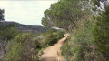
(7) Turn left onto the path that runs along the boundary of the first property and descends towards the rocky coast, almost to sea level. Look for a rather tricky passageway, below a footbridge, which leads to a dilapidated flight of steps climbing up the cliff. The route then continues along the top of the cliff on a narrow path more or less lined with bushes.

(8) The path descends to the bottom of a cove, from where it climbs back up between two walls to join Avenue de Ségur. Follow this road to the left until you come to Allée du Ressac on the left.

(9) Head down Allée du Ressac on the left to enjoy a beautiful view over Baie de la Cousse.
Turn round and continue along Avenue de Ségur, take the first left at the next roundabout, and carry on to Beaucourt Beach. Carry on straight ahead, then turn left onto Avenue Louise, then right onto Avenue du Prado.

(10) Turn left and take a small path leading to the little Port de l’Aricot. Carry on along Avenue du Prado.

(11) When you can see the buildings at Plage de la Gorguette, turn left onto a footpath with a metal railing that leads down to the beach. Take a stroll along the beach, then head back up Chemin de la Plage, followed by Avenue de la Gorguette, which leads onto Route de Bandol. Follow this road south-east to the parallel parking spaces at number 883, just before a swimming pool supplier: there are plenty of parallel parking spaces here, ideal for a car meet-up (E).


Waypoints

  1. S : mi 0 - alt. 13 ft - Chemin des Hoirs
  2. 1 : mi 0.16 - alt. 10 ft - Port Méditerranée
  3. 2 : mi 1.21 - alt. 10 ft - The Comex diving tower
  4. 3 : mi 1.6 - alt. 3 ft - The Tower of Sanary
  5. 4 : mi 2 - alt. 16 ft - Junction with the coastal path
  6. 5 : mi 2.45 - alt. 46 ft - Towards Pointe de Portissol
  7. 6 : mi 3.94 - alt. 49 ft - The diapir at Pointe de la Cride
  8. 7 : mi 4.25 - alt. 52 ft - The coastal path along the cliffs
  9. 8 : mi 4.48 - alt. 13 ft - Exit from the coastal path
  10. 9 : mi 4.75 - alt. 56 ft - Allée du Ressac
  11. 10 : mi 5.76 - alt. 16 ft - The Port de l’Aricot
  12. 11 : mi 5.93 - alt. 52 ft - Descent to the beach
  13. E : mi 6.27 - alt. 92 ft - Route de Bandol

Notes

We did this walk in early April 2023.

There are no technical or physical difficulties. Just make sure you wear suitable footwear for the rocky section after the point (4) (Bau Rouge coast) and, above all, for the coastal stretch between the point (7) and the point (8) (along the cliff face).

Important notes:
- For the Bau Rouge coast, choose a day with few waves, otherwise you risk getting thoroughly soaked. You should also plan your visit for low tide (yes, there is a slight tidal range, with amplitudes between 30 and 50 cm), as at ‘high’ tide the flat area in front of the UCPA jetty may be submerged, forcing you to do a bit of scrambling over the rocks to get across safely. In the event of unfavourable conditions, it is better to take the Les Baux staircase (4) and reach the point (5) via the streets running directly parallel to the coast.
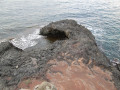
- For the section of the coastal path along the cliff face after point (7), only attempt this if you have no problems with your knees or a fear of heights, as the descent via a dilapidated staircase is somewhat tricky and may be splashed by waves if the sea is a little rough – see the photo – and the path is often narrow and may seem dangerous; a safety line has been installed along part of the route. If you’re worried or conditions are poor, head straight for Avenue de Ségur by exiting the Cap de la Cride enclosure and turning left (the streets are clearly signposted).

It should be noted that a large section of the old coastal path between La Cride and La Gorguette is now impassable or even non-existent, due to a lack of willingness on the part of the local council to maintain it, perhaps also encouraged by a few local residents who are reluctant to share their seafront with walkers...

Apart from Bonnegrâce Beach and the two sections of the coastal path, most of the walk is therefore on paved roads – though there is relatively little motor traffic.

We have opted to suggest a one-way route, with a drop-off at the start and a car pick-up at the finish, but it is possible to make a rewarding return journey through the quiet streets of the peninsula, thereby extending the route by around five kilometres.

Worth a visit

In just a few kilometres, this walk will treat you to some stunning views and plenty to think about.

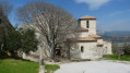
- Starting with the pretty modern chapel dedicated to Saint Thérèse of the Child Jesus, on Chemin des Hoirs.
- The Port Méditerranée, which was recently opened following much controversy.
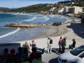
- Bonnegrâce beach: the famous surfing spot nicknamed “Brutal Beach”.
- Sanary market, which has been named the most beautiful market in France (a bit overrated in my opinion, when you consider, amongst others, the markets in Cotignac and Riez...).
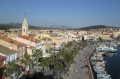
- Sanary harbour and its many ‘pointus’ (traditional fishing boats), each one more colourful than the next.
- Sanary’s seafront, with its shops, church and the colourful buildings along the Corniche des Baux.
- The remnants of the Cousteau era (the Comex turret, the Frédéric Dumas Museum, dedicated to underwater exploration).
- The Marine Archaeology Museum at the Tour de Sanary, and the tower’s upper terrace, which offers a superb panoramic view of the harbour and the town – though this terrace is closed on windy days.
- The Bau Rouge coastline, with its red, orange and ochre sandstone, which displays marine erosion patterns that are as interesting as they are beautiful.
- Pointe Grise, where one can observe structures bearing witness to a major tectonic event.
- The Pointe de la Cride, where, alongside the 19th-century battery and the 21st-century sewage treatment works, you can observe geological curiosities: layers of flint-rich dolomite, upright and folded, intruded into the southern part of the headland by a diapir of fossil-rich gypsum sands.
- And many other things that you’re sure to discover for yourself.

Reviews and comments

3.6 / 5
Based on 4 reviews

Reliability of the description
3.8 / 5
Ease of following the route
3.8 / 5
Route interest
3.3 / 5
guy83'9
guy83'9

Hello, I didn't go on this hike.
Thank you for all these available hikes.
Guy MOREAU

Machine-translated

stjo
stjo

@13sisyphe, could you please specify which sections were closed, and whether this was a temporary closure (due to weather conditions, for example) or a permanent closure (due to a municipal order, for example)?
Thank you in advance.

Machine-translated

13sisyphe
13sisyphe

Overall rating : 2 / 5

Date of your route : Oct 25, 2025
Reliability of the description : ★★☆☆☆ Disappointing
Ease of following the route : ★★☆☆☆ Disappointing
Route interest : ★★☆☆☆ Disappointing
Very busy route : No

Very disappointing hike. All access to the seafront on the Portissol side was closed, so there was too much tarmac. We cut the hike short and returned to the town.

Machine-translated

User 21595273

Overall rating : 4.7 / 5

Date of your route : Aug 22, 2025
Reliability of the description : ★★★★★ Very good
Ease of following the route : ★★★★★ Very good
Route interest : ★★★★☆ Good
Very busy route : No

Accurate description and interesting details

Machine-translated

User 21595273

Overall rating : 4 / 5

Date of your route : Aug 25, 2025
Reliability of the description : ★★★★☆ Good
Ease of following the route : ★★★★☆ Good
Route interest : ★★★★☆ Good
Very busy route : No

Very precise presentation and interesting comments

Machine-translated

naunaudubroussan
naunaudubroussan

Overall rating : 3.7 / 5

Date of your route : May 11, 2023
Reliability of the description : ★★★★☆ Good
Ease of following the route : ★★★★☆ Good
Route interest : ★★★☆☆ Average
Very busy route : Yes

too crowded

Machine-translated

Other walks in the area

For more walks, use our search engine .

The GPS track and description are the property of this route's author. Please do not copy them without permission.