Country:

 City:
City:


The starting point is at the ‘Cuges Libération’ bus stop (line 11) in the town centre (Place de la Libération) in Cuges.
For cars, there is parking available near the town hall.
(S) Leave the D8n and head uphill towards the fountain. Continue along Rue du Docteur A. Gastinel. Passing the church on your left, carry on straight ahead. At the junction, turn right onto Chemin de la Ribassée.
(1) When you reach the Espace Fortuné Jayne, continue along the tarmac road to the right (Chemin de la Sainte Madeleine). Further on, carry straight on, leaving the Chemin de Sainte Croix on your right.
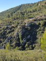
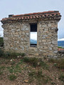
(2) Follow the yellow markings to the water tower. Above the reservoir, take the track leading down to the left. Further on, at the hairpin bend to the right, the track climbs more steeply. A little further on, at the crossroads, carry straight on. On the left, you can see the radome of the Pic de Bertagne radar station, then, on the right, a few terraced fields and the remains of a ruined sheepfold.
(3) At a hairpin bend to the left, turn right onto the path that heads uphill (yellow markings). When you reach a track, turn right. Pass through a gate, come to another track and follow it to the left. The track winds uphill.
(4) At a fork in the road, turn left (yellow and red markings). The track passes under a high-voltage power line. You’ll reach an underground cistern; continue straight ahead, slightly to the right, along the track that climbs up to the Jas de Sylvain.
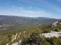
(5) Leave the Jas via the path heading due west. Several paths branch off to the right; keep to the left at all times. Magnificent views over the hills to the south.
(6) You’ll reach a wide track (underground water tank) and follow it to the right. Immediately ignore a path branching off to the left and stay on the track (west-south-west) until you reach a wayside shrine, with the Jas de Micéau below on the left.
(7) Continue along the main track; do not take the track branching off to the right, but turn left instead. Pass under a high-voltage power line and follow the track for a long way as it descends gently.
(8) At the junction with another track, turn right and continue downhill.
(9) At the crossroads, take the track on the left which descends towards the Cuges valley. After a hairpin bend to the right, you’ll reach another junction.
(10) Turn left onto the track leading downhill. Take two hairpin bends, one to the left and then one to the right. Continue downhill and take two more hairpin bends, one to the left and then one to the right. You’ll pass under a high-voltage power line again.
(11) At the crossroads, turn left. Take a right-hand hairpin bend (do not take the path leading off to the left). A little further on, take a left-hand hairpin bend.
(12) At a junction, turn right onto the Traverse de Puyricard. You’ll come to the D8n road, where you’ll find the ‘Le Puits’ bus stop on the right for line 11 (E).

 Visorando Member
 Difficult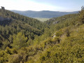
 Association / Club / Walk leader