From Peypin to La Destrousse via the Col du Marseillais

This lovely walk, winding from valley to valley, takes you from Peypin to the Col du Marseillais. Stunning views of Sainte-Victoire, as well as of Roquevaire and the Huveaune valley from the pass. Then the descent back down to the village of La Destrousse.
- The walk is accessible at the start and finish via the free bus network of the Pays d’Aubagne et de l’Etoile (line 17).

Details

32759501
Creation:
Last update:
Last review:
  • Walking
    Activity: Walking
  • ↔
    Distance: 6.20 mi
  • ◔
    Average duration: 4h 00 
  • ▲
    Difficulty: Moderate

  • ⚐
    Back to start: No
  • ↗
    Ascent: + 1,365 ft
  • ↘
    Descent: - 1,680 ft

  • ▲
    Highest point: 1,677 ft
  • ▼
    Lowest point: 633 ft
  • ⚐ Country: France
  • ⚐ City: Peypin (13124)
  • ⚑
    Start: N 43.384858° / E 5.574688°
  • ⚑
    End: N 43.376782° / E 5.603855°
  • Hour-by-hour weather

Description of the walk

The start point is at the “Halte routière” bus stop in Peypin (line 17). Parking nearby.

Markings: yellow, then yellow and red

(S) Head west towards the roundabout. There, head towards Pichauris on the D46a. Follow a path that climbs up the embankment on the left. You’ll come across a track; take it to the left as you climb. At the junction, take the first path on the right. Further on, turn right again, heading downhill towards the cemetery.
At the small hut on the left, turn left immediately afterwards and take the path leading downwards. At the bottom of the valley, avoid a false trail that heads straight on and take the one climbing up to the left.
After crossing the bed of a dry stream, carved out with magnificent little natural pools, leave the path leading uphill on your left and continue following the yellow markings.

(1) You’ll come to a gate. Follow the track climbing up to the left until you reach another gate; go through it and head down the track.

(2) At the crossroads, turn onto the track furthest to the right. Further on, on the left, there’s a lovely view of Sainte-Victoire. Pass a path on the right. You’ll reach a clearing with a house on the left; turn right opposite it.
Turn right in front of a water tank marked 305 and turn left just past it. The path climbs and passes some concrete picnic tables.

(3) At the pass with a ruined house, turn immediately right onto the path climbing to the right. Join a track at a hairpin bend. Take it to the right as it climbs. Pass through a gate and under a high-voltage power line. Ignore a track climbing up from the right.

Unmarked

(4) At a fork in the road, turn left. Stunning view of Sainte Victoire. Stay on the track.

Yellow markings, then yellow and red

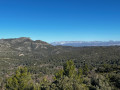
(5) At the Col du Marseillais, panoramic views of Roquevaire and the Huveaune valley to the south-west. Further on, pass by a water tank marked 73. At the Fork in the road, turn right.

(6) Further on, in a right-hand bend, there is a small cairn on the left, marked ‘Vallon de Pieresca’. Take the path leading down to the left. At the crossroads, turn right. At the next junction, turn right again onto a steep, slippery descent over scree. You’ll reach a hairpin bend; follow it down to the left.

(7) When you reach a point where a track climbs up to the right towards Roquevaire, leave it and continue towards La Destrousse. A little further on, on the left, you’ll see a chain and a track leading down; leave this and continue straight on.

Blue markings

(8) At a right-hand bend, take a path leading down to the left. Further on, take the track on the right, then follow the track opposite. At the junction, turn right and pass a dead-end track on the right. Turn left at the next junction onto the road that climbs steeply.

Yellow markings

(9) At the top of the hill, turn right, then turn right at the junction.

No markings

(10) A little further on, turn left onto Rue Le Deven until you reach the D7. Turn right. The bus stop for Peypin is on the left a few dozen metres away. The bus stop for Souque Nègre is a little further down, after the roundabout.

(E) Le Panorama bus stop (La Destrousse).
Car park nearby.

Waypoints

  1. S : mi 0 - alt. 961 ft - ‘Halte Routière de Peypin’ bus stop
  2. 1 : mi 0.96 - alt. 1,070 ft - La Rouvière
  3. 2 : mi 1.38 - alt. 1,106 ft - Cride crossroads
  4. 3 : mi 2.31 - alt. 1,273 ft - Col de la Maison en Ruines
  5. 4 : mi 2.8 - alt. 1,660 ft - Fork in the road
  6. 5 : mi 3.12 - alt. 1,558 ft - Col du Marseillais (479m)
  7. 6 : mi 3.67 - alt. 1,388 ft - Cairn towards the Pieresca valley
  8. 7 : mi 4.2 - alt. 1,004 ft - Roquevaire – La Destrousse junction
  9. 8 : mi 4.44 - alt. 945 ft - Leave the track
  10. 9 : mi 5.41 - alt. 823 ft - Pierrasca
  11. 10 : mi 5.73 - alt. 840 ft - Rue Le Deven
  12. E : mi 6.2 - alt. 633 ft - Le Panorama bus stop. Near the - Merlançon (ruisseau) 2 - Affluent de l'Huveaune

Notes

From 1 June to 30 September, access to the woodland areas is restricted. Please check the Prefecture’s website: (https://www.bouches-du-rhone.gouv.fr/Act...).
No water along the route.
Beautiful views of Sainte-Victoire.
The descent can be steep and slippery in places. Please take care.

Reviews and comments

4.3 / 5
Based on 3 reviews

Reliability of the description
4 / 5
Ease of following the route
4.7 / 5
Route interest
4.3 / 5
paulroyet
paulroyet

Overall rating : 4.3 / 5

Date of your route : Mar 26, 2026
Reliability of the description : ★★★★☆ Good
Ease of following the route : ★★★★★ Very good
Route interest : ★★★★☆ Good
Very busy route : No

Please note that the car park mentioned in Peypin (the start of the walk) is free for two hours only. However, there are free parking spaces with no time limit a little further on.

Machine-translated

User 2311939

Overall rating : 4 / 5

Date of your route : Mar 26, 2026
Reliability of the description : ★★★★☆ Good
Ease of following the route : ★★★★☆ Good
Route interest : ★★★★☆ Good
Very busy route : No

We did this hike on a day when the mistral was blowing really hard – it really ruffled our hair!!! The vegetation was in full bloom – thyme, orchids, wild irises – and there were some lovely stretches along streams swollen by the rain from the previous weeks.

Machine-translated

Dominique Rollin
Dominique Rollin

Overall rating : 4.7 / 5

Date of your route : Sep 20, 2025
Reliability of the description : ★★★★☆ Good
Ease of following the route : ★★★★★ Very good
Route interest : ★★★★★ Very good
Very busy route : No

Enjoy your hike exploring the Peypin countryside

Machine-translated

Other walks in the area

For more walks, use our search engine .

The GPS track and description are the property of this route's author. Please do not copy them without permission.