


Refine your search for walks in Bourmont
Bourmont walks


 La Bove and La Cona
 Visorando Member
 6.84 mi
 +594 ft
 -597 ft
 3h 40
3h 40
 Moderate
 Departure from Bourmont (Haute-Marne)
Starting from Bourmont, a charming little village in the Haut-Marne region, you’ll go on a short walk through the surrounding forest.
Between Millières and Esnouveaux via Le Raillemont
 7.01 mi
+528 ft
-518 ft
3h 40
Moderate
Departure from Millières (Haute-Marne) (Haute-Marne)
7.01 mi
+528 ft
-518 ft
3h 40
Moderate
Departure from Millières (Haute-Marne) (Haute-Marne)
Discover part of the Langres plateau and the Rognon valley. A route through woods and meadows.
The Route des Moines through the Morimond Forest
6.00 mi
+279 ft
-279 ft
3h 00
 Easy
Departure from Parnoy-en-Bassigny (Haute-Marne)
Easy
Departure from Parnoy-en-Bassigny (Haute-Marne)
A pleasant walk around the site of the former Morimond Abbey and through the woods of the same name. Morimond Abbey, a Cistercian abbey founded in 1115, is the mother house of more than seven hundred monasteries for men and women in France and Europe. The route also takes you past the Morimond Lakes, a series of artificial lakes created by the Cistercian monks to supply water to the abbey’s various outbuildings: gardens, mills, sawmill, nail-making workshop, and so on.
The meanders of the Mouzon
 10.34 mi
+1,191 ft
-1,181 ft
5h 50
Moderate
Departure from Rebeuville (Vosges)
10.34 mi
+1,191 ft
-1,181 ft
5h 50
Moderate
Departure from Rebeuville (Vosges)
A lovely walk, offering remarkable views over the Mouzon valley.
The route is straightforward for the majority of the walk.
The only slightly technical sections requiring your attention are:
- Near the landmark (3), the stony descent towards the Grotte de l’Enfer,
- After the waypoint (8), the descent down the rudimentary staircase, facing the drop, is a little dizzying.
Le Cul du Cerf, starting from Orquevaux
5.40 mi
+364 ft
-364 ft
2h 50
Moderate
Departure from Orquevaux (Haute-Marne)
A route that takes you to the Cul du Cerf, a limestone cirque 200 metres wide and 65 metres high, at the bottom of which flows the underground spring known as La Manoise. A Natura 2000-listed site notable for its flora, where you can admire the spring gushing from the ground, protected by a metal grille. A fairly technical route with some difficulties due to the nature of the terrain.
In the footsteps of the past in Bulgnéville
 Tourist office
 7.27 mi
+607 ft
-587 ft
3h 50
Moderate
Departure from Bulgnéville (Vosges)
7.27 mi
+607 ft
-587 ft
3h 50
Moderate
Departure from Bulgnéville (Vosges)
A route linking Bulgnéville to Lake Conge in Saulxures-les-Bulgnéville, mainly through woodland and of a manageable length.
The Three Lakes Trail in Bulgnéville
 11.75 mi
+853 ft
-830 ft
6h 10
Moderate
Departure from Bulgnéville (Vosges)
11.75 mi
+853 ft
-830 ft
6h 10
Moderate
Departure from Bulgnéville (Vosges)
The longest of the routes starting from Bulgnéville is ideal for those who enjoy a slightly more challenging walk, but it’s a real treat for the eyes, with its lush greenery and lakes.
Route longue autour des deux lacs à Bulgnéville
 8.06 mi
+607 ft
-581 ft
4h 15
Moderate
Departure from Bulgnéville (Vosges)
8.06 mi
+607 ft
-581 ft
4h 15
Moderate
Departure from Bulgnéville (Vosges)
A fairly easy, tree-lined route between two towns renowned for their lakes.
 From Neufchâteau station to the Citadel of Langres (Navarre campsite)
53.87 mi
+1,732 ft
-1,145 ft
8 hrs
 Difficult
Departure from Neufchâteau (Vosges)
Difficult
Departure from Neufchâteau (Vosges)
This stage follows the southern part of the Eurovélo 19 "La Meuse à vélo" route (1,050 km from Langres to Rotterdam). From Neufchâteau, we follow the meandering Mouzon, a tributary of the Meuse. We then leave it behind, taking less travelled but more direct roads that avoid the meanders of the Meuse. We rejoin the EV19 just before the "Source de la Meuse" site, on the Langres plateau crossed by three watersheds. With the plateau reaching a height of 450 m, the gradients are not significant, but on arrival, you will need to make a little effort to climb the promontory on which the Citadel of Langres is perched. Your reward: a splendid view at dusk!
Les Balcons de la Folie in Contrexéville
 3.10 mi
+289 ft
-289 ft
1h 40
Easy
Departure from Contrexéville (Vosges)
3.10 mi
+289 ft
-289 ft
1h 40
Easy
Departure from Contrexéville (Vosges)
Suitable for everyone, this route will allow you to discover the diversity of the landscapes and the rich variety of flora and fauna found in the aquatic and woodland environments.
Vair and the Roman Road in Contrexéville
 6.48 mi
+364 ft
-354 ft
3h 20
Moderate
Departure from Contrexéville (Vosges)
6.48 mi
+364 ft
-354 ft
3h 20
Moderate
Departure from Contrexéville (Vosges)
A lovely walk through varied landscapes (lakeshore, forest, countryside, town), where you can discover a rich heritage: there’s something for everyone!
Between forests and thermal spas in Contrexéville
 9.31 mi
+666 ft
-646 ft
4h 50
Difficult
Departure from Contrexéville (Vosges)
9.31 mi
+666 ft
-646 ft
4h 50
Difficult
Departure from Contrexéville (Vosges)
With a variety of landscapes and natural environments, a rich heritage and a dip to cool off after your walk, here’s what’s in store on this lovely hike!
The Lakes Trail in the Park: from Contrexéville to Vittel
 3.77 mi
+249 ft
-243 ft
1h 55
Easy
Departure from Contrexéville (Vosges)
3.77 mi
+249 ft
-243 ft
1h 55
Easy
Departure from Contrexéville (Vosges)
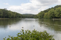
A trail linking the two spa towns, accessible to all, on foot or by bike.
Notre-Dame-de-Bon-Secours in Châtenois
 7.89 mi
+640 ft
-633 ft
4h 10
Moderate
Departure from Châtenois (Vosges) (Vosges)
7.89 mi
+640 ft
-633 ft
4h 10
Moderate
Departure from Châtenois (Vosges) (Vosges)
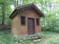
Club Vosgien route where you will see crosses and calvaries, an altarpiece, a chapel, a church and an ancient Roman road, through the shimmering countryside and deciduous woods.
The Vivier hillside at Andelot
 2.28 mi
+144 ft
-128 ft
1h 10
Easy
Departure from Andelot-Blancheville (Haute-Marne)
2.28 mi
+144 ft
-128 ft
1h 10
Easy
Departure from Andelot-Blancheville (Haute-Marne)
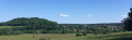
A short, easy walk with views of Andelot, Montéclair and the Fouillot hill that hides Rimaucourt. You can also see the Moulin district and its very old Tréfilerie factory.
Morizécourt - Bourbonne-les-Bains
14.52 mi
+377 ft
-804 ft
7h 00
Difficult
Departure from Morizécourt (Vosges)
A route showcasing the transition in landscapes and architecture between the Vosges and the Haute-Marne.
From the Joan of Arc Basilica to Les Faux
 13.41 mi
+997 ft
-1,014 ft
7h 00
Difficult
Departure from Domrémy-la-Pucelle (Vosges)
13.41 mi
+997 ft
-1,014 ft
7h 00
Difficult
Departure from Domrémy-la-Pucelle (Vosges)
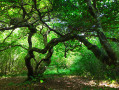
A rich and varied route, starting from the Joan of Arc Basilica, taking you to see the strange, twisted beech trees of Sionne (much less famous, and therefore less popular than the Faux de Verzy), through beautiful, unspoilt forests and a few pastures, to discover a well-hidden dolmen. The tour concludes with a visit to Domrémy-la-Pucelle.
Saprée Vadrouille in the land of Joan of Arc in Domrémy-la-Pucelle
 Association / Club / Walk leader
 6.53 mi
+636 ft
-614 ft
3h 35
Moderate
Departure from Domrémy-la-Pucelle (Vosges)
6.53 mi
+636 ft
-614 ft
3h 35
Moderate
Departure from Domrémy-la-Pucelle (Vosges)
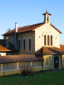
With the Jubilee Year of Hope, since November 2024, our Catholic Church in the Vosges has developed a proposal: "Saprée Vadrouille, travel journal for paths of hope", with three issues per year focusing on liturgical times and the saints of the Vosges.Several itineraries are proposed in the Vosges as local pilgrimages and paths of hope. This is an opportunity to rediscover our region and our local saints throughout the Vosges department. Each itinerary can be done independently of the others, at any time of year. "Dans le pays de Jeanne" (In the Land of Joan) is the itinerary proposed in the second issue of "Saprée Vadrouille", which you can discover here.