


Refine your search for walks in Bourganeuf
Bourganeuf walks


 The Bois des Bœufs route in Bourganeuf
 Tourist office
 8.67 mi
 +794 ft
 -804 ft
 4h 40
4h 40
 Moderate
 Departure from Bourganeuf (Creuse)
Starting from the medieval town of Bourganeuf, this route immerses you in a haven of countryside. Between the murmur of the Mourne waterfalls and the rocky panorama of the Roches de Mazuras, you’ll pass through a sanctuary of greenery where time seems to have stood still.
Route No. 45: Le Bois des Bœufs.
The Gorges du Verger in Bourganeuf
 3.47 mi
+433 ft
-433 ft
2h 00
3.47 mi
+433 ft
-433 ft
2h 00
 Easy
Departure from Bourganeuf (Creuse)
Easy
Departure from Bourganeuf (Creuse)
The unmissable walk in Bourganeuf, featuring gorges, a rushing stream and exceptional views of the medieval town. In short, an absolute must to discover the rich natural and architectural heritage of this town founded by the Knights Hospitaller inthe 12th century.
Along the Mourne to the Roches Mazuras
 Visorando Member
 7.40 mi
+712 ft
-696 ft
4h 00
Moderate
Departure from Bourganeuf (Creuse)
7.40 mi
+712 ft
-696 ft
4h 00
Moderate
Departure from Bourganeuf (Creuse)
The first part of the circuit takes you along La Mourne, a lively little river with numerous waterfalls and cascades. The second part takes you through the Faux-Mazuras forest, and the third part finally takes you to the top of the Roches Mazuras, in a corner of moorland, where you can enjoy unobstructed views.
Mont de Transet and La Chaise à Thauron
 3.22 mi
+305 ft
-299 ft
1h 45
Easy
Departure from Thauron (Creuse)
3.22 mi
+305 ft
-299 ft
1h 45
Easy
Departure from Thauron (Creuse)
This 5 km route, which links two villages, mainly follows very old rural paths, cleaned by volunteers from the Pierres et Nature de Thauron association: two recent forest tracks, created for the exploitation of conifer plantations, and a tarmaced communal road, which has a long history.
Through the Thaurion Gorges
 4.27 mi
+577 ft
-577 ft
2h 30
Easy
Departure from Thauron (Creuse)
4.27 mi
+577 ft
-577 ft
2h 30
Easy
Departure from Thauron (Creuse)
Starting from Thauron, this is an easy walk that takes you along a small section of the magnificent Thaurion Gorges, then into the countryside.
Circular loop from Saint-Pardoux-Morterolles to the Augerolles waterfalls
 10.06 mi
+1,453 ft
-1,470 ft
5h 55
Moderate
Departure from Saint-Pardoux-Morterolles (Creuse)
10.06 mi
+1,453 ft
-1,470 ft
5h 55
Moderate
Departure from Saint-Pardoux-Morterolles (Creuse)
A circular route starting from Saint-Pardoux-Morterolles that also allows you to discover the Cascades d'Augerolles site. This hike passes through meadows, woods, forests and the areas around the waterfalls. A few panoramic views, streams and a plank bridge complete the picture. It should be noted that the roads, where there are any, are forest roads, some paved and some unpaved, but in any case very little used.
Along the Béraude via La Roche Branlante
 12.87 mi
+1,204 ft
-1,217 ft
7h 00
12.87 mi
+1,204 ft
-1,217 ft
7h 00
 Difficult
Departure from Saint-Pierre-Chérignat (Creuse)
Difficult
Departure from Saint-Pierre-Chérignat (Creuse)
Explore the banks of the Béraude, a little-known river. This walk also takes you through the Epagne Forest, a listed site with soil that is unique to the region. Almost at the end of the route, the Roche Branlante, once again by the water’s edge, will amaze many.
In the footsteps of Martin Nadaud
 5.82 mi
+876 ft
-856 ft
3h 25
Moderate
Departure from Soubrebost (Creuse)
5.82 mi
+876 ft
-856 ft
3h 25
Moderate
Departure from Soubrebost (Creuse)
Starting from the Martinèche car park, Martin Nadaud, the most famous mason in the Creuse, invites you to follow the paths of his childhood to discover the built and natural heritage of the commune of Soubrebost in half a day.
The Champs de Pierres and Augerolles waterfalls
 1.81 mi
+299 ft
-318 ft
1h 05
Moderate
Departure from Saint-Pardoux-Morterolles (Creuse)
1.81 mi
+299 ft
-318 ft
1h 05
Moderate
Departure from Saint-Pardoux-Morterolles (Creuse)
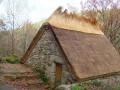
At the edge of the Millevaches plateau, set off on a walk, accompanied by information panels, to explore a listed natural site covering 50 hectares.
The Poirier Waterfall
 6.09 mi
+446 ft
-440 ft
3h 10
Easy
Departure from Saint-Hilaire-le-Château (Creuse)
6.09 mi
+446 ft
-440 ft
3h 10
Easy
Departure from Saint-Hilaire-le-Château (Creuse)
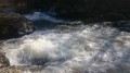
This is an opportunity to discover a rather secret path leading to the impressive Poirier Waterfall. Here, the Thaurion becomes a bubbling river that bounces off large granite boulders. This walk will also take you across two footbridges over the Thaurion, between twin ponds, along paths through woods and undergrowth, and across meadows.
Les trois puys de Villard
 6.06 mi
+407 ft
-407 ft
3h 10
Easy
Departure from Janaillat (Creuse)
6.06 mi
+407 ft
-407 ft
3h 10
Easy
Departure from Janaillat (Creuse)
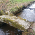
Les paysages sur la vallée de la Creuse sont stupéfiants et variés. Vous verrez des cours d'eau, des forêts, le Moulin de Villard qui fonctionne encore, des vielles maison et des vaches (en saison). Bref un condensé de Creuse en une seule randonnée.
Route des Bordes
 6.69 mi
+988 ft
-958 ft
3h 55
Moderate
Departure from Royère-de-Vassivière (Creuse)
6.69 mi
+988 ft
-958 ft
3h 55
Moderate
Departure from Royère-de-Vassivière (Creuse)
The Bordes route offers typical landscapes as well as varied panoramic views of the Limousin countryside.
Haute Faye route
 5.91 mi
+827 ft
-823 ft
3h 25
Moderate
Departure from Royère-de-Vassivière (Creuse)
5.91 mi
+827 ft
-823 ft
3h 25
Moderate
Departure from Royère-de-Vassivière (Creuse)
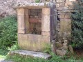
Discover the local heritage (crosses, fountains, wells...) and the skills of our ancestors.
Rigole du Diable and the Mazure moors
7.40 mi
+558 ft
-548 ft
3h 55
Moderate
Departure from Royère-de-Vassivière (Creuse)
A very beautiful walk combining three circular loops and offering a wide variety of landscapes: gorges and rocky outcrops along the Rigole du Diable, followed by peat bogs, superb heather moors, wet meadows, and undergrowth of fir or deciduous trees of various species.
the Devil’s Channel
 1.82 mi
+246 ft
-236 ft
1h 05
Easy
Departure from Royère-de-Vassivière (Creuse)
1.82 mi
+246 ft
-236 ft
1h 05
Easy
Departure from Royère-de-Vassivière (Creuse)
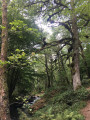
A fairly family-friendly hike. The outward journey is downhill along a bucolic stream, through a lush, almost tropical deciduous forest. The return is more austere, through a mysterious, moss-covered coniferous forest.
Maquis of the Bois du Thouraud in Maisonnisses
 5.95 mi
+630 ft
-650 ft
3h 15
Easy
Departure from Maisonnisses (Creuse)
5.95 mi
+630 ft
-650 ft
3h 15
Easy
Departure from Maisonnisses (Creuse)
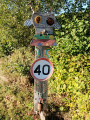
A pleasant little commemorative walk starting from Les Châtres or Maisonnisses, exploring the Bois du Thouraud and the site of the first Creuse maquis, in memory of the maquisards who fell on 7 September 1943, and the upper reaches of the Gartempe near its source, the Pierre Fade.
Route des Deux Digues (Saint-Martin route)
 5.88 mi
+459 ft
-446 ft
3h 05
Moderate
Departure from Royère-de-Vassivière (Creuse)
5.88 mi
+459 ft
-446 ft
3h 05
Moderate
Departure from Royère-de-Vassivière (Creuse)
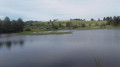
The embankments and the beautiful view of the lake, the sweeping landscapes beyond Le Chataignoux, the lovely rows of trees, the walk around Peu de Vaux, and the arrival at Auchaise are all delightful surprises on this walk near Lake Vassivière.
Route of the two dykes at Vassivière
 4.35 mi
+417 ft
-413 ft
2h 20
Easy
Departure from Royère-de-Vassivière (Creuse)
4.35 mi
+417 ft
-413 ft
2h 20
Easy
Departure from Royère-de-Vassivière (Creuse)
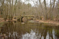
The dam is complemented by the Auchaise dyke, which seals off a depression in the ground on the right bank about 400m from the main structure. This reservoir also receives water diverted from the upper basins of the Taurion (La Vaud-Gelade), Vienne, Dorat and Chandouille (Faux-la-Montagne) rivers.
The Auchaise and Auphèle embankments
3.05 mi
+315 ft
-331 ft
1h 40
Easy
Departure from Royère-de-Vassivière (Creuse)
A short walk that takes you up to a slight elevation as you pass through the hamlet of Auchaise, with its traditional houses, before descending to the lakeside, crossing its two embankments, and then heading down to the foot of the dam on the Maulde.
Route around Lake Vassivière
 23.57 mi
+1,280 ft
-1,286 ft
2 days
Moderate
Departure from Royère-de-Vassivière (Creuse)
23.57 mi
+1,280 ft
-1,286 ft
2 days
Moderate
Departure from Royère-de-Vassivière (Creuse)
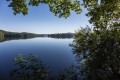
This two-stage route of 2 x 18 km will take you on a journey of discovery around one of the largest artificial lakes in France.
You can expect to see mid-mountain landscapes, varied vegetation including fir forests, moors and peat bogs, and wild flora and fauna on this tour of Lake Vassivière, commonly known as "Little Canada".
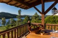
The highlight of the route: a stopover at the Pourvoirie du Lac stopover lodge (accommodation, breakfast and dinner with a panoramic view of the lake).
From the Vassivière Dam to Nergout
 11.99 mi
+614 ft
-551 ft
6h 05
Moderate
Departure from Royère-de-Vassivière (Creuse)
11.99 mi
+614 ft
-551 ft
6h 05
Moderate
Departure from Royère-de-Vassivière (Creuse)
This first stage takes you through unspoilt countryside, with a route that is both wild and surprising.
The Thaurion Valley
 8.57 mi
+692 ft
-676 ft
4h 35
Moderate
Departure from Royère-de-Vassivière (Creuse)
8.57 mi
+692 ft
-676 ft
4h 35
Moderate
Departure from Royère-de-Vassivière (Creuse)
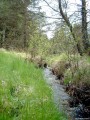
The Rigole du Diable is a picturesque site situated in the upper Thaurion valley. This site is a Natura 2000 site and is listed in the ZNIEFF inventory. The Rigole du Diable and its tributary are strewn with pebbles and boulders. Here you’ll find the unusual Rocher du Diable near the old Planchette mill. Legendary stones are common in Limousin. These strangely shaped boulders, formed by the erosion of exposed granite, have often captured the imagination of local people.
Route des 7 Peux
 7.98 mi
+538 ft
-538 ft
4h 10
Moderate
Departure from Royère-de-Vassivière (Creuse)
7.98 mi
+538 ft
-538 ft
4h 10
Moderate
Departure from Royère-de-Vassivière (Creuse)
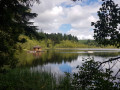
The village of Royère-de-Vassivière was established on a strategic pass on the Millevaches plateau, at the crossing point of a prehistoric ridge path. The ridge paths (or pouges) allowed people to travel long distances. They favoured the granite peaks of the rounded hills, called Puy or Peux, and avoided the damp, peaty valley bottoms that only cattle frequented.
Masgrangeas Wood and Chassagnas Peninsula
7.97 mi
+761 ft
-781 ft
4h 20
Moderate
Departure from Royère-de-Vassivière (Creuse)
A walk on the Millevaches Plateau, mainly through woodland, passing through the pretty hamlet of Masgrangeas. After a circular route through the Bois de la Roche, the route continues with a circular route around the Chassagnas Peninsula, along Lake Vassivière, then a walk around the small Île de Vauveix.
Route des Tourbières - Vassivière
 8.83 mi
+837 ft
-843 ft
4h 45
Moderate
Departure from Royère-de-Vassivière (Creuse)
8.83 mi
+837 ft
-843 ft
4h 45
Moderate
Departure from Royère-de-Vassivière (Creuse)
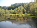
Peat bogs develop in granite basins called alveoli, where the acidic, poor soil provides favourable conditions for their growth. These fragile environments are home to a specific flora composed of very particular primitive plants: sphagnum mosses. The different stages are visible here: low marshes covered with quaking bogs, active raised bogs, and peat heaths bordered by willows and birches.
The Chassagnas Peninsula on Lake Vassivière
 4.49 mi
+364 ft
-371 ft
2h 25
Easy
Departure from Royère-de-Vassivière (Creuse)
4.49 mi
+364 ft
-371 ft
2h 25
Easy
Departure from Royère-de-Vassivière (Creuse)
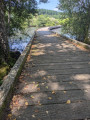
Chassagnas, of Latin origin, Cassania or Gallic Cassanus, refers to the oak tree. Chassagnas consists of a wooded slope down to the edge of Lake Vassivière and a partially cleared summit offering a 180° view of the lake.The Chassagnas peninsula, jutting out into the heart of Lake Vassivière, forms the boundary between Creuse and Haute-Vienne. Together with its twin, the Puy du Rocher, which overlooks Vauveix, it acts as a barrier between the lake's two main bays.
Circular route via the Puy de la Croix and Royère
8.17 mi
+663 ft
-653 ft
4h 20
Moderate
Departure from Royère-de-Vassivière (Creuse)
A walk starting from Lake Vassivière offering a variety of landscapes: the lake shore, heathland with heather or ferns, mixed woodland, pastures with Limousin cattle, peat bogs, and numerous ponds.
Le Puy de la Croix
1.39 mi
+194 ft
-194 ft
0h 50
Easy
Departure from Royère-de-Vassivière (Creuse)
A pleasant walk on the Puy de la Croix, which overlooks Lake Vassivière, along beautiful paths through heathland covered in heather and gorse (which flower in late summer), passing by the Puy de la Croix viewpoint and then along the lake’s shore.