


Refine your search for walks in Barjon
Barjon walks
 Crossing the Mont de l'Échelle and Bonière State Forests
 Visorando Member
 9.74 mi
 +912 ft
 -1,188 ft
 5h 15
 Moderate
 Departure from Avot (Côte-d'Or)
This is the first of eight stages in the Côte d’Or valleys on the Mediterranean side of the Atlantic/Mediterranean watershed. We set off from the entrance to the Forêts National Park and then cross the Mont de l’Échelle and Bonière State Forests. We then emerge onto a path jutting out above the Ignon valley. The heritage sites include wash houses, hemp retting pits, wells and a communal oven converted into a shelter.
Salives, medieval town
 7.39 mi
+840 ft
-853 ft
4h 10
Moderate
Departure from Salives (Côte-d'Or)
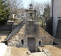
Salives, a must-see medieval village in Côte d'Or: its ramparts, its keep, the heraldic route recounting the medieval life of the village, and its wash house with the main source of the Tille river under the church. This route also takes in Barjon Castle and Saint-Frodulphe Chapel. A little further on, there is a mill with a water wheel that is still in working order. Also worth seeing in Le Meix are the wash house beneath the town hall and the château.
The Maquis Trail in Avot
 Local authority
 8.14 mi
+1,093 ft
-1,079 ft
4h 40
Moderate
Departure from Avot (Côte-d'Or)
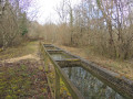
Starting from Avot, this walk takes you in the footsteps of the Maquis Lucius and the local Resistance during the Second World War. Taking in forest tracks, a section of the GR®7, rural heritage and rolling countryside, the route passes several sites linked to the history of the Maquis: a former command post, an equipment depot and a parachute drop zone known as ‘Sacristie’. The route also passes through Avelanges before returning to Avot, offering a beautiful view of the village at the end of the walk.
Path from En Nachot to Avot
 5.88 mi
+692 ft
-709 ft
3h 20
 Easy
Departure from Avot (Côte-d'Or)
Starting from the central square of the village of Avot, where the statue of Diana the Huntress (1837) stands, the En Nachot footpath takes you through part of the village. Here you can admire examples of architectural heritage (a house and its leat on the River Tille) and industrial heritage (the chimney of the old sawmill) before winding your way along the northern slope of the Nachot woodland. This forest, situated on the hill overlooking the village, offers the chance to discover some remains of the old game reserve and to find a few mushrooms in season.
Circular route between Avot and Salives
 14.06 mi
+1,404 ft
-1,398 ft
7h 40
 Difficult
Departure from Avot (Côte-d'Or)
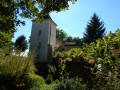
A lovely walk around one of the four sources of the River Tille, taking in significant medieval remains in the villages of Le Meix, Salives and Barjon.
Avot circular route to Courlon
11.27 mi
+1,352 ft
-1,207 ft
6h 20
Moderate
Departure from Avot (Côte-d'Or)
Hike starting from towns north-west of Is-sur-Tille. You will hike through forests and plains, passing through two towns with a rich heritage: Courlon Castle, an old mill, a foundry and beautiful buildings.
Springs and retting pits starting from Poiseul-lès-Saulx
 Tourist office
 6.68 mi
+860 ft
-866 ft
3h 50
Moderate
Departure from Poiseul-lès-Saulx (Côte-d'Or)
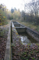
This forest route takes you to the Four à Pain refuge, the Puits du Bois, the Ormette spring, the Vignottes spring and retting pits, and the Champignolles wash house and retting pits. Route proposed by the Tille and Ignon Valleys Tourist Office. Official route registered with the Côte-d'Or PDIPR (public network of footpaths and trails). Hunting days: Saturday, Sunday, and public holidays. PDIPR route in the Côte-d'Or.
Farms and villages starting from Grancey-le-Château
 16.10 mi
+1,690 ft
-1,693 ft
7 hrs
 Very difficult
Departure from Grancey-le-Château-Neuvelle (Côte-d'Or)
A challenging hike classified as very difficult due to both its length and the difficult sections on certain parts of the route, requiring a good sense of direction and observation due to sections through woodland and meadows off the beaten track (between (9) and (10), near (12)), as well as a poorly maintained woodland path (between (12) and (13)). It is recommended that you follow the GPX track. In good weather, the scenery is pleasant and varied. There are charming rural villages.
Grancey-le-Château to Cussey-les-Forges circular loop
 11.61 mi
+1,381 ft
-1,378 ft
6h 35
Difficult
Departure from Grancey-le-Château-Neuvelle (Côte-d'Or)
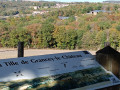
An easy walk along good paths and tracks, taking in two typical villages (Grancey-le-Château being the most noteworthy), through beautiful mixed woodland and some farmland offering interesting views.The route also follows a lovely section of the ‘Trail of the First Farmers’, which uses illustrated educational panels to trace local history back well before the Common Era.
A circular loop around Grancey-le-Château via Courlon
 8.14 mi
+735 ft
-715 ft
4h 25
Moderate
Departure from Grancey-le-Château-Neuvelle (Côte-d'Or)
An easy walk along good paths and trails, taking in two remarkable villages whilst passing through beautiful mixed woodland and some farmland offering interesting views.
Circular route in the Moloy National Forest starting from L'Abergement.
 6.49 mi
+643 ft
-656 ft
3h 35
Moderate
Departure from Moloy (Côte-d'Or)
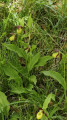
Walk in the Moloy National Forest. This walk will take you along the Bellefontaine Forest Road, past the summits and through numerous valleys. The Combe de Bellefontaine is home to a site famous for its wild orchids, the Lady’s Slipper orchids.
"Legend has it that, pursued by a satyr, Venus lost her clogs in the forest whilst running to escape him. Ever since that day, lady’s slippers have sprung up every spring."André Beuchot
In pursuit of the mares of Moloy and Courtivron
9.02 mi
+715 ft
-735 ft
4h 45
Moderate
Departure from Moloy (Côte-d'Or)
Through the valleys and forests around Moloy, this is a long summer walk, often in the shade, offering the chance to explore the valleys and springs of the Ignon Valley. The route passes by the two ‘Juments’ – Moloy and Courtivron – which are the two farms on the limestone plateaus above Moloy.
Around Saulx-le-Duc
 5.67 mi
+564 ft
-568 ft
3h 05
Easy
Departure from Saulx-le-Duc (Côte-d'Or)
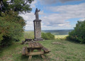
A short, easy and very pleasant hike leading to the Butte Saint-Siméon in Saulx-le-Duc, the highest point offering a beautiful view of the Ignon valley. No technical difficulty, but the climb to the Butte Saint-Siméon is steady.
The terrain south of Lamargelle
 5.95 mi
+709 ft
-722 ft
3h 20
Easy
Departure from Lamargelle (Côte-d'Or)
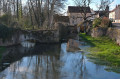
A circular route around Lamargelle, to discover this beautiful village on the banks of the Ignon, the Combe Saint-Seine and the sweeping landscapes of this secluded valley. This route showcases the village, set in the beautiful valley of the Ignon with its mills, wash houses and castle. It also takes you through the valleys linked to the golden legend of Saint-Seine, who founded the abbey of the same name, and whose abbots owned Lamargelle Castle.