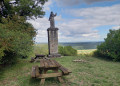
The terrain south of Lamargelle

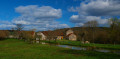
A circular route around Lamargelle, to discover this beautiful village on the banks of the Ignon, the Combe Saint-Seine and the sweeping landscapes of this secluded valley. This route showcases the village, set in the beautiful valley of the Ignon with its mills, wash houses and castle. It also takes you through the valleys linked to the golden legend of Saint-Seine, who founded the abbey of the same name, and whose abbots owned Lamargelle Castle.

Details

93641450
Creation:
Last update:
Last review:
  • Walking
    Activity: Walking
  • ↔
    Distance: 5.95 mi
  • ◔
    Average duration: 3h 20 
  • ▲
    Difficulty: Easy

  • ⚐
    Back to start: Yes
  • ↗
    Ascent: + 709 ft
  • ↘
    Descent: - 722 ft

  • ▲
    Highest point: 1,555 ft
  • ▼
    Lowest point: 1,135 ft
  • ⚐ Country: France
  • ⚐ City: Lamargelle (21440)
  • ⚑
    Start/End: N 47.533698° / E 4.839976°
  • ❏
    IGN map(s): Ref. 3021SB
  • Hour-by-hour weather

Photos

Description of the walk

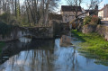
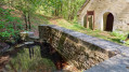
(S/E) From the town hall courtyard, head down towards the river via a small dirt path followed by a few steps. Then take Rue du Vivier on the right. At thefirst junction, turn left onto Rue de Pellerey. After a stone wall, visit a small wash house, known as ‘d’en Haut’, situated on a leat of the River Ignon.

(1) Continue along Rue de Pellerey, passing a farm on the right, until you reach the Moulin d’en Haut.

(2) At the crossroads, continue straight on along the white path to reach the Ignon. First cross the leat of the Moulin d’en Haut, then the “wild” Ignon. Continue along the white path towards the forest.

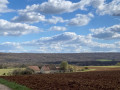
(3) At the next junction, take the correct path on the left and climb up the Soitures hillside. Then cross a field, with a vast, unobstructed panorama, cross the Bois de la Charpeigne and come out onto the road leading up from the village.

(4) Head straight on for a few metres, then turn right onto the white path. Continue climbing up onto the plateau, with another sweeping panorama, to reach the entrance to a quarry that is still in operation.

(5) Continue along the white path through a small wood to reach the entrance to the Petite Montagne farm.

(6) Leave it on your right and follow the path which then descends, first through a field, then through woods and finally, at the bottom, into a valley.

(7) In this Combe de Saint-Seine, turn left onto the thalweg path. Descend between a steep slope on the left and a gentler one on the right, with scattered rocks on both sides. You will reach a junction at the mouth of two large valleys on either side.

(8) Continue down the thalweg of the Combe de Saint-Seine, and arrive at a hollow after some springs on the left, recognisable by the pebbles their waters have deposited in the valley.

(9) Then turn left onto the rather steep path that climbs up, marked with pink paint on the trees. As it climbs, it leaves the new valley floor of this valley to your right. Continue up the slope until you emerge at the top onto a wide forest track, a flat dirt path. Take this to the left until you reach a large hunting lodge.

(10) Walk past this hut, keeping it on your left, and take the wide path on the right. It runs flat through the forest on the plateau before descending to a large four-way junction. Take the path furthest to the left, which is also the steepest. Continue along this path down a fairly steep slope. After the sharp bend to the left, the going becomes gentler. Walk past a shed to reach a small road.

(11) Follow it to the left to return to Lamargelle, crossing a small stream via a bridge and then passing the cemetery on the left. Continue until you reach the small road leading to the quarry. The castle is opposite. Turn right to cross the Ignon over a beautiful stone bridge. Immediately afterwards, turn left onto the path leading to the Lavoir d’en Bas. Head back up Rue de Frénois, cross the village by keeping left and reach the church then the town hall (S/E).

Waypoints

  1. S/E : mi 0 - alt. 1,155 ft - Lamargelle Town Hall
  2. 1 : mi 0.15 - alt. 1,138 ft - Small wash house at the top
  3. 2 : mi 0.44 - alt. 1,155 ft - Moulin d'en haut - Ignon (rivière)
  4. 3 : mi 0.74 - alt. 1,148 ft - Junction
  5. 4 : mi 1.66 - alt. 1,480 ft - Crossroads on the dirt track
  6. 5 : mi 2.07 - alt. 1,522 ft - Entrance to the quarry
  7. 6 : mi 2.31 - alt. 1,516 ft - La Petite Montagne Farm
  8. 7 : mi 2.88 - alt. 1,299 ft - Saint-Seine Valley
  9. 8 : mi 3.61 - alt. 1,217 ft - Valley on the left
  10. 9 : mi 3.91 - alt. 1,201 ft - Entrance to the valley, pink markings
  11. 10 : mi 4.42 - alt. 1,509 ft - Hunting lodge
  12. 11 : mi 5.22 - alt. 1,152 ft - Small road towards Lamargelle
  13. S/E : mi 5.95 - alt. 1,152 ft - Lamargelle Town Hall

Notes

Easy parking at Lamargelle town hall.

The final valley is quite difficult, with a gradient of over 15%; it is possible to return by taking the path to the other valley at (8).

Worth a visit

The very pretty village of Lamargelle: the Ignon valley, the wash houses, the castle (private).

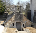
In the village, head down Rue du Lavoir to admire this small columned wash house and the Abîme site with views of the castle.

Reviews and comments

5 / 5
Based on 1 review

Reliability of the description
5 / 5
Ease of following the route
5 / 5
Route interest
5 / 5
Denis26
Denis26 ★

Thank you, NanaDidi, for pointing that out; I’ve just updated the description accordingly.

Machine-translated

NanaDidi
NanaDidi

Overall rating : 5 / 5

Date of your route : Apr 16, 2026
Reliability of the description : ★★★★★ Very good
Ease of following the route : ★★★★★ Very good
Route interest : ★★★★★ Very good
Very busy route : No

A pleasant country walk with some lovely views. Lamargelle is a pretty village well worth a stop.
The route description is very good and you could (almost) manage without any additional tools. Just one small detail: at point 4, the ‘white path’ is a small unpaved road used by lorries; it isn’t in line with the previous one but clearly turns right.
Thanks to MichelRando

Machine-translated

Other walks in the area

For more walks, use our search engine .

The GPS track and description are the property of this route's author. Please do not copy them without permission.