Country:
 City:
City:


Start from the church, along the D996. Several parking spaces nearby.
(S/E) Walk up the Grande Rue, past the café, then further up turn left onto the Place du Monument. Continue for 150 m and take the small tarmac road on the left, Chemin de la Combe Aulogne, marked with yellow signs for the Sentier Paramelle. Follow the path towards the forest
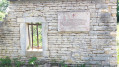
(1) Pass a small spring with a stone trough, then carry on into the forest. As you follow the thalweg uphill, you’ll reach another small spring, the Fontaine Abon.
(2) Continue up the valley floor of the combe and, at an altitude of 431, take the side valley or ‘combet’ on the left. Climb up towards the plateau – this is the steepest part of the walk – and at the top, go straight on, passing through the gate into the communal forest. Continue straight on, staying on the main path
(3) Look out for a path on the right; the forest has recently been cleared and vegetation is encroaching on the track. Take this path; it leads straight on to the next ridge
(4) Turn left onto the Grande Sommière des Essarts, which slopes gently downwards. The slope becomes steeper towards the end of this section; watch out for brambles
(5) At a major fork in the road, take the wide but unmarked path on the left; it climbs up the Combe des Manches. At an altitude of 443, walk alongside a huge field on the left, surrounded by an electric fence, then come to a gate on the path. Go through the barrier using the chain, and make sure you close it again afterwards. Look out for the rooftops of La Jument de Moloy on your left and head for the main white track at the end.
(6) Turn right and, on this stretch, admire the vast, unobstructed panorama over the Tille and Ignon valleys. Join the D996.
(7) Follow the road to the right – or rather, after crossing it – so you’ll be on the left-hand verge. You’ll reach the walls of the second ‘Jument’ on this walk, the one at Courtivron. Follow the road after the bend and, at the next hilltop, take the field path on the left.
(8) Continue along the path – which runs in the sunshine – and head into the nearby woodland. Pass an abandoned hunting lodge on your left and then carry on straight ahead through the Combe de Jument. A wide, steep descent with drainage channels; follow the thalweg, ignoring all paths you come across to the right or left. Emerge alongside a field and reach the junction with a wide white track.
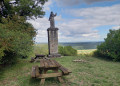
(9) 20 metres to the right is the pretty Calvary site, a stone cross with a large lime tree next to it (bench and picnic area available). Retrace your steps.
(9) Set off again along the wide white track. It overlooks the whole of the Ignon valley, with a few gentle ascents and descents. You’ll come to a stone wall; walk alongside it on the right – this is the wall of Moloy Castle. Carry on and head back to the village. At thefirst street you come to, turn right towards the castle (private – not open to the public), then turn left towards the church and its small square (S/E).
 Visorando Member

 Easy
Easy  Tourist office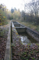
 Difficult