


trotnatu

 Visorando Member
 Premium user
 Sign up:
Published route(s)
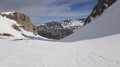
 Plate Longe and Coste Belle
 3.01 mi
 +2,329 ft
 -2,326 ft
 3h 25
3h 25
 Difficult
 Departure from Saint-Étienne-en-Dévoluy (Hautes-Alpes)
A lovely ridge walk, largely off-trail and at times steep. The final section of the ascent to the pass takes place in an alpine setting, over uncertain terrain where you must find your own way as best you can, with no marked trail. You should only attempt this if you are well accustomed to steep, off-trail alpine terrain. Walking poles, or even an ice axe, may prove very useful.
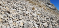
La Demoiselle and Les Prêtres
 7.41 mi
+3,724 ft
-3,724 ft
6h 40
Difficult
Departure from Saint-Disdier (Hautes-Alpes)
7.41 mi
+3,724 ft
-3,724 ft
6h 40
Difficult
Departure from Saint-Disdier (Hautes-Alpes)
A hike with no significant difficulty, although it is a little steep in the upper section and mainly off-track. It ends at a curious little summit perched in the middle of the upper cirque to the south of the Tête de l’Aupet. It offers a superb view. Griffon vultures are often seen here.
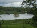
The Charentonne ponds
 6.86 mi
+374 ft
-354 ft
3h 30
6.86 mi
+374 ft
-354 ft
3h 30
 Moderate
Departure from Saint-Evroult-Notre-Dame-du-Bois (Orne)
Moderate
Departure from Saint-Evroult-Notre-Dame-du-Bois (Orne)
A lovely, easy walk along well-marked paths. It offers a beautiful route from one pond to another.
Please note: avoid during hunting season.
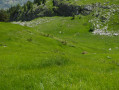
The Pic de Bure circular from the Superdévoluy station
 10.86 mi
+4,587 ft
-4,583 ft
7 hrs
10.86 mi
+4,587 ft
-4,583 ft
7 hrs
 Very difficult
Departure from Saint-Étienne-en-Dévoluy (Hautes-Alpes)
Very difficult
Departure from Saint-Étienne-en-Dévoluy (Hautes-Alpes)
This is a long circular loop that takes you along the two possible hiking routes on this side of the mountain. The difficulty is mainly due to the length. The elevation gain is also significant and some passages require great care (cables).
The Tête de l’Aupet via the Crête de la Clape
 7.24 mi
+4,708 ft
-4,688 ft
6 hrs
Very difficult
Departure from Saint-Disdier (Hautes-Alpes)
7.24 mi
+4,708 ft
-4,688 ft
6 hrs
Very difficult
Departure from Saint-Disdier (Hautes-Alpes)
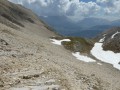
The Tête de l’Aupet is a stunning summit that dominates the area. The route suggested here includes an unchallenging ridge walk and offers a little-used alternative to the normal route, which can get quite crowded.
The ridges of Saint-Saturnin-lès-Apt
 11.59 mi
+2,405 ft
-2,431 ft
7h 25
Moderate
Departure from Saint-Saturnin-lès-Apt (Vaucluse)
11.59 mi
+2,405 ft
-2,431 ft
7h 25
Moderate
Departure from Saint-Saturnin-lès-Apt (Vaucluse)
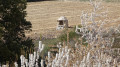
A long and beautiful excursion over easy but varied countryside, with some steeper sections on the descent but on an excellent path.
A loop of the Pic du Guajara
 5.32 mi
+2,408 ft
-2,431 ft
4h 35
Difficult
Departure from La Orotava (Province de Las Palmas)
5.32 mi
+2,408 ft
-2,431 ft
4h 35
Difficult
Departure from La Orotava (Province de Las Palmas)
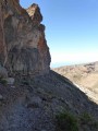
A superb loop on one of Tenerife's most beautiful peaks. The whole circuit offers an extraordinary view of the caldera and the summit of the Pico del Teide. The difficulty lies in the suspended passage below the summit. It's an aerial passage, but never exposed, so don't attempt it if visibility is poor.
New markings have been added to some of the passages, so the description below will probably have to be adapted to the new markings on the summit section.
The Chauvet ridges
 5.64 mi
+2,274 ft
-2,283 ft
4h 35
Difficult
Departure from Agnières-en-Dévoluy (Hautes-Alpes)
5.64 mi
+2,274 ft
-2,283 ft
4h 35
Difficult
Departure from Agnières-en-Dévoluy (Hautes-Alpes)
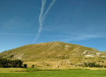
A lovely ridge walk suitable for anyone who isn’t put off by a hike that’s mainly off-trail. On the Chauvet ridge, the route along the very edge is sometimes a little dizzying and steep. However, it’s always easy to avoid the difficult sections by keeping slightly to the left of the ridge.
Circular in the Réno Valdieu forest
 14.34 mi
+883 ft
-896 ft
7h 20
Difficult
Departure from La Chapelle-Montligeon (Orne)
14.34 mi
+883 ft
-896 ft
7h 20
Difficult
Departure from La Chapelle-Montligeon (Orne)
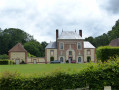
A lovely walk, mostly on good paths, which allows you to visit a magnificent forest, admire a few ponds and pass by some religious buildings. The only difficulty is the length.
Woods and hills in the Saint-Évroult area
10.89 mi
+696 ft
-696 ft
5h 35
Moderate
Departure from Saint-Evroult-Notre-Dame-du-Bois (Orne)
An easy walk along wide paths and small, tarmac-surfaced roads with very little traffic. Best avoided during the hunting season as the public path runs through private woodlands used for hunting. Numerous signs warn of this, and on this section it is not possible to leave the suggested route.
Please note the necessary change from point (9) due to changes in the terrain on 16 September 2019.
The Black Mountain
 1.41 mi
+545 ft
-545 ft
1h 05
1.41 mi
+545 ft
-545 ft
1h 05
 Easy
Departure from Tinajo (Province de Las Palmas)
Easy
Departure from Tinajo (Province de Las Palmas)
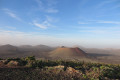
A short, easy stroll offering fine views of the wine-growing area and volcanoes.
Barrancos and wild beaches around Femés
 8.54 mi
+2,057 ft
-2,070 ft
5h 45
Moderate
Departure from Yaiza (Province de Las Palmas)
8.54 mi
+2,057 ft
-2,070 ft
5h 45
Moderate
Departure from Yaiza (Province de Las Palmas)
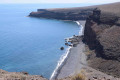
An easy walk through hardly visited valleys, including three almost deserted beaches. Good trail for most of the way.
⚠️However, a passage looks very impressive before you start, but the path is well marked and it will only be a problem for people who are very prone to vertigo.
All around Saint-Evroult-Notre-Dame-du-Bois
 3.98 mi
+200 ft
-177 ft
2h 00
Easy
Departure from Saint-Evroult-Notre-Dame-du-Bois (Orne)
3.98 mi
+200 ft
-177 ft
2h 00
Easy
Departure from Saint-Evroult-Notre-Dame-du-Bois (Orne)
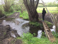
A leisurely walk along good country lanes.
The Saint-Sulpice-sur-Risle area
8.79 mi
+236 ft
-240 ft
4h 15
Moderate
Departure from Saint-Sulpice-sur-Risle (Orne)
A pleasant walk through meadows and woods, mostly on very good paths.
A circular walk in the Pays d’Ouche
 15.49 mi
+197 ft
-200 ft
7h 20
Moderate
Departure from Mesnil-Rousset (Eure)
15.49 mi
+197 ft
-200 ft
7h 20
Moderate
Departure from Mesnil-Rousset (Eure)
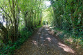
A lovely walk in a setting typical of the Normandy countryside, taking place mainly on wide forest or farm tracks or on very narrow tarmac roads with no other traffic. Best avoided, however, if you’re allergic to tarmac. The first part of the route follows theGRP® Risle-Charentonne.
There are no particular difficulties apart from the almost complete lack of signposting; a GPS track is undoubtedly essential to follow the route properly, and the distance.
Around Mahéru
 10.60 mi
+945 ft
-945 ft
5h 40
Moderate
Departure from Mahéru (Orne)
10.60 mi
+945 ft
-945 ft
5h 40
Moderate
Departure from Mahéru (Orne)
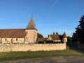
A lovely, unpretentious walk through charming, rolling countryside. There are many old houses, often beautifully restored.
The route follows very narrow tarmac roads and wide paths through fields or woods. In places, however, it consists of simple, narrow footpaths.
Le Crêt des Mouches from Le Fontany
 6.70 mi
+4,304 ft
-4,285 ft
6h 50
Difficult
Departure from Saint-Ferréol (Haute-Savoie)
6.70 mi
+4,304 ft
-4,285 ft
6h 50
Difficult
Departure from Saint-Ferréol (Haute-Savoie)
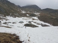
A classic hike, on a path that is mostly quite steep but generally well-marked.
La Tournette from Serraval
 7.54 mi
+4,288 ft
-4,281 ft
5 hrs
Very difficult
Departure from Serraval (Haute-Savoie)
7.54 mi
+4,288 ft
-4,281 ft
5 hrs
Very difficult
Departure from Serraval (Haute-Savoie)
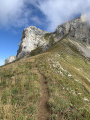
This is undoubtedly the least-used route to reach La Tournette. The ascent follows a broad, wooded slope that turns to grassy terrain facing east, before joining the higher slopes traversed by the more popular route starting from Montmin on the western side.
Please note: the final few metres to the summit (5) require care when navigating the cables and ladders.
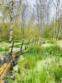
The Paaskula bog
 5.35 mi
+56 ft
-56 ft
2h 30
Moderate
Departure from Estonia
5.35 mi
+56 ft
-56 ft
2h 30
Moderate
Departure from Estonia
This route, easily accessible from Tallinn by public transport, allows you to visit a beautiful peat bog that is ultimately not very frequented. The description draws attention to the deterioration of part of the route and allows you to avoid it. Trying to force your way through would certainly be very dangerous. This is an easy hike if you follow this description, but it cannot be done without walking through water up to your calves for a few hundred metres.