Country:

 City:
City:


From the village of Serraval, follow the D1 northwards, then take the small road branching off to the left towards the hamlet of L’Ermite, which you pass through. Shortly after this hamlet, turn right onto a small stone-paved road towards La Molloire. Follow it to the car park at an altitude of 1,031 metres (the small road is occasionally covered with tarmac in poor condition, so drive with care).
Park in the small, grassy lay-by to the left of the road. Signs indicate various hiking routes, including La Tournette (estimated ascent time: 4½ hours).
(S/E) With your back to the car park, follow the small road which leads to the hamlet of La Molloire after 300 metres.
(1) In the hamlet, take the path that runs through it. After 200 m, you’ll reach a crossroads.
(2) At this junction, ignore the path branching off to the right, heading north, and continue along the path that follows on from the one taken from La Malloire. A signpost indicates the direction of La Tournette, and you can rely on it. The path is well marked and easy to follow. It is initially level or climbs gently through the forest. Shortly after leaving the woodland, the path winds its way up in numerous hairpin bends until it reaches the charming Refuge des Praz d’Zeures.
(3) The path goes round the refuge (there are several possible routes). It makes a wide circular loop to the right and then climbs towards a broad, clearly visible pass at an altitude of around 2,030 metres.
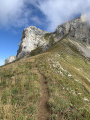
(4) From the pass, take the path that branches off to the right in a hairpin bend towards La Tournette (you’ll join the walkers coming from Montmin). Start by climbing below the rocky ridge, then reach a wide ledge from which there is a fantastic view of Lake Annecy. At the end of the ledge, reach the base of the rocks, which you go round to reach the base of the cables.
(5) Reach the summit by following the cables and ladders. Return via the same route you took on the way up to the car park at the start (A/D).

 Visorando Member
 Difficult
 Moderate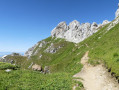
 Association / Club / Walk leader

 Tourist office
 Easy
Easy