Plate Longe and Coste Belle

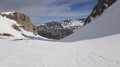
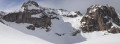
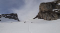
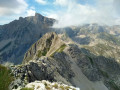
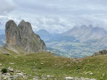
A lovely ridge walk, largely off-trail and at times steep. The final section of the ascent to the pass takes place in an alpine setting, over uncertain terrain where you must find your own way as best you can, with no marked trail. You should only attempt this if you are well accustomed to steep, off-trail alpine terrain. Walking poles, or even an ice axe, may prove very useful.

Details

562376
Creation:
Last update:
Last review:
  • Walking
    Activity: Walking
  • ↔
    Distance: 3.01 mi
  • ◔
    Average duration: 3h 25 
  • ▲
    Difficulty: Difficult

  • ⚐
    Back to start: Yes
  • ↗
    Ascent: + 2,329 ft
  • ↘
    Descent: - 2,326 ft

  • ▲
    Highest point: 7,362 ft
  • ▼
    Lowest point: 5,033 ft

Photos

Description of the walk

Start from the car park at the Cabane de l’Avalanche. This point can be reached from Saint-Étienne-en-Dévoluy, heading towards Le Forest via the D17. Continue along the D417, then take the Bois Rond forest road (suitable for any vehicle if driven with care) on the left at Pont du Villard, heading towards Pré Grand.

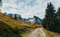
(S/E) Head up the clearly visible valley towards the south-west, following a fairly well-marked, zigzagging path.
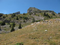
Climb above the tree line at around 1,650 metres, then continue up to around 1,700 metres.

(1) Then leave the well-marked track which branches off to the left towards the south-east, heading for a sheepfold and then the Vallon d’Âne, and continue straight ahead, due south, along faint tracks (several possible routes). Join a path coming in from the right at around 1,870m.

(2) Continue along this path through the valley between La Corne and Coste Belle and reach the pass at 2,048m.

(3) Leave the level path heading towards Combe Ratin. Continue almost due south, climbing slowly over scree and grassy slopes until you are directly below the 2,197m pass. You are now at an altitude of around 2,100m.

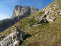
Then climb as best you can towards the pass. This is the trickiest part of the hike. You must proceed with caution and choose your route carefully, making use of the few sheep tracks, small grassy ledges or stable sections.

(4) The pass is wide, grassy and comfortable. The distinct ridge that follows is broad and easy to follow right up to the summit of Coste Belle.
From the summit of Coste Belle, the descent down the grassy, stony slope is quite steep at first but gradually levels out. There is no marked path. Head down as best you can in a north-easterly direction.

(5) At the bottom of the slope, head due north and join the path, at around 1,700 metres, leading to the sheepfold mentioned on the ascent. Follow the path descending from the Vallon d’Âne towards the north-west for a few dozen metres and rejoin the ascent track.

(1) Follow the same route down to the start (S/E).

Waypoints

  1. S/E : mi 0 - alt. 5,033 ft - Car park at the Cabane de l’Avalanche
  2. 1 : mi 0.35 - alt. 5,515 ft - Leave the path and continue due south
  3. 2 : mi 0.78 - alt. 6,145 ft - Entrance to the valley between La Corne and Coste Belle
  4. 3 : mi 1.2 - alt. 6,683 ft - Pass 2,048 m: leave the level path
  5. 4 : mi 1.54 - alt. 7,172 ft - Col 2197
  6. 5 : mi 2.27 - alt. 6,109 ft - Bottom of the slope
  7. S/E : mi 3.01 - alt. 5,036 ft - Car park at the Cabane de l’Avalanche

Notes

Alternatives:
- You can also easily reach the start point from the Bure cable car car park by following the D417. Then continue along the track to reach the Cabane de l’Avalanche car park. This adds 500 metres to the hike.
- In (5), the route can be adapted to suit your preferences to reach the Vallon d’Âne path; from there, head due east towards 1,900 metres to reach the path to the Chalet du Vallon d’Âne at around 1,780 metres. About a hundred metres before the chalet, follow the path that branches off to the left, heading north-west, to reach the sheepfold mentioned on the ascent.
- If you are put off by the climb to the 2197 pass, you can always opt for the very easy ascent of La Corne, skirting it to the north, which takes you over gentle grassy slopes without any difficulty.

Reviews and comments

4.8 / 5
Based on 2 reviews

Reliability of the description
5 / 5
Ease of following the route
4.5 / 5
Route interest
5 / 5
dick le montagnard
dick le montagnard

Overall rating : 5 / 5

Date of your route : Mar 16, 2020
Reliability of the description : ★★★★★ Very good
Ease of following the route : ★★★★★ Very good
Route interest : ★★★★★ Very good

I followed the route to point 3, the 2,048-metre pass, on a snowshoe hike from the Superdévoluy resort. I had no trouble following the route; the GPS track is excellent, as is the route description (even on snow-covered terrain). After Point 3, I reached the Vallon and the Combe de Corne (a variant of the Tour du Dévoluy on the GR de Pays trail) by keeping to the right to descend back to the forest track leading above the lower station of the Plateau de Bure Observatory cable car. A lovely circular route with a high-mountain feel amidst the Dévoluy cliffs, completed in 4 hours starting from Superdévoluy. Only attempt this if you are at least somewhat accustomed to winter mountain terrain, given the risks involved.

Machine-translated

gaelle18
gaelle18

Overall rating : 4.7 / 5

Date of your route : Jul 23, 2018
Reliability of the description : ★★★★★ Very good
Ease of following the route : ★★★★☆ Good
Route interest : ★★★★★ Very good

A lovely walk, which I rounded off with a visit to the Coste Belle cave on the way down: an easy 100-metre traverse, and a really unique experience! A head torch is essential. To find the cave, head down as signposted and, at around 2,150 metres, start a roughly horizontal traverse to the right. The entrance to the cave itself is hard to spot but clearly marked by a large cairn with a stick; it is exactly where shown on the IGN map.

Machine-translated

Other walks in the area

For more walks, use our search engine .

The GPS track and description are the property of this route's author. Please do not copy them without permission.