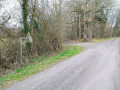
Woods and hills in the Saint-Évroult area

An easy walk along wide paths and small, tarmac-surfaced roads with very little traffic. Best avoided during the hunting season as the public path runs through private woodlands used for hunting. Numerous signs warn of this, and on this section it is not possible to leave the suggested route.
Please note the necessary change from point (9) due to changes in the terrain on 16 September 2019.

Details

1834608
Creation:
Last update:
Last review:
  • Walking
    Activity: Walking
  • ↔
    Distance: 10.89 mi
  • ◔
    Average duration: 5h 35 
  • ▲
    Difficulty: Moderate

  • ⚐
    Back to start: Yes
  • ↗
    Ascent: + 696 ft
  • ↘
    Descent: - 696 ft

  • ▲
    Highest point: 1,043 ft
  • ▼
    Lowest point: 768 ft

Description of the walk

Park at the side of the D13, in a space between the road and the Étang des Saints-Pères, at the entrance to the leisure centre.

(S/E) Return to the junction and take the sharp right-hand bend onto the D31 towards Sainte-Gauburge (there are large cleared areas allowing you, if you prefer, to avoid walking on the tarmac). The road curves widely to the right and then runs straight ahead.

(1) When the road curves very slightly to the left, take a path that branches off at a right angle to the right, heading north-west (this is the third path branching off the road that you should take). This path climbs and then descends to the Étang de Charentonne.

(2) At the edge of the pond, leave the path that continues straight ahead and turn at a right angle to the left, heading south-west. Carry on straight ahead until you reach the Pont de la Lune crossroads.

(3) Then take the path that veers slightly to the right of the direction you’ve been following so far. Follow this path to the Chapelle Saint-Évroult.

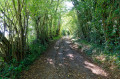
(4) In front of the chapel, turn sharply right onto the only authorised path (the Ligne des Laitiers). Reach the D50 and cross it with care. Continue straight on (this section passes through private woodland, which should be avoided during the hunting season; observe any restrictions and do not take any side paths). Cross the Ligne Sainte-Marie.

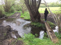
(5) Just as the slope begins to steepen, leave the Ligne des Laitiers, turn left at a right angle and continue to the Ruisseau de Trémont. Cross the stream and turn right at a right angle. Cross the Ruisseau de Chaude Fontaine and reach a small tarmac road.

(6) Follow the tarmac road to the right. Follow it as far as the village of Les Touquettes.

(7) Cross the D13 main road with care and join the very quiet D658 opposite. Shortly after the centre of Les Touquettes, leave the road that appears to continue straight ahead and follow the departmental road to the right. Pass La Champonnière and reach a junction.

(8) Turn sharply right onto the road leading downhill (D659), passing the edge of a large pond and a stud farm. You’ll reach a clearly marked crossroads.

Please note: the old route description (9 to 10) is no longer passable.
The path is overgrown; numerous fallen branches and tree trunks make progress very difficult, and a fence appears to indicate a change in the status of this route.
You should therefore stick to the easier alternative route:

(9) Continue along the D659 to St Evroult.

(10) Turn right and follow this road with care until you reach the junction with the D13 in the centre of Saint-Évroult.)

(11) Turn left and follow the path alongside the pond to return to the starting point (S/E).

Waypoints

  1. S/E : mi 0 - alt. 827 ft - Car park near the leisure centre - La Charentonne : 1er petit pont de bois
  2. 1 : mi 0.89 - alt. 935 ft - 3rd road on the right
  3. 2 : mi 1.23 - alt. 860 ft - Charentonne Pond
  4. 3 : mi 2.18 - alt. 925 ft - Pont de la Lune junction
  5. 4 : mi 2.91 - alt. 935 ft - Saint-Évroult Chapel
  6. 5 : mi 4 - alt. 1,004 ft - Turn left at the junction
  7. 6 : mi 4.69 - alt. 948 ft - Back on the tarmac, turn right
  8. 7 : mi 6.17 - alt. 840 ft - Les Touquettes – D13
  9. 8 : mi 7.63 - alt. 869 ft - Junction, turn right
  10. 9 : mi 8.47 - alt. 945 ft - Crossroads, turn left
  11. 10 : mi 9.42 - alt. 876 ft - D230
  12. 11 : mi 10.52 - alt. 869 ft - Saint-Évroult – D13
  13. S/E : mi 10.89 - alt. 827 ft - Car park near the leisure centre

Notes

Despite the tarmac sections, the walk is very peaceful. The only precaution concerns crossing hunting grounds. It is certainly out of the question to cross, in particular, from (3) to (4) if a hunt is in progress. Big game is hunted here and gunfire is very dangerous. The route is no doubt often used by horse riders. There are a few signposts intended for them.
There is just one real difficulty: the length.

The section from (9) to (10) is a bit tricky and may be found unpleasant. It is easy to avoid. Simply carry on straight ahead at (9) and head directly to Saint-Évroult via the D659.

Worth a visit

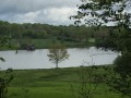
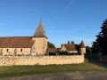
Enjoy the varied woodland, the numerous ponds, the Chapel of Saint-Évroult and its fountain (the source of the Charentonne), and the rolling countryside, dotted with Norman houses of all sizes, many of which are truly beautiful.

Reviews and comments

3.5 / 5
Based on 5 reviews

Reliability of the description
3.4 / 5
Ease of following the route
3.4 / 5
Route interest
3.8 / 5
13aout
13aout

Overall rating : 2.3 / 5

Date of your route : Jan 12, 2026
Reliability of the description : ★★☆☆☆ Disappointing
Ease of following the route : ★☆☆☆☆ Very disappointing
Route interest : ★★★★☆ Good
Very busy route : No

Hello, it was impossible to continue at point 9 because of a dead-end road, fenced fields, and a private road. We therefore had to finish the journey on the road, which was not pleasant at all due to the amount of tarmac.

Machine-translated

User 17943306

Overall rating : 5 / 5

Date of your route : Jul 07, 2025
Reliability of the description : ★★★★★ Very good
Ease of following the route : ★★★★★ Very good
Route interest : ★★★★★ Very good
Very busy route : No

Nice hike, shame there's a bit of road when we're in a group.

Machine-translated

Grole61
Grole61

Overall rating : 3.3 / 5

Date of your route : Apr 18, 2022
Reliability of the description : ★★★★☆ Good
Ease of following the route : ★★★★☆ Good
Route interest : ★★☆☆☆ Disappointing
Very busy route : No

A difficult route as there are no signposts – just a few white ribbons tied to branches. It’s impossible for a walker or hiker to complete this route without a compass, or a GPS if you know how to use one
Not to be recommended; the local council or the hiking association could have made an effort to mark the route properly. A frustrating hike with these long, unmarked paths.

Machine-translated

trotnatu
trotnatu
• Edited:

Thank you for pointing that out. I’ve just been to have a look for myself and it’s true that the situation has deteriorated over the last few months. Trees have fallen, vegetation has grown, and a fence has even appeared… (though I’m not sure what the status of that is!). So, as you say, it’s best to head straight back to the village, and I’ve updated the description accordingly.

Machine-translated

jcr61
jcr61
• Edited:

Overall rating : 4 / 5

Date of your route : May 31, 2019
Reliability of the description : ★★★★☆ Good
Ease of following the route : ★★★★☆ Good
Route interest : ★★★★☆ Good

It’s a shame there was a bit too much driving towards the end of the route, and after the stud farm at No. 9 it was difficult to find the way; but I had a lovely day

Machine-translated

Other walks in the area

For more walks, use our search engine .

The GPS track and description are the property of this route's author. Please do not copy them without permission.