Country:
 City:
City:


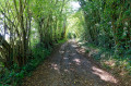
Park in the handy car park by the Route de l’Aigle in Mesnil-Rousset.
(S/E) Take the D45 towards La Haye Saint-Sylvestre.
After 200 metres, turn right onto a small road heading towards the church. Walk past the church until you reach another small road. Take this road to the left, then, at the first junction, turn right onto the Route de la Vallée de Roulle Crotte. Cross a tiny stream that runs under the road, then reach a Y-junction.
(1) Take the left-hand branch and walk alongside a field, following a line of trees. You’ll reach a T-junction where you’ll find the only sign on the route indicating theGRP® Risle Charentonne.
Turn left, then very quickly right again. You’ll reach a small road.
(2) Follow it for a few metres to the left, then turn right at a right angle. You’ll pass through two sets of bends, but generally speaking, keep heading in the same south-easterly direction. Join the very narrow D655 and follow it to the left, passing through the small hamlet of Le Chesnay.
(3) A few metres past Le Chesnay, do not continue along the tarmac road but turn left, heading north, onto a wide farm track. Turn right, heading east, onto a similar track. You will reach the hamlet of Chambord. Turn right and cross the village via the D22, following it for about 400m.
(4) Turn left onto a tiny tarmac road and continue to follow the GRP®.
(5) When the road bends to the right, leave it and carry on straight ahead along a wide track until you reach another road, which you take to the right. Then follow the tracks that lead up to the D114.
(6) Just before reaching this busy road, turn left, heading east, onto a tiny road towards Bois Maillard.
(7) Pass through the hamlet and then take a track heading due south. Follow a route generally south-south-west until you reach the hamlet of Le Boulay Filleul.
(8) From this point, stop following theGRP®, which heads south-east, and continue along a small tarmac road heading south-west then west.
Take care here: Cross the D919 main road. Leave a private track on your right heading towards La Petite Broudière and continue along the wide track on the left, which leads to a small road.
(9) Follow it south for 50m, then take a wide farm track heading west. Cross the D 656 and continue in the same direction. Pass the hamlet of La Bellangère. Reach Val de Roulle Crotte.
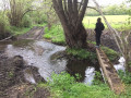
(10) Follow the path southwards along the stream. This path bends at a 90-degree angle before reaching the D 656.
(11) Turn right onto it, heading north. Cross the D 14 with care. Continue to Couvains.
(12) Cross the Ruisseau de Val de Couvains, continue northwards, and reach the Noë de Couvains. Continue north-east to reach the hamlet of Les Ménages and the junction with the D919.
(13) Cross this road very carefully, then pass through the hamlet of Marnefer and, after about 500 metres, rejoin the path you followed on the way there.
(2) Please note: it is easy to miss this turn-off if you allow yourself to be carried too far along the small road you are walking on.
Turn left onto theGRP® and return to the car park on the edge of the Route de l’Aigle in Mesnil-Rousset (S/E) via the same route as on the way there.


 Visorando Member

 Easy
Easy