


saverne67th

 Visorando Member
 Premium user
 - Gender: man
Sign up:
Published route(s)
 Le Champ du Feu from Hohwald
 11.32 mi
 +1,883 ft
 -1,854 ft
 6h 50
6h 50
 Average
 Departure from Le Hohwald (Bas-Rhin)
This hike will take you from Hohwald to Champ du Feu and Col de la Charbonnière. There are beautiful views of the Vosges from Crête des Myrtilles.
Billebaum-Haberacker-Ochsenstein-Krappenfels
4.60 mi
+623 ft
-600 ft
2h 40
 Easy
Departure from Reinhardsmunster (Bas-Rhin)
Easy
Departure from Reinhardsmunster (Bas-Rhin)
This short walk will take you to the sandstone "table rocks" typical of the Northern Vosges, with a visit to the medieval Ochsenstein Castle, perched atop one of these rocks.
Le Climont from the south side from the Col de Steige
 5.84 mi
+1,411 ft
-1,411 ft
3h 55
5.84 mi
+1,411 ft
-1,411 ft
3h 55
 Difficult
Departure from Ranrupt (Bas-Rhin)
Difficult
Departure from Ranrupt (Bas-Rhin)
The Climont is a curious conical massif which you will approach from the south face. The climb is steep, but the view from the top of the Julius Tower, at an altitude of over 960m, is well worth the effort.
21/04/2025: Five years after its first publication, I revisited this route to check that the description still matches the terrain. I took the opportunity to clarify certain sections and add a few waypoints.
The descent is quite technical and difficult, and it is best to avoid it in wet weather, or else do the hike in the opposite direction. Enjoy the outing, everyone.
The Ungersberg from Reichsfeld
 6.51 mi
+1,831 ft
-1,831 ft
4h 35
Average
Departure from Reichsfeld (Bas-Rhin)
6.51 mi
+1,831 ft
-1,831 ft
4h 35
Average
Departure from Reichsfeld (Bas-Rhin)
This circuit starts in Reichsfeld and takes you up to the Col de l'Ungersberg via the Gruckert chalet, then to the summit of the Ungersberg.
Please note that the initial slope is quite steep and long (nearly 14% for the first 2 kilometres).
Rohrschollen Island and Nature Reserve in Strasbourg (short version)
 2.69 mi
+20 ft
-20 ft
1h 15
Easy
Departure from Strasbourg (Bas-Rhin)
2.69 mi
+20 ft
-20 ft
1h 15
Easy
Departure from Strasbourg (Bas-Rhin)
A short trip to the Nature Reserve on Rohrschollen Island at the gates of Strasbourg.
A little-known getaway full of discoveries.
Please note that dogs are strictly prohibited in the reserve, even on a leash.
(5) June 2021: the city of Strasbourg has installed five rustic Highland Cattle cows on the island to clear the undergrowth beneath the power lines.
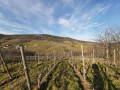
Baumgarten Abbey and Bernardvillé vineyard
 4.29 mi
+643 ft
-643 ft
2h 30
Easy
Departure from Bernardvillé (Bas-Rhin)
4.29 mi
+643 ft
-643 ft
2h 30
Easy
Departure from Bernardvillé (Bas-Rhin)
An easy hike to discover Baumgarten Abbey and the vineyards of Reichsfeld and Bernardvillé, with beautiful views of the Alsace plain and the Black Forest.
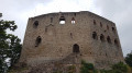
Andlau and Spesbourg Castles from Mittelbergheim
 6.20 mi
+1,060 ft
-1,083 ft
3h 45
Easy
Departure from Mittelbergheim (Bas-Rhin)
6.20 mi
+1,060 ft
-1,083 ft
3h 45
Easy
Departure from Mittelbergheim (Bas-Rhin)
An easy hike that will take you to the two castles of Andlau: Andlau and Spesbourg.
 Cycling on both sides of the Rhine from Strasbourg
18.15 mi
+49 ft
-49 ft
2 hrs
Easy
Departure from Strasbourg (Bas-Rhin)
A beautiful bike ride of nearly 30 km starting from the Stade de la Meinau in Strasbourg. It will take you through the Neuhof forest, up along the Canal d'Alsace on the French side, then back along the German bank, following the Old Rhine to the Jardin des Deux Rives, which straddles the Rhine and the border between Strasbourg and Kehl.
The route favours cycle paths and trails that are closed to vehicles.
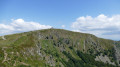
Gaschney, Hohneck, Schiessrothried: in search of chamois
 9.19 mi
+3,110 ft
-3,087 ft
6h 55
Difficult
Departure from Muhlbach-sur-Munster (Haut-Rhin)
9.19 mi
+3,110 ft
-3,087 ft
6h 55
Difficult
Departure from Muhlbach-sur-Munster (Haut-Rhin)
The slopes of the Hohneck and the surrounding glacial cirques are all areas frequented by the chamois reintroduced to the Vosges in the 1950s, over 60 years ago.You might just spot them on this hike.
The BloyGR®®531trail between (S/E) and (1) is closed from 1 November to 30 April under a prefectural order dated 18 May 2022.
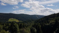
Le Bonhomme, the three passes and the battlefields of 1914-1918
 11.31 mi
+2,539 ft
-2,559 ft
7h 25
Difficult
Departure from Le Bonhomme (Haut-Rhin)
11.31 mi
+2,539 ft
-2,559 ft
7h 25
Difficult
Departure from Le Bonhomme (Haut-Rhin)
This hike will take you from Le Bonhomme to the 1914-1918 battlefields of Tête des Faux, then to the three passes of Calvaire, Louschbach and Bonhomme. Along the way, depending on the season, you can enjoy the abundance of blueberry bushes along the path.
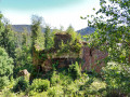
Freudeneck, Wangenbourg and Heidenschloss castles
 7.84 mi
+1,690 ft
-1,686 ft
5h 05
Average
Departure from Romanswiller (Bas-Rhin)
7.84 mi
+1,690 ft
-1,686 ft
5h 05
Average
Departure from Romanswiller (Bas-Rhin)
Between Romanswiller and Wangenbourg, this route allows you to visit the two medieval castles of Freudeneck and Wangenbourg and ends at the rocky outcrop of Heidenschloss.
Moderator's warning on 01/02/2021: Please note! Due to orientation issues, some hikers have added directions in the comments at the bottom of this page.
15/05/2024: Route modified to avoid private property.
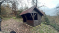
Mencke Rock and Waterfall, Heidenschloss, Rotfels
 6.79 mi
+892 ft
-896 ft
3h 55
Average
Departure from Romanswiller (Bas-Rhin)
6.79 mi
+892 ft
-896 ft
3h 55
Average
Departure from Romanswiller (Bas-Rhin)
Come and discover the improvements made by Otto Mencke at the end of the 19th century on the outskirts of Romanswiller: the small diversion canal from the Ziegbach which feeds a waterfall cascading from a rock. Then climb up to Heidenschloss to enjoy a beautiful view of the Mossig valley and continue on to Rotfels where you will see Wangenbourg Castle through the trees.
Steinernehiesel–Haberacker–Ochsenstein
 7.70 mi
+1,588 ft
-1,591 ft
4h 55
Average
Departure from Haegen (Bas-Rhin)
7.70 mi
+1,588 ft
-1,591 ft
4h 55
Average
Departure from Haegen (Bas-Rhin)
From the valley floor up to the summits, passing the forest lodges at Schaeferplatz and Haberacker, the medieval Ochsenstein Castle and the sandstone rock formations of the Schlossberg and Krappenfels.
A lovely walk with a bit of elevation gain and a few kilometres to ensure you have a pleasant day out.
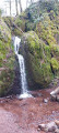
Circular loop above Lutzelhouse
 6.74 mi
+1,027 ft
-1,007 ft
4h 00
Average
Departure from Urmatt (Bas-Rhin)
6.74 mi
+1,027 ft
-1,007 ft
4h 00
Average
Departure from Urmatt (Bas-Rhin)
This short outing will allow you to discover some natural and man-made curiosities, pretty paths and remarkable trees.
Best done in good weather and not on windy days.
From Barr to Obernai via Mont Sainte-Odile
 12.05 mi
+2,110 ft
-2,175 ft
7h 25
Difficult
Departure from Barr (Bas-Rhin)
12.05 mi
+2,110 ft
-2,175 ft
7h 25
Difficult
Departure from Barr (Bas-Rhin)
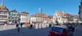
I suggest an online hike. The starting point is Barr station, which is easily accessible by train from Strasbourg. The finish is at Obernai station, from where you can easily catch a train back to Strasbourg; there are services every hour on weekdays.
The route will take you through the villages of Barr, Saint-Nabor, Bernardswiller and the town of Obernai, first through the vineyards and then into the forest on the slopes of Mont Sainte-Odile. You’ll be able to admire the ruins of the imposing Château du Landsberg (12th century). You can visit Hohenbourg Abbey, founded in 680 by Saint Odile, patron saint of Alsace, and admire the ruins of Niedermünster Abbey below.
Enjoy exploring!
From Sélestat to Ribeauvillé via Haut-Koenigsbourg
 13.49 mi
+1,946 ft
-1,713 ft
7h 55
Difficult
Departure from Sélestat (Bas-Rhin)
13.49 mi
+1,946 ft
-1,713 ft
7h 55
Difficult
Departure from Sélestat (Bas-Rhin)
Hiking trail from Sélestat station, easily accessible from many towns in Alsace, to Ribeauvillé, from where you can return to Sélestat station by bus.
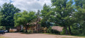
The route offers magnificent views of the Vosges mountains from the outskirts of Sélestat, with Kintzheim Castle and Haut-Koenigsbourg Castle on your left, the village of Châtenois opposite you, and Ramstein and Ortenbourg castles above Scherwiller on your right.
You will pass through part of Châtenois before tackling the climb to Haut-Koenigsbourg Castle, a major tourist attraction in Alsace. You will finally end your journey in the middle of the vineyards, between Bergheim, a charming fortified village in the foothills of the Vosges, and Ribeauvillé, your destination.
From Houlgate to Villers-sur-Mer via the Falaises des Vaches Noires
6.84 mi
+384 ft
-384 ft
3h 30
Average
Departure from Houlgate (Calvados)
Discover the Falaises des Vaches Noires (Black Cow Cliffs) from the heights and the shore. They are so named because of the limestone blocks piled up on the beach and covered with black seaweed, which make them look like cows. The Falaises des Vaches Noires were already renowned in the 18th century for their fossils and exceptional stratigraphy. Many fossils can be identified in the sand (please note that digging in the cliffs is prohibited).
A FEW PRECAUTIONS:- The beach is not accessible at high tide. It is essential to check the tide times before setting off. Only enter the beach at low tide, 3 to 4 hours after high tide. See Practical information.
- It is forbidden to climb the cliffs or remove fossils. However, you may collect fossils that are exposed on the surface of the sand.
Tour du Faudé, Col du Calvaire, Gazon du Faing from Orbey
 12.32 mi
+3,484 ft
-3,478 ft
8h 40
12.32 mi
+3,484 ft
-3,478 ft
8h 40
 Very difficult
Departure from Orbey (Haut-Rhin)
Very difficult
Departure from Orbey (Haut-Rhin)
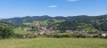
I suggest a fairly long hike with a significant elevation gain, classified as very difficult, which will allow you to discover the Orbey Valley with various remarkable viewpoints and several interesting sites: the Tour du Faudé, destroyed in 1915 and 1944 and rebuilt in the 1990s, the Duchesne Cemetery, a national necropolis for French soldiers who fell at Tête des Faux during theFirst World War, and the Gazon du Faing with its panoramic trail, a veritable balcony overlooking Lac Blanc and the Orbey Valley.
Caution! This route includes a very technical and difficult section on the descent from the ridges to Lac Blanc, between points (14) and (15). Do not attempt in wet weather. Choose the alternative route described in the practical information.
Champ du Feu and Col de la Perheux from Fouday
 13.48 mi
+2,556 ft
-2,552 ft
8h 25
Difficult
Departure from Fouday (Bas-Rhin)
13.48 mi
+2,556 ft
-2,552 ft
8h 25
Difficult
Departure from Fouday (Bas-Rhin)
This hike will take you through Ban-de-la-Roche, a place dear to Pastor Jean-Frédéric Oberlin, who served there for 60 years. The route will take you through magnificent landscapes, past a little-known castle (or what remains of it) and to the highest point in the Bas-Rhin.It is a fairly long hike with a significant elevation gain, classified as difficult, which I completed in about 7 hours of walking.
On the heights of Riquewihr and Hunawihr
 8.11 mi
+1,831 ft
-1,824 ft
5h 20
Average
Departure from Riquewihr (Haut-Rhin)
8.11 mi
+1,831 ft
-1,824 ft
5h 20
Average
Departure from Riquewihr (Haut-Rhin)
Here is a walk that will allow you to explore the hills of Riquewihr with its castles, the Reichenstein and the Bilstein, as well as the ruins of Sylo Abbey above Hunawihr.You might also take the opportunity to visit the village of Riquewihr and sample its wines.Enjoy your walk.