


Natacha2b

 Visorando Member
 Premium user
 - Gender: woman
Sign up:
Published route(s)
 Candia circular starting from Bonifatu
 2.65 mi
 +988 ft
 -988 ft
 2h 05
2h 05
 Moderate
 Departure from Calenzana (Haute-Corse)
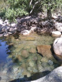
The Bonifatu Territorial Forest has a multitude of trails. The Candia circular, marked in purple, is ideal for a short walk. Starting in the direction suggested here, you can finish by relaxing in the river. Perfect for families or beginners.
Very shady.
Bonifatu Two-Sides Circular Loop
 5.93 mi
+2,152 ft
-2,152 ft
4h 35
Moderate
Departure from Calenzana (Haute-Corse)
5.93 mi
+2,152 ft
-2,152 ft
4h 35
Moderate
Departure from Calenzana (Haute-Corse)
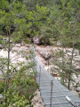
Bonifatu, with its forest of pine and oak trees, is a great spot for swimming, as well as for walking and hiking. Here, I suggest a route that combines several circular loops, allowing you to explore different slopes.
Circular three-village tour in Zilia
 7.46 mi
+2,657 ft
-2,674 ft
5h 45
Moderate
Departure from Zilia (Haute-Corse)
7.46 mi
+2,657 ft
-2,674 ft
5h 45
Moderate
Departure from Zilia (Haute-Corse)
A circular hike that allows you to visit three villages in Balagne whilst taking in views of the Réginu and Montegrosso plains on both sides. With its wooded sections and magnificent views, this hike is a wonderful way to discover the region. In the background, the magnificent Montegrossu looms over the village of Zilia at the start.
Walk in the woods at Avapessa
 3.64 mi
+574 ft
-591 ft
2h 10
3.64 mi
+574 ft
-591 ft
2h 10
 Easy
Departure from Avapessa (Haute-Corse)
Easy
Departure from Avapessa (Haute-Corse)
This short circular starting from the village of Avapessa is short and easy, making it ideal for family walks with children, for example. The fact that much of the route is shaded makes it ideal for summer walks.
Please note: the route presented here avoids a section of road suggested by the IGN map in favour of a wooded, signposted path marked in red.
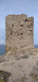
Between two towers from Arinella Beach
 3.30 mi
+256 ft
-240 ft
1h 45
Easy
Departure from Lumio (Haute-Corse)
3.30 mi
+256 ft
-240 ft
1h 45
Easy
Departure from Lumio (Haute-Corse)
As you walk along the coast, this walk will allow you to explore the remains of the built heritage, whilst admiring the view of the Gulf of Calvi and its citadel. The route passes by the square Tower of Caldanu and arrives at the round Tower of Spano. Two different Genoese architectural styles serving the same purpose: to watch for dangers coming from the sea...
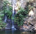
Carchetu circular
 1.88 mi
+394 ft
-384 ft
1h 10
Easy
Departure from Carcheto-Brustico (Haute-Corse)
1.88 mi
+394 ft
-384 ft
1h 10
Easy
Departure from Carcheto-Brustico (Haute-Corse)
This circular loop can be done with the family, for example, or simply to discover the Orezza region on a short and easy hike. During this walk, you can discover the region's natural heritage (waterfall) as well as its architectural heritage.
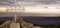
Sant'Angelo from Silvarecciu
 4.23 mi
+1,801 ft
-1,795 ft
3h 30
Moderate
Departure from Silvareccio (Haute-Corse)
4.23 mi
+1,801 ft
-1,795 ft
3h 30
Moderate
Departure from Silvareccio (Haute-Corse)
Sant Angelo (1,200 m) is a peak located between Casinca and Castaniccia. At its summit, you can enjoy a 360° view of the sea, the Biguglia lagoon and the surrounding villages and valleys.
The hike takes place in the undergrowth, mostly under the protection of chestnut trees.
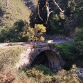
Santa Lucia di Moriani Circular Route
 6.91 mi
+1,709 ft
-1,706 ft
4h 40
Moderate
Departure from Santa-Lucia-di-Moriani (Haute-Corse)
6.91 mi
+1,709 ft
-1,706 ft
4h 40
Moderate
Departure from Santa-Lucia-di-Moriani (Haute-Corse)
The walk takes place mainly in woodland, particularly chestnut trees. It is very pleasant to walk alongside various streams such as the Ruisseau de Canapajo, after the Pont de l'Enfer. The ruins of an old mill are also visible. The route also passes through the hamlet of Serrale.
Circular route starting from Cervione
 5.87 mi
+2,287 ft
-2,290 ft
4h 40
Moderate
Departure from Cervione (Haute-Corse)
5.87 mi
+2,287 ft
-2,290 ft
4h 40
Moderate
Departure from Cervione (Haute-Corse)
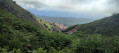
Located above Cervione, this hike offers a chance to admire varied landscapes and vegetation. The viewpoints, on either side of the mountains, also allow you to gaze from afar at built heritage, such as the Chapel of Scupiccia, for example, or the village of Santa-Maria Poggio. In the distance, out at sea, the Island of Monte Cristo can also be seen.
Circular walk starting from the village of Parata
 4.53 mi
+2,041 ft
-2,054 ft
3h 50
Moderate
Departure from Parata (Haute-Corse)
4.53 mi
+2,041 ft
-2,054 ft
3h 50
Moderate
Departure from Parata (Haute-Corse)
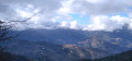
Nestled in the Castaniccia region at the end of the D46 departmental road lies the rural village of Parata, which serves as the starting point for several walks. The walk suggested here climbs up to the ridges, passing by the Chapel of San Bartolomeu. The views on either side of the ridge you follow offer vistas of both the Tyrrhenian Sea and the Castaniccia region with its villages.
Olmi circular route to Bocca Croce
 3.42 mi
+748 ft
-741 ft
2h 15
Easy
Departure from Olmi-Cappella (Haute-Corse)
3.42 mi
+748 ft
-741 ft
2h 15
Easy
Departure from Olmi-Cappella (Haute-Corse)
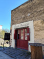
This walk is suitable for families. It is not particularly difficult and offers a bucolic stroll after visiting the villages. Much of the walk is shaded.
Three villages in Castagniccia starting from Piedicroce
 4.04 mi
+1,148 ft
-1,142 ft
2h 50
Moderate
Departure from Piedicroce (Haute-Corse)
4.04 mi
+1,148 ft
-1,142 ft
2h 50
Moderate
Departure from Piedicroce (Haute-Corse)
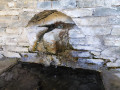
This circular route in Castagniccia offers both a remarkable natural and cultural setting. Passing through villages and other built-up areas, it allows you to discover Corsican heritage: houses, chapels, churches, a convent (near Piedicroce), as well as wash houses and fountains. The circular path, mostly in the woods, is shaded while offering exceptional views of the various villages in the region. Small streams provide refreshing breaks in summer, while remaining passable in winter.
Calatoghju Circular Loop
 1.73 mi
+686 ft
-686 ft
1h 25
Easy
Departure from Calenzana (Haute-Corse)
1.73 mi
+686 ft
-686 ft
1h 25
Easy
Departure from Calenzana (Haute-Corse)
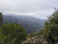
This short circular route in the heart of the Bonifatu National Forest is perfect for exploring the area in a short space of time. The route passes by the ruins of Prince Pierre Bonaparte's castle and offers shaded passages. The route is marked in green.
Double circular loop in Speloncato
 2.25 mi
+561 ft
-577 ft
1h 30
Easy
Departure from Speloncato (Haute-Corse)
2.25 mi
+561 ft
-577 ft
1h 30
Easy
Departure from Speloncato (Haute-Corse)
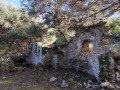
This short hike is interesting for its various monuments: fountains, wash house, ruined castle, houses, church and even a beehive house.
The path is shaded.
The gentle slope makes for an easy heritage walk at the foot of the village of Speloncato, which is ideal for families.
Circular route starting from Campodonico
 5.11 mi
+1,844 ft
-1,854 ft
3h 55
Moderate
Departure from Pie-d'Orezza (Haute-Corse)
5.11 mi
+1,844 ft
-1,854 ft
3h 55
Moderate
Departure from Pie-d'Orezza (Haute-Corse)
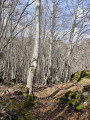
This circular route starting from Campodonico traverses varied mountain landscapes in the heart of Castagniccia. On the plateau, a breathtaking view allows you to admire the mountain range of central Corsica and the remarkable villages of Castagniccia, whilst enjoying a distant view of the sea. Furthermore, there are traces of ancient buildings to admire at Bocca al Prato.
Double circular route between Vescovato and Olmu
 7.50 mi
+1,969 ft
-1,972 ft
5h 10
Moderate
Departure from Haute-Corse
7.50 mi
+1,969 ft
-1,972 ft
5h 10
Moderate
Departure from Haute-Corse
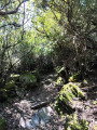
This walk forms a circular route linking the villages of Vescovato and Olmu. It starts in Vescovato, where the architectural heritage is well worth exploring for the curious, and passes through the village of Olmu, which will delight lovers of the ‘old stone’ architecture found in island villages. The landscapes you pass through are varied, ranging from woodland to oak groves and open, exposed areas such as the ridges. Thus, as you move from one slope to another, from one bank to the other, you will have the opportunity to enjoy views of both the sea and the islands bordering Corsica, as well as views of the mountains, which are sometimes snow-capped depending on the season.
The Mains d'Or of Monte d'Oro
5.81 mi
+2,572 ft
-2,579 ft
4h 55
 Difficult
Departure from Vivario (Haute-Corse)
Difficult
Departure from Vivario (Haute-Corse)
This hike offers the chance to discover the work of Italian artist Claudio Parmiggiani. In 1999, the sculptor carved his handprints, palms facing upwards. They were then set in granite. Strictly speaking, this artwork is not on the path leading up to the summit of Monte d’Oro. You will need to veer off the path to find it. Behind dense vegetation, you will find a large granite boulder below, in which the Golden Hands are embedded. It is therefore important to follow the GPS track.The hike enters the forest and climbs towards Monte d'Oro. The final kilometre is more challenging, with a climb that is at times steep and stony. You will need to use your hands to help you. You will also need to cross granite slabs that are sometimes very steep. Depending on the season, part of this final kilometre may also be waterlogged. For these reasons, the hike is classified as ‘difficult’.