Circular walk starting from the village of Parata

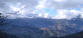
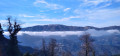
Nestled in the Castaniccia region at the end of the D46 departmental road lies the rural village of Parata, which serves as the starting point for several walks. The walk suggested here climbs up to the ridges, passing by the Chapel of San Bartolomeu. The views on either side of the ridge you follow offer vistas of both the Tyrrhenian Sea and the Castaniccia region with its villages. 

Details

44684814
Creation:
Last update:
Last review:
  • Walking
    Activity: Walking
  • ↔
    Distance: 4.53 mi
  • ◔
    Average duration: 3h 50 
  • ▲
    Difficulty: Moderate

  • ⚐
    Back to start: Yes
  • ↗
    Ascent: + 2,041 ft
  • ↘
    Descent: - 2,054 ft

  • ▲
    Highest point: 3,950 ft
  • ▼
    Lowest point: 1,972 ft
  • ⚐ Country: France
  • ⚐ City: Parata (20229)
  • ⚑
    Start/End: N 42.371377° / E 9.407275°
  • ❏
    IGN map(s): Ref. 4349OT, 4351OT
  • Hour-by-hour weather

Photos

Description of the walk

Park before the Church of San Gavinu in Parata.

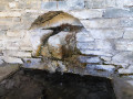
(S/E) Head towards the church and you’ll immediately find the start of the path on the right. Just before reaching the summit leading to the ridge, you’ll come across a spring.

(1) Carry on along the path to reach the ridge and a crossroads.

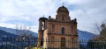
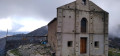
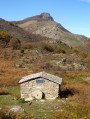
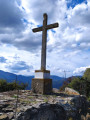
(2) Take care to take the path on the right, which climbs up to the Chapel of San Bertolomeo and continues along the ridges. Pass Pointe Stolo and leave Mont de Concone on your left. You will reach a junction. 

(3) Take the path on the right which descends towards Parata. Take care not to take the wrong turn; the path must go downhill. On this section, the IGN map does not correspond to the actual terrain, but the path is marked in orange.

(4) At this fork, turn right downhill and further down you’ll come to the junction with the old route, which is still shown on maps. 

(5) Turn right, heading towards the village of Parata.

(6) Walk through the village to the car park (S/E). 

Waypoints

  1. S/E : mi 0 - alt. 1,985 ft - Car park D46
  2. 1 : mi 1.24 - alt. 3,081 ft - Source
  3. 2 : mi 1.48 - alt. 3,442 ft - Junction, turn right
  4. 3 : mi 2.66 - alt. 3,701 ft - Junction
  5. 4 : mi 3.23 - alt. 3,117 ft - On the right, going downhill
  6. 5 : mi 3.75 - alt. 2,434 ft - T-junction, left: fluorescent orange
  7. 6 : mi 4.42 - alt. 2,005 ft - Parata
  8. S/E : mi 4.53 - alt. 1,985 ft - Arrival

Notes

You can park in front of the parish church.

Worth a visit

The tiny village of Parata is home to a biscuit shop and patisserie that will delight you! 

Also worth a visit is the parish church of San Gavinu. 

Reviews and comments

3.9 / 5
Based on 3 reviews

Reliability of the description
3.7 / 5
Ease of following the route
3.7 / 5
Route interest
4.3 / 5
User 841838

Overall rating : 5 / 5

Date of your route : Sep 01, 2026
Reliability of the description : ★★★★★ Very good
Ease of following the route : ★★★★★ Very good
Route interest : ★★★★★ Very good
Very busy route : No

A lovely, easy circular walk with beautiful views of the Castagniccia. Excellent sheep’s cheese matured at the sheepfold.

Machine-translated

christophe62500
christophe62500

A lovely route through the woodland
The distance is closer to 10 km
It’s true that doing the route in the opposite direction allows you to stop for a bite to eat at San Bertuli (a small inn with friendly owners) before starting the descent towards Parata (a 3.42 km descent)

Machine-translated

colasmar
colasmar

Overall rating : 4.3 / 5

Date of your route : Aug 18, 2025
Reliability of the description : ★★★★★ Very good
Ease of following the route : ★★★★☆ Good
Route interest : ★★★★☆ Good
Very busy route : No

Overall, a nice route. There is just one point (clearly indicated on Visiorando) where you need to be careful to turn right at the crossroads
If you follow the recommended route, the climb is easy, but I found the descent a bit tough. There's a great place to stop at the church of San Bartolomeu, where a real shepherd sells delicious charcuterie and excellent broccio doughnuts. But be careful if you follow the recommended route, as this stop comes up very quickly (around 2.5 km) and there is still quite a climb ahead. So it's best to eat lightly. Otherwise, if you go in the opposite direction, this break will be welcome after about 3 to 3½ hours.

Machine-translated

Netra
Netra ★

Hello User 24746018,

Which coordinates are you referring to? The ones shown for the start/finish point? If that’s the case, it’s strange, as these coordinates are calculated automatically based on the map.

If not, were you still able to find the starting point? Did you go on the walk?

Machine-translated

User 24746018

Overall rating : 2.3 / 5

Date of your route : May 24, 2025
Reliability of the description : ★☆☆☆☆ Very disappointing
Ease of following the route : ★★☆☆☆ Disappointing
Route interest : ★★★★☆ Good
Very busy route : No

According to the coordinates given, Parata is located in the Tyrrhenian Sea!

Machine-translated

Other walks in the area

For more walks, use our search engine .

The GPS track and description are the property of this route's author. Please do not copy them without permission.