Country:
 City:
City:


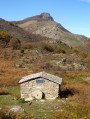
The route starts near the San-Pietro Chapel, off the D46, where you’ll find parking spaces.
(S/E) Take the path which initially runs alongside the road, then branches off to the left and soon reaches the junction with a wider, unpaved track. If you’re walking the route anti-clockwise, take care to spot this junction, as it’s not very visible due to the layout of the terrain: the sign has fallen over.
(1) Head up to the right until you rejoin the D46. Cross it and continue straight ahead along a dirt track which turns 90° to the right and heads east. You’ll come to a junction.
(2) Continue along the road to the right of the junction until you approach the Ruisseau d’Isola, then follow its left bank after negotiating a hairpin bend. You’ll come to a crossroads.
(3) Head to the right, go down to the stream, cross it, then head back up for about one kilometre to reach a junction that isn’t shown on the map.
(4) Continue uphill to the right, following the orange markings, and leave the red markings on your left. You’ll reach Bonifaziu – remember to close the gate marking the entrance to the village.
(5) Take the path on the right to join the D136, which leads to San-Damiano. Follow it for a few dozen metres, then look out for a path on the right with orange markings. Continue along this path, which climbs up to San Damianu, crossing the road several times.
(6) Leave the D136 and turn left onto the road leading up to Mont-d’Olmo. Leave this road after about 200 metres to take a path that branches off to the right, rejoining the road further up at a bend. Continue uphill until you reach the sign for Mont d’Olmo, marked in orange.
(7) Take the path on the right to reach the hamlet from above and carry on in the same direction.
(8) At the junction, turn left onto the tarmac path and continue uphill. Then leave the tarmac path to take the dirt track branching off to your right, which leads to a junction.
(9) From there, take the path on your right signposted ‘San Bertuli’. If the suggested walk takes you to Mount Emerini, you should head towards San Bertuli.
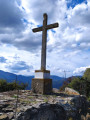
(10) Please note: at this point, the path continues for a few metres with orange markings, but then leads nowhere. You need to find the junction before the short descent and the sign on a large oak tree marked “Trail 9”. Climb up to where there is a cairn to rejoin the path leading to the cross. Then climb up onto the ridge and continue on to Mount Emerini.
(11) Continue along the south-facing ridge to reach Pietra Giusta.
(12) Carry on along the path until you reach a junction.
(13) Go straight on to descend to San Bertuli: chapel and panoramic views. In summer, this is also a place where you can stop for a bite to eat. Please note: there are four paths leading to San Bertuli; on the way back, make sure you follow the same route (San Damianu).
(14) Turn back.
(13) Take the path on your left to head back down towards Piazzole. Follow the ridge path for about 500 m.
(15) Turn right to head back down to Piazzole. At the entrance to the village, please make sure you close the gate properly.
(16) Walk through the village and join the D46. Continue to the right to return to your car park (S/E).
 Visorando Member
 Moderate
 Easy
Easy