The Mains d'Or of Monte d'Oro

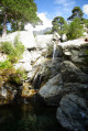
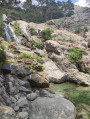
This hike offers the chance to discover the work of Italian artist Claudio Parmiggiani. In 1999, the sculptor carved his handprints, palms facing upwards. They were then set in granite. Strictly speaking, this artwork is not on the path leading up to the summit of Monte d’Oro. You will need to veer off the path to find it. Behind dense vegetation, you will find a large granite boulder below, in which the Golden Hands are embedded. It is therefore important to follow the GPS track.
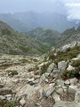
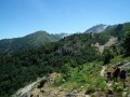
The hike enters the forest and climbs towards Monte d'Oro. The final kilometre is more challenging, with a climb that is at times steep and stony. You will need to use your hands to help you. You will also need to cross granite slabs that are sometimes very steep. Depending on the season, part of this final kilometre may also be waterlogged. For these reasons, the hike is classified as ‘difficult’.

Details

97860449
Creation:
Last update:
Last review:
  • Walking
    Activity: Walking
  • ↔
    Distance: 5.81 mi
  • ◔
    Average duration: 4h 55 
  • ▲
    Difficulty: Difficult

  • ⚐
    Back to start: Yes
  • ↗
    Ascent: + 2,572 ft
  • ↘
    Descent: - 2,579 ft

  • ▲
    Highest point: 5,495 ft
  • ▼
    Lowest point: 2,986 ft
  • ⚐ Country: France
  • ⚐ City: Vivario (20219)
  • ⚑
    Start/End: N 42.128206° / E 9.133854°
  • ❏
    IGN map(s): Ref. 4251OT, 4251OTR, 4252OT, 4252OTR
  • Hour-by-hour weather

Description of the walk

The hike starts at di a casa di a Natura (immersion centre). You can park further down, near the station.

(S/E) Head towards the nature centre, di a casa di a Natura. Follow the path uphill.

(1) After crossing the footbridge, take the path that climbs to the left, marked in yellow.

(2) The path crosses the forest road once, then four more times. You must then follow the yellow markings and the signs indicating "Monte d'Oro".
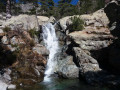
Wade across the stream and take the path up to the left. After a short flat section, the climb begins on a steep, stony path. The path also passes over large granite slabs. Take care.

(4) At this point, the path bends and a wooden sign indicating "les Mains d'Or" is simply placed to one side (it may therefore no longer be there, or may have been moved). From this point, you must cross through vegetation where there is no marked path. You must then descend to find a large granite boulder where the sculptures are located.

(5) Return to the car park via the reverse route of the outward journey ::S/E::.

Waypoints

  1. S/E : mi 0 - alt. 2,992 ft - Gare de Vizzavona
  2. 1 : mi 0.5 - alt. 3,114 ft - Footbridge - Vecchio (rivière)
  3. 2 : mi 1.38 - alt. 3,625 ft - Shortcut
  4. 3 : mi 2.14 - alt. 4,367 ft - Fording
  5. 4 : mi 2.83 - alt. 5,482 ft - Les Mains d'Or signpost
  6. 5 : mi 2.9 - alt. 5,427 ft - Les Mains d'Or
  7. S/E : mi 5.81 - alt. 2,986 ft - Gare de Vizzavona

Notes

Take plenty of water and dress appropriately: good waterproof walking boots with soles that provide good grip, as well as walking poles. Even in summer, take something to keep you warm, as snow may still be present.

Download the map in "offline" mode and use your GPS to find the Mains d'Or. There may be no mobile signal along the route.

Worth a visit

You’ll be moving from the forest to the mountains. After seeing the “Mains d’Or”, you can continue your ascent to the “Bocca di Pozzi” pass.

Other walks in the area

For more walks, use our search engine .

The GPS track and description are the property of this route's author. Please do not copy them without permission.