Double circular loop in Speloncato

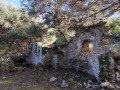
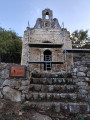
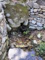
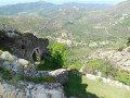
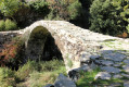
This short hike is interesting for its various monuments: fountains, wash house, ruined castle, houses, church and even a beehive house.

The path is shaded.

The gentle slope makes for an easy heritage walk at the foot of the village of Speloncato, which is ideal for families.

Details

92091870
Creation:
Last update:
Last review:
  • Walking
    Activity: Walking
  • ↔
    Distance: 2.25 mi
  • ◔
    Average duration: 1h 30 
  • ▲
    Difficulty: Easy

  • ⚐
    Back to start: Yes
  • ↗
    Ascent: + 561 ft
  • ↘
    Descent: - 577 ft

  • ▲
    Highest point: 1,132 ft
  • ▼
    Lowest point: 577 ft

Photos

Description of the walk

Park along the D71.

There is a whole network of paths that eventually converge. Be sure to follow the information on the map so as not to lengthen your route.

(S/E) Cross the road carefully and pass between two buildings (there is a sign). Continue north for about 50 metres until you reach a fork.

(1) Turn left and continue north-west for about 400 metres.

(2) In front of a building and an intersection, turn left and continue straight ahead for about 200 metres (ignore the other intersections) until you reach a crossroads.

(3) Go straight downhill and continue straight ahead. Ignore the first path on the right, then a second on the left and, after 400 m, another on the left. Pass some fountains and arrive at an intersection.

(4) Turn right, passing over the fountain undergoing restoration, which is on the path on your left. Cross a stream and continue straight ahead. Leave the path on your left, turn south-east/south and return to the crossroads you passed on the way there.

(3) Turn left and, following the same route as on the way there, return to the car park (S/E).

Waypoints

  1. S/E : mi 0 - alt. 1,132 ft - Parking is available along the D71.
  2. 1 : mi 0.05 - alt. 1,070 ft - Fork
  3. 2 : mi 0.29 - alt. 820 ft - Batisse
  4. 3 : mi 0.41 - alt. 797 ft - Crossroads of the circular loop
  5. 4 : mi 1.24 - alt. 587 ft - Fountain
  6. S/E : mi 2.25 - alt. 1,129 ft - Parking is available along the D71.

Notes

There are two fountains along the route.

Worth a visit

Ruined castle, fountains, wash house, church, chapel.

The village of Speloncato is also worth exploring, with its church and convent.

Reviews and comments

5 / 5
Based on 1 review

Reliability of the description
5 / 5
Ease of following the route
5 / 5
Route interest
5 / 5
User 18258930

Overall rating : 5 / 5

Date of your route : Jun 18, 2026
Reliability of the description : ★★★★★ Very good
Ease of following the route : ★★★★★ Very good
Route interest : ★★★★★ Very good
Very busy route : No

A very interesting and well-shaded heritage trail. Signposts and local information complement the very precise route descriptions.

Machine-translated

Other walks in the area

For more walks, use our search engine .

The GPS track and description are the property of this route's author. Please do not copy them without permission.