Country:
 City:
City:


You can park just before the ‘passage canadien’ at the entrance to Campodonicio or along the road before you reach the village, as parking within the village is reserved for residents.
(S/E) From the Canadian gate, enter the village and follow the signs on the left indicating several walking routes. Open, then remember to close the black gate leading to the walking routes: you need to give the handle a firm pull. Walk a few dozen metres, then follow a small wooden sign on your right pointing towards San Petrone.
(1) At the junction, continue straight ahead along the path (on your left), following the sign for “San Petrone 2h45”. Ignore the path that climbs up to the right.
(2) Go through the gate, remembering to close it behind you, and continue along the path until you reach a three-way junction.
(3) Take the path on your right, towards Bocca Favalta and San Petrone. Continue uphill until you reach a junction marked by signposts.
(4) Caution! A few metres before the junction, the path continues to the left and leads to a stream. The bend leading to the signposts is a hairpin bend and not easy to spot. If you end up at the stream, don’t panic – just retrace your steps for about ten metres to get back onto the path.
(5) Turn left, towards Bocca Favalta and San Petrone, and reach the top of the pass
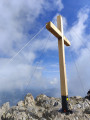
(6) Turn right and reach the summit by walking along the ridge. Then carry on to the plateau. The signpost may have fallen off its post, but the other directions are marked. You’ll reach the plateau and the junction with the walk starting from the Col de Prato.
(7) Continue climbing to the right, towards San Petrone.
(8) From this point, the gradient becomes steeper for about 100 metres, then levels off.
(9) From here, the route becomes more physically demanding as you make your way to the summit.
(10) Follow the same route back to the car park (S/E)
 Visorando Member
 Moderate
 Easy
Easy