Country:
 City:


The route suggested here starts from the village of Campana. You can park along the D71. The markings are yellow at the start of the village, then change to orange throughout the route.
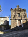
(S/E) The route starts at the top of the village; there are yellow markings leading up to the church. Once you reach the church, turn right and follow the dirt track until you reach a junction.
(1) Take the path branching off to the left, signposted ‘Campodonicio’. After 2.5 km, you’ll reach a fork in the path with a gate.
(2) From here, the route will be marked in orange until the end of the route. After closing the gate behind you, take the path on the left towards the village. Pass through a second gate and join the tarmac road (D246) on the left, which leads out of the village. Continue along this road for half a kilometre, until you reach a pigsty.
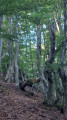
(3) Just below the pigsty, leave the tarmac road and take the dirt footpath that runs through the woodland for 1 km until you reach a road.
(4) Take this on the left, then head right towards Pastoreccia. When you reach the bend, head towards the village (the road on the right also leads to Pastoreccia, but you’ll have to go downhill to rejoin the main road). Head downhill to the left and rejoin the dirt track for half a kilometre until you reach the D71 and the Saint-François d’Orezza Convent. The markings are still orange.
(5) You’ll arrive opposite the Orezza Convent. Continue along the road to the left for about ten metres.
(6) Leave the road and follow the dirt track opposite for about 2.5 km until you reach a junction.
(7) Head uphill towards Campana.
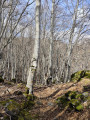
(8) Please note: take care, as it’s easy to miss the fork in the path leading uphill to the right. Always follow the orange markings painted on the chestnut trees. This climb of about 1 km may seem a little challenging towards the end of the walk. A few metres before reaching the road, go through the gate and remember to close it behind you before heading back to the car park along the D71 ( S/E).
 Visorando Member
 Difficult

 Easy