


mitchka

 Visorando Member
 Premium user
 Sign up:
Published route(s)
 The Fromené Valley
 3.76 mi
 +276 ft
 -262 ft
 2h 00
2h 00
 Easy
Easy
 Departure from Plessala (Côtes-d'Armor)
A circular route with the first section along the hillside and at the bottom of the valley, followed by a return via the Mené ridges.
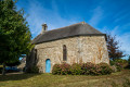
The Chapel of Saint-Guénaël and the Pellionnaye Menhir
 7.76 mi
+436 ft
-423 ft
3h 55
7.76 mi
+436 ft
-423 ft
3h 55
 Moderate
Departure from Gomené (Côtes-d'Armor)
Moderate
Departure from Gomené (Côtes-d'Armor)
A circular walk through the woods and countryside of Gomené, along footpaths or small tarmac roads, between the Chapel of Saint-Guénaël and the Pellionnaye Menhir.
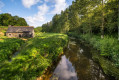
La Roche au Cerf circular starting from Langast
 7.24 mi
+394 ft
-377 ft
3h 40
Moderate
Departure from Langast (Côtes-d'Armor)
7.24 mi
+394 ft
-377 ft
3h 40
Moderate
Departure from Langast (Côtes-d'Armor)
A circular route, mainly on footpaths and sunken lanes, takes you from the village of Langast, with its very old church, to the thousand-year-old site of the Roche au Cerf ford and along streams and then the Lié valley.
Discover Moncontour and its surroundings
 6.64 mi
+449 ft
-479 ft
3h 25
Moderate
Departure from Moncontour (Côtes-d'Armor)
6.64 mi
+449 ft
-479 ft
3h 25
Moderate
Departure from Moncontour (Côtes-d'Armor)
This circular route allows you to discover the small medieval town by strolling through its narrow streets, then walking along the leat and through sunken paths to the Notre-Dame-du-Haut Chapel. The last part of the walk offers beautiful views of the town and its ramparts.
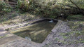
From Tournemine to Pointe de Bréhin
 6.62 mi
+712 ft
-692 ft
3h 40
Moderate
Departure from Plérin (Côtes-d'Armor)
6.62 mi
+712 ft
-692 ft
3h 40
Moderate
Departure from Plérin (Côtes-d'Armor)
This circular route straddles the municipalities of Plérin and Pordic. The route follows the coastal path between Tournemine Beach and Pointe de Bréhin, offering beautiful views of Rosaires Beach and the port of Binic. The return journey is inland, mainly through valley bottoms.
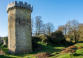
The Lié valley upstream from La Chèze
 13.92 mi
+607 ft
-600 ft
6h 55
13.92 mi
+607 ft
-600 ft
6h 55
 Difficult
Departure from La Prénessaye (Côtes-d'Armor)
Difficult
Departure from La Prénessaye (Côtes-d'Armor)
This walk follows the River Lié, a tributary of the River Oust, itself a tributary of the River Vilaine. It follows the Voie Verte, a former railway line linking Saint-Méen-le-Grand and Carhaix-Plouguer. It offers the chance to explore La Chèze, a small village in the shadow of its castle ruins, the former stronghold of the Lords of Rohan. The circular route ends with paths and small roads through the hills of the Saint-Barnabé and La Prénessaye countryside.
Panoramic views of Mont-Saint-Michel
 18.34 mi
+397 ft
-397 ft
8h 45
Difficult
Departure from Roz-sur-Couesnon (Ille-et-Vilaine)
18.34 mi
+397 ft
-397 ft
8h 45
Difficult
Departure from Roz-sur-Couesnon (Ille-et-Vilaine)
A circular route offering a variety of views of Mont-Saint-Michel. From the viewing points on the hills overlooking the bay, the paths along the polder dykes or the edges of the salt marshes and canals, this architectural marvel is always in view.
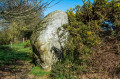
Menhirs of Le Mené
 8.07 mi
+377 ft
-351 ft
4h 00
Moderate
Departure from Langourla (Côtes-d'Armor)
8.07 mi
+377 ft
-351 ft
4h 00
Moderate
Departure from Langourla (Côtes-d'Armor)
The entire Mené region, in the heart of the Armorican Massif, is dotted with large granite boulders, the eroded remains of ancient mountains. This walk offers the chance to discover a few menhirs. The ‘Chaos de Quemelin’ site is also remarkable. The Rance winds its way through a chaos of rocks. Throughout the route, you’ll notice the presence of granite, often in piles of large boulders pushed to the edges of fields or into the woods to make way for crops.
Croquélien, in the footsteps of the Margot fairies
 0.98 mi
+121 ft
-121 ft
0h 35
Easy
Departure from Le Gouray (Côtes-d'Armor)
0.98 mi
+121 ft
-121 ft
0h 35
Easy
Departure from Le Gouray (Côtes-d'Armor)
Brittany is a land of legends. The site of Croquélien, with its chaotic granite boulders, was once reputed to be the home of the Margot fairies. This short walk will allow you to discover this pretty spot, searching for the evocative shapes of the rocks – the fairies’ bathtub, the armchair… or the fabulous treasure they are said to have hidden there.
Route des moulins autour de Plouguenast-Langast
 9.82 mi
+574 ft
-577 ft
5h 00
Moderate
Departure from Plouguenast (Côtes-d'Armor)
9.82 mi
+574 ft
-577 ft
5h 00
Moderate
Departure from Plouguenast (Côtes-d'Armor)
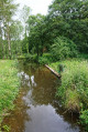
The commune of Plouguenast-Langast offers numerous walking, horse-riding and cycling routes. This walk avoids tarmac roads as much as possible, favouring footpaths and sunken lanes through the countryside, woodland and valley floors. It passes close to numerous watermills which, until the mid-20th century, were an essential part of rural life.
A short walk around the Roche-au-Cerf site
 2.13 mi
+154 ft
-141 ft
1h 05
Easy
Departure from Plessala (Côtes-d'Armor)
2.13 mi
+154 ft
-141 ft
1h 05
Easy
Departure from Plessala (Côtes-d'Armor)
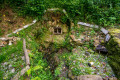
A very pretty little walk that takes you along almost no tarmac roads and follows the Lié valley, on the edge of the Loudéac forest. It takes you to some very interesting sites: La Roche-au-Cerf and its thousand-year-old ford, the castle and the Essarts mill.
Circular from Tréveneuc to Pointe du Bec de Vir
 4.50 mi
+407 ft
-407 ft
2h 25
Easy
Departure from Tréveneuc (Côtes-d'Armor)
4.50 mi
+407 ft
-407 ft
2h 25
Easy
Departure from Tréveneuc (Côtes-d'Armor)
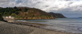
A short walk that allows you to discover the village of Tréveneuc and its coastline via the customs officers' path.
Moncontour et ses châteaux
 5.19 mi
+469 ft
-469 ft
2h 50
Easy
Departure from Hénon (Côtes-d'Armor)
5.19 mi
+469 ft
-469 ft
2h 50
Easy
Departure from Hénon (Côtes-d'Armor)
The area around Moncontour, an ancient fortified town, is home to several châteaux and manor houses. This circular route through the countryside and woods takes in three of them: Château Bellevue, Château des Granges and Manoir du Vauclair. The last part of the route also offers lovely views of the town of Moncontour.
Walk... on iron from the start at Vaublanc
 5.11 mi
+558 ft
-561 ft
2h 50
Easy
Departure from Plémet (Côtes-d'Armor)
5.11 mi
+558 ft
-561 ft
2h 50
Easy
Departure from Plémet (Côtes-d'Armor)
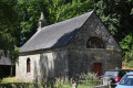
Set off to explore the surroundings of the Forges du Vaublanc, which was an important iron foundry fromthe 17th tothe 19th century. The ore came from the region. The route follows the Lié, which provided hydraulic power to the factory, then crosses the Loudéac forest where dozens of charcoal burners produced the charcoal needed to fuel the blast furnaces.
Short circular ‘Deer Loop’ walk in Tréby
 6.23 mi
+545 ft
-574 ft
3h 20
Moderate
Departure from Trébry (Côtes-d'Armor)
6.23 mi
+545 ft
-574 ft
3h 20
Moderate
Departure from Trébry (Côtes-d'Armor)
This route is part of the Circuit des Chevreuils,a PR® trail marked in yellow and 18 km long. The 10 km section described here focuses on the upper part of the commune of Trébry and starts at Bel Air which, at an altitude of 339 m, is the highest point in the Côtes d’Armor.
From the railway line to the Roman road via Laurenan
6.32 mi
+233 ft
-256 ft
3h 05
Moderate
Departure from Laurenan (Côtes-d'Armor)
An easy walk that follows the old railway line of the narrow-gauge railway from Carhaix to La Brohinière, then joins the Chemin de l’Etrat, a Roman road linking Corseul to Vannes. This is the eastern section of the short walking route ‘Au carrefour des voies’.
The Ascent of Mont Bel Air
8.74 mi
+784 ft
-784 ft
4h 40
Moderate
Departure from Trédaniel (Côtes-d'Armor)
Admittedly, this isn’t the Alps, but this circular route still takes you up to the highest point in the Côtes d’Armor (339 m above sea level). The walk starts at the very pretty Notre-Dame du Haut chapel and climbs via sunken paths, farm tracks and small roads to the Notre-Dame du Mont-Carmel chapel. These two places of worship were once popular pilgrimage destinations and sites of indulgences. The route offers some beautiful views of the countryside stretching as far as the shores of Saint-Brieuc Bay.
Walk around the Rochereuil site
 3.17 mi
+243 ft
-269 ft
1h 40
Easy
Departure from Sévignac (Côtes-d'Armor)
3.17 mi
+243 ft
-269 ft
1h 40
Easy
Departure from Sévignac (Côtes-d'Armor)
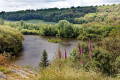
The Rochereuil site is a rocky promontory overlooking a pond. It has been a place of pilgrimage to the Virgin Mary since 1914, when a replica of the Grotto of Lourdes was built there. This short walk through the woodland offers views of the ponds at Château de la Moussaye and lovely panoramic views of the Sévignac countryside. It ends by following a botanical trail along the Ruisseau de la Rosaie.