Country:
 City:


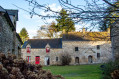
Park near the church in Vieux Bourg.
(S/E) Take the road opposite the church, towards Les Hauts Champs. After 200 m, turn onto the path on the right, just after the stream. Follow this path and cross the Lié via the footbridge.
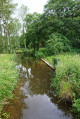
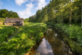
(1) Then take the path on the right, which runs alongside the river. Cross the river again via a second footbridge to reach the Guette-ès-Lièvres site.
(2) Take the road on the left, cross the bridge, then take the path on the right, which climbs into the woods. Stay on this path, at the top of the valley, until you reach the wall of a house. Continue for a further 100 m before turning into a sunken lane on the left. You will reach the Route de la Ville Danne.
(3) Turn right onto this road. At the next junction, by the Chauchix cross, turn right again and head down to Pontgamp.
(4) Cross the D768 (dangerous road).
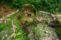
You can turn left and walk about a hundred metres to the wash house. Behind the wash house, beneath the road, you’ll see the old Sainte-Anne Fountain.
(5) Turn round and head back to the fork in the road.
(4) Continue straight ahead, walking carefully along the D768 for 120 metres without crossing the Lié, then turn left onto a path.
(6) Head up to the right, towards the village of Plouguenast, using the footbridge that crosses the River Lié. Then head up to the left along Rue du Général de Gaulle, until you reach the Église du Vieux Bourg.
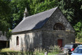
(7) Turn back for 60 metres and turn left onto Rue Francis David. At the end of this street, turn right and cross the D768, taking care at all times. Carry on straight ahead for 50 metres and turn right before the fire station. Then take the path on the left which passes in front of the doorway of the former Chapel of Saint-Michel de Cornéan, the sole remnant of a chapel that was destroyed and subsequently rebuilt in this park.
(8) Continue along the path which climbs into the woods, then descends towards the river. Ignore the D768 and continue to the left, staying on the left bank for about a hundred metres, before crossing the Lié via a footbridge.
(9) Then follow the path that runs alongside the river to the Moulin de Guette-ès-Lièvres. Walk past the mill to return to the left bank. Head back to the junction you passed on the way out.
(2) Cross the road and keep to the left, on the path that runs alongside the river. At the first junction, carry on straight ahead to the Moulin Lanfonço. Walk along the rear wall of the building and continue straight ahead. The path leads back to the Vieux Bourg (S/E).

 Visorando Member
 Moderate