Punta de Llobatera

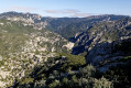
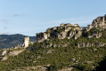
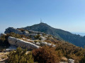
Explore the mountains above Mas de Barbarans on a circular walk offering beautiful views of the Montsià mountain range and overlooking the coastal plain. The walk reaches its highest point at Punta de la Llobatera at 786 m.

Details

n°37348914
Creation:
Last update:
Last review:
  • Walking
    Activity: Walking
  • ↔
    Distance: 6.41 mi
  • ◔
    Average duration: 4h 25 
  • ▲
    Difficulty: Moderate

  • ⚐
    Back to start: Yes
  • ↗
    Ascent: + 1,709 ft
  • ↘
    Descent: - 1,673 ft

  • ▲
    Highest point: 2,608 ft
  • ▼
    Lowest point: 1,115 ft

Photos

Description of the walk

Park in the village of Mas de Barbarans.

(S/E) Head up to the very north of the village. The path starts from the road overlooking the village (sign for “Punta de Llobatera”). You’ll come to a crossroads (alt. 410 m).

(1) Take the path which climbs steeply. It is clearly marked and signposted with cairns throughout the route. You’ll come to a marker at a junction.

(2) Continue to the right along the path to enjoy some views of the jagged ridges.

(3) Return to the previous marker.

(2) Turn right onto the path towards Punta de Llobatera and head towards it.

(4) After Punta de Llobatera, the path continues along the ridge and then descends to another junction.

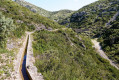
(5) Continue along the path on the left, which descends across a few scree slopes until it reaches an irrigation channel.

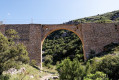
(6) Where there is no path, follow the irrigation channel to the left until you reach the aqueduct (Pont de les Canals). Go down the path to the left of the bridge, then follow the path downhill which runs alongside the stream. Continue along this path until you reach the road.

(7) Turn left onto the road to reach the village of Mas de Barbarans and the starting point (S/E).


Waypoints

  1. S/E : mi 0 - alt. 1,115 ft - Mas de Barbarans
  2. 1 : mi 0.58 - alt. 1,352 ft - Start of the trail
  3. 2 : mi 2.28 - alt. 2,418 ft - Junction A/rR towards Rocca Bianca
  4. 3 : mi 2.57 - alt. 2,608 ft - Viewpoint
  5. 4 : mi 3.68 - alt. 2,507 ft - Punat de Llobatera
  6. 5 : mi 4.17 - alt. 2,129 ft - junction
  7. 6 : mi 5 - alt. 1,273 ft - Les Canals Bridge
  8. 7 : mi 5.8 - alt. 1,132 ft - Road
  9. S/E : mi 6.41 - alt. 1,122 ft - Mas de Barbarans

Notes

This walk should be done early in the morning as there is no shade. Bring plenty of water (there are no water sources along the route).

Reviews and comments

4.2 / 5
Based on 2 reviews

Reliability of the description
4.5 / 5
Ease of following the route
4 / 5
Route interest
4 / 5
Dugland
Dugland

Overall rating : 3.7 / 5

Date of your route : Sep 30, 2024
Reliability of the description : ★★★★☆ Good
Ease of following the route : ★★★☆☆ Average
Route interest : ★★★★☆ Good
Very busy route : No

A very beautiful view, but there are lots of very stony, slippery paths, so it’s a bit tricky

Machine-translated

Pedro1957
Pedro1957

Overall rating : 4.7 / 5

Date of your route : Sep 14, 2024
Reliability of the description : ★★★★★ Very good
Ease of following the route : ★★★★★ Very good
Route interest : ★★★★☆ Good
Very busy route : No

The ascent for ‘intermediate’ walkers is relatively straightforward and quick, with no particular difficulties.

However, the descent is technical, with scree slopes everywhere – steep and fast-going for 4 km! Not recommended for beginners or those in trainers…

After the viaduct (irrigation canal), it’s a gentle stroll.

Thanks to the Spanish cairns, which are very well marked

Beautiful scenery, superb Santa Barbara

Machine-translated

Other walks in the area

For more walks, use our search engine .

The GPS track and description are the property of this route's author. Please do not copy them without permission.