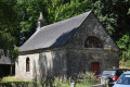
Route des moulins autour de Plouguenast-Langast

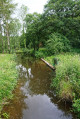
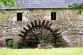
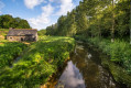
The commune of Plouguenast-Langast offers numerous walking, horse-riding and cycling routes. This walk avoids tarmac roads as much as possible, favouring footpaths and sunken lanes through the countryside, woodland and valley floors. It passes close to numerous watermills which, until the mid-20th century, were an essential part of rural life.

Details

3506133
Creation:
Last update:
Last review:
  • Walking
    Activity: Walking
  • ↔
    Distance: 9.82 mi
  • ◔
    Average duration: 5h 00 
  • ▲
    Difficulty: Moderate

  • ⚐
    Back to start: Yes
  • ↗
    Ascent: + 574 ft
  • ↘
    Descent: - 577 ft

  • ▲
    Highest point: 600 ft
  • ▼
    Lowest point: 404 ft
  • ⚐ Country: France
  • ⚐ City: Plouguenast (22150)
  • ⚑
    Start/End: N 48.277872° / W 2.705842°
  • ❏
    IGN map(s): Ref. 0917SB
  • Hour-by-hour weather

Photos

Description of the walk

Start at Pontgamp in Plouguenast, near the bridge over the Lié. You can park in the car park in front of the nature centre.

(S/E) Set off along the right bank of the Lié. The path begins to the right of the municipal technical services building. Follow this path through the valley to the Moulin de Guette-ès-Lièvres

(1) After the mill, before the bridge over the Lié, take the path on the right behind the toilet block, which climbs through the woodland. Stay on this path as it rises gently. About a hundred metres after passing behind a house, take the left-hand path at the junction, which joins the small road leading to the hamlet of La Ville Danne.

(2) At the end of the path, take the road on the right, then at the junction with a cross, turn left and walk alongside a housing estate.

(3) After the housing estate, do not take the road on the right; instead, about fifty metres further on, take a signposted path that joins and crosses the D768 county road. Please note that this is a very busy road. Cross it with care, then take the path opposite. Stay on this path through the woodland as it runs alongside a small road, which you will eventually reach.

(4) Then take the first path on the left, cross the Ruisseau de la Corcée and arrive at the hamlet of Dinamel.

(5) As you leave this hamlet, take the road on the right. At the junction, continue along the road on the right, then, just before the stream, take the path on the left which joins a road.

(6) At the road, walk a few metres before turning left towards Ville Chauvel. Then continue along the track to the village of L’Aunay Modu. Do not take the first road on the right in the hamlet (private property) but the second one. Follow it to the D76.

(7) Turn right onto the D76 and proceed with caution for 200 metres. At the first junction, take the road on the left. Then continue along the path to the right of the houses. Next, turn onto the first path on the right. Continue along this path, crossing a small tarmac road to reach the hamlet of La Ville Morgan.

(8) In this village, follow the road on the left leading to La Ville Bertho. Turn left on arrival, then, in the hamlet, turn right and immediately left. The path descends into the valley near the Moulin du Cran.

(9) At the junction with the access road to the mill, take the path on the right running alongside a meadow. Stay on this path, which runs alongside the valley and the stream.

(10) At the end of this path, cross the road and follow the one opposite (towards Saint-Michel d’en Bas) for about fifty metres. Turn left at the first path. This path overlooks the Lié valley and passes above the mills of Saint-Michel and Les Quatrevaux.

(11) When you reach the Route du Moulin des Quatrevaux, take the path opposite which runs alongside and then crosses the leat. Then cross the Lié and continue along this path until you reach the Route du Moulin Saint-Michel. Follow this road to the left, then turn right at the next junction. Continue straight on, heading down towards the river.

(12) At the junction just before the bridge, turn left, then, after 100 m, turn onto a path on the right. This leads to the hamlet of Lingouët.

(13) At Lingouët, carry on straight ahead, then turn left before the bridge. Walk through the hamlet of La Ville Gour and, as you leave it, turn left onto a path through the woodland that follows the road. Follow this path to the end.

(14) Cross the road and follow the path that runs alongside the River Lié, leading back to Pontgamp (S/E).

Waypoints

  1. S/E : mi 0 - alt. 430 ft - Le Pontgamp, Plouguenast
  2. 1 : mi 0.62 - alt. 417 ft - Guette-ès-Lièvres Mill. Bridge over the - Lié (rivière)
  3. 2 : mi 1.16 - alt. 545 ft - Road junction near Ville Danne
  4. 3 : mi 1.55 - alt. 541 ft - Crossing the RD 768
  5. 4 : mi 2.01 - alt. 531 ft - Path on the left
  6. 5 : mi 2.38 - alt. 525 ft - Dinamel
  7. 6 : mi 2.93 - alt. 538 ft - La Ville Chauvel on the left
  8. 7 : mi 3.64 - alt. 600 ft - D 76
  9. 8 : mi 4.8 - alt. 541 ft - Ville Morgan
  10. 9 : mi 5.71 - alt. 482 ft - Moulin du Cran
  11. 10 : mi 6.46 - alt. 459 ft - Crossing the road
  12. 11 : mi 7.19 - alt. 499 ft - Route du Moulin des Quatrevaux
  13. 12 : mi 8 - alt. 456 ft - Turn left before the bridge
  14. 13 : mi 8.6 - alt. 492 ft - The hamlet of Lingouet
  15. 14 : mi 9.15 - alt. 466 ft - Crossing the road
  16. S/E : mi 9.82 - alt. 430 ft - Le Pontgamp, Plouguenast

Notes

(1) The Guette-ès-Lièvres site features a picnic area and a children’s play area near the mill, as well as toilet facilities.

Alternative route:
(10) You can continue straight on, cross the Lié and reach (12) (a 2.5 km shortcut).

Reviews and comments

3.9 / 5
Based on 4 reviews

Reliability of the description
4.3 / 5
Ease of following the route
4.3 / 5
Route interest
3.3 / 5
Artemisia
Artemisia

Today’s post at 6.41 pm has already been published. I don’t understand.

Machine-translated

User 29155019

A walk set off early in the morning.
There aren’t many windmills along the route. The trail runs largely through woodland and along sunken paths; it’s constantly going up and down. No time to get bored. Superb views over the valley. The varied terrain makes for a diverse route.

Machine-translated

Artemisia
Artemisia

Overall rating : 3 / 5

Date of your route : Jul 26, 2026
Reliability of the description : ★★★★☆ Good
Ease of following the route : ★★★★☆ Good
Route interest : ★☆☆☆☆ Very disappointing
Very busy route : No

The first part of the route is a real treat for lovers of charcuterie. The second part is quite pleasant as it follows the course of the River Lié. The mills are simply private homes, nothing more.

Machine-translated

User 29155019

Overall rating : 4.7 / 5

Date of your route : Jun 27, 2026
Reliability of the description : ★★★★☆ Good
Ease of following the route : ★★★★★ Very good
Route interest : ★★★★★ Very good
Very busy route : Yes

We set off on our walk early in the morning.
There aren’t many mills along the route. The trail runs largely through woodland and along sunken paths; it’s constantly going up and down. No time to get bored. Superb views over the valley. The varied terrain makes for a diverse route.

Machine-translated

godillot49
godillot49

Overall rating : 4.3 / 5

Date of your route : May 25, 2023
Reliability of the description : ★★★★★ Very good
Ease of following the route : ★★★★☆ Good
Route interest : ★★★★☆ Good
Very busy route : Yes

It often strays quite far from the main river

Machine-translated

MARTDomi
MARTDomi

Overall rating : 3.7 / 5

Date of your route : May 31, 2021
Reliability of the description : ★★★★☆ Good
Ease of following the route : ★★★★☆ Good
Route interest : ★★★☆☆ Average
Very busy route : No

A lovely walk.
Most of the paths are signposted as PR, mountain bike or bridleways. They are therefore clearly visible, well marked and well maintained

Machine-translated

capali
capali

Sorry, I haven’t done that route yet – I’ll do it next week
Kind regards
PS. Regarding the questions asked earlier, we haven’t been given the information we need to answer them, so
we haven’t done the walk yet!!!!! So we can’t answer your questions....
Édith

Machine-translated

Other walks in the area

For more walks, use our search engine .

The GPS track and description are the property of this route's author. Please do not copy them without permission.