Country:
 City:
City:


Park at Pont Querra, near the old station which has been converted into a stopover lodge.
(S/E) Take the Voie Verte south-westwards, towards Loudéac.
(1) Just before the A-road, turn right, then left to pass under the four-lane carriageway. Then
then turn left and carry on until you rejoin the Voie Verte.
(2) Join the Voie Verte on the right towards Loudéac for two kilometres, until you reach the junction with a small road.
(3) Leave the Voie Verte, turn left, then left again before taking the track on the right as you leave the hamlet of La Ville Glay. You will reach the locality known as La Vallée.
(4) Leave the road and take the path opposite, which starts at the left-hand gable of the house. At the end of the path, turn left twice. You’ll reach the junction with a minor road (D778).
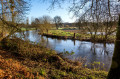
(5) Cross with care so that you can walk 200 m safely (picnic area then pavement). Just after the bend, cross again with the same care to take a path that branches off to the right before becoming a street. Go round the pond on the left, then cross the Lié via the footbridge. Walk up the street opposite until you reach the cemetery.
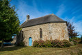
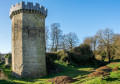
(6) Turn right, continue to the church and turn right again onto the main road (Rue de la Madeleine). After crossing the river once more, turn right towards Loudéac. You will reach the ruins of the Château de la Chèze.
(7) Then take the path on the left, running outside the moat, which climbs up to Rue de la Grange. Turn right here, then veer left to reach the junction before the hamlet of Les Sept Faux.
(8) Take the path on the left. At the end of this, turn right. Follow the edge of a wood, then, after crossing a stream, you’ll come out onto a small road. Follow this straight on for about 150 metres until you reach an inverted Y-junction.
(9) Take the path on the right, then after about one kilometre, turn left and arrive at a place called La Fourchette.
(10) Follow the main road to the right before taking the first left. At the end, turn right and continue to the village of Blanlin.
(11) Turn onto a small road on the left joining the Voie Verte. Follow it, turning left towards the west. Pass under the power line and come out at a crossroads with four directions running almost perpendicular to one another.
(12) Turn right, then right again. On leaving the hamlet of La Ville Bougaud, take the road on the right. Join a track at a right-angled junction.
(13) Turn left onto it, then, just before the private property, take the path on the right leading towards the wind turbines. After 500 m, turn left and follow the straight path which runs between two wind turbines, then joins a small road.
(14) Turn right onto it and reach the D14. Turn left onto it and leave it very quickly to head off to the right. At the next junction at La Goussaie d’en haut, turn left and head for the hamlet of Billiac.
(15) Turn right towards La Prénessaye to pass under the four-lane road. Then take the first road on the right and continue to Quelneuc.
(16) At the entrance to the hamlet, take the path that descends to the right towards the valley. At the end of this path, follow the road to the left, then take the first road on the right. Continue straight on along this road, which leads out above the Pont Querra. Turn right to cross the Lié and return to the car park at the old Pont Querra railway station (S/E).

 Visorando Member
 Easy
Easy 
 Association / Club / Walk leader
 Moderate