Country:
 City:
City:


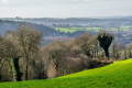
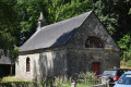
Park next to the church.
(S/E) Set off eastwards along the small street that climbs to the left of the war memorial. After
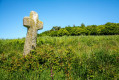
50 m, take the path on the right. This is the old Way of the Cross leading up to the Chapel of Our Lady of the Seven Sorrows. At the start of the last century, prominent local families funded the crosses lining this ascent and had their names inscribed on them.
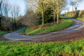
(1) Continue along the same path for about a hundred metres, then head straight on along a tree-lined avenue. Cross the road (D76) and follow it until you reach the edge of the village.
(2) Turn left towards the pond, skirting it on the right. Walk past the campsite and head towards its exit, to the right of the toilet blocks. When you reach the edge of the county road, go straight on along the path that climbs into the woods, running parallel to the road. This is the start of an old fitness trail. Just past the slalom poles, take the path on the left uphill.
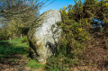
(3) The summit is the starting point for downhill mountain bike trails. Follow the path that heads eastwards along the ridge. Just past the saddle-shaped rock, turn left, then right at the bottom of the woodland. Continue along the farm track.
(4) Carry on straight ahead along the road. A little further on, on the left, is the Manoir du Placis, an old 17th-century manor house. Continue to the hamlet of Kermené, then turn left and head for the crossroads.
(5) Turn right, then immediately afterwards take the road on the left towards Les Pêchières.
(6) If, by any chance, aggressive dogs block your path, turn right towards Lessart, cross the hamlet and then keep left towards Les Pêchières. Then turn right and continue straight on along the farm track to the ridge (option shown on the map).
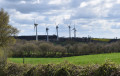
(7) This ridge, which also forms the watershed between the English Channel and the Atlantic, was once followed by the route of a Roman road. Today, wind turbines make the most of the altitude and the often particularly windy conditions.
Take the path on the left which follows this ridge. To the right, you can see the village of Collinée. After the third wind turbine, take the path on the left for about 500 metres.
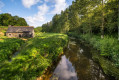
(8) Take the path on the right, which follows a field before heading down into a small valley. At the bottom of the valley, turn right. Initially, the path follows a stream, then crosses it and moves away from it.
(9) Turn right to cross the hamlet of Le Bocage. Upon reaching the road, you’ll be treated to another view, this time of Bel Air, recognisable by its telecommunications masts. This is the highest point in the department.
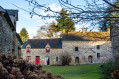
Turn left. At the first four-way junction, take the left-hand road, then the first right. Follow this road down through the hamlets of La Châtelet and Le Haut Monay. When you reach a new road, turn left. A little further on, on the left, you’ll see the village’s old state school, quite a distance from the village centre.
Walk down to the stream and cross it.
(10) Immediately afterwards, turn left towards the Moulin de la Roche. After about a hundred metres, take a path on the right (not shown on the map) which leads into a wood. The path crosses the wood and comes out onto a road. Then turn right to return to the starting point (S/E).


 Visorando Member
 Easy
Easy