


jaz69

 Visorando Member
 Premium user
 Sign up:
Published route(s)
 Circular mountain bike loop in the Saou Forest
 13.24 mi
 +3,156 ft
 -3,140 ft
 3 hrs
3 hrs
 Difficult
 Departure from Saou (Drôme)
A long climb (800m elevation gain over 13km, taking just over 2 hours) but not particularly difficult to reach the Refuge des Girards by mountain bike. From there, it is advisable to continue on foot, for example to climb the Trois Becs. The return route is technical, following the path alongside the River Vèbre.
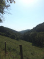
 The Yzeron valley from Saint-Laurent-de-Vaux
 5.80 mi
+997 ft
-1,024 ft
3h 30
5.80 mi
+997 ft
-1,024 ft
3h 30
 Moderate
Departure from Saint-Laurent-de-Vaux (Rhône)
Moderate
Departure from Saint-Laurent-de-Vaux (Rhône)
A long walk through the forest and across fields on either side of the Yzeron valley. Quite a few small climbs and descents, some of which are a little steep (at least one climb is too difficult for mountain bikers)
Moderator's rating The section between (8) and (9) is no longer accessible. See reviews (22/03/2022) for an alternative
Boucle au départ du Col de la République
 5.49 mi
+449 ft
-430 ft
2h 55
5.49 mi
+449 ft
-430 ft
2h 55
 Easy
Departure from Saint-Genest-Malifaux (Loire)
Easy
Departure from Saint-Genest-Malifaux (Loire)
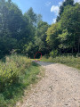
a peaceful walk with no difficult sections but not recommended for young children or pushchairs, through forest, alongside ponds and numerous fields in the Pilat Park.
Update 20/08/25: photos added and details provided for the fork at point (7)
Update 15/07/2025: route modified between points (5) and (7) due to the gradual disappearance of the path on the western edge of the pond.
Circular route between Vaugneray and Pollionnay
 4.68 mi
+981 ft
-968 ft
3h 00
Moderate
Departure from Grézieu-la-Varenne (Rhône)
4.68 mi
+981 ft
-968 ft
3h 00
Moderate
Departure from Grézieu-la-Varenne (Rhône)
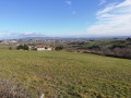
A circular loop of around two hours on the southern slopes of the Monts du Lyonnais with fairly varied scenery. A bit of a workout on the climb, and the paths are too uneven for a pushchair
Walk above Messimy
 4.68 mi
+719 ft
-692 ft
2h 45
Easy
Departure from Messimy (Rhône)
4.68 mi
+719 ft
-692 ft
2h 45
Easy
Departure from Messimy (Rhône)
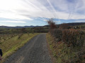
Short walk on the edge of the Monts du Lyonnais with a slight climb at the start.
This route can be shortened by a good third (and thus avoid a return trip on the same path) by parking at the Hameau de la Basse Bruyère (1)
Circular route starting from Lacaune
 6.37 mi
+1,322 ft
-1,322 ft
4h 05
Moderate
Departure from Lacaune (Tarn)
6.37 mi
+1,322 ft
-1,322 ft
4h 05
Moderate
Departure from Lacaune (Tarn)
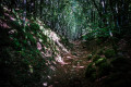
The hike starts with a steady climb to reach the ridge of the Hautes Terres d'Oc. The descent is gentle, through a beautiful beech forest, along holly hedges and a small stream at the end. There is shade all along the way except for 2-3 km at the summit.
Walk between Rochefort and La Poipe
 4.42 mi
+919 ft
-899 ft
2h 50
Moderate
Departure from Saint-Martin-en-Haut (Rhône)
4.42 mi
+919 ft
-899 ft
2h 50
Moderate
Departure from Saint-Martin-en-Haut (Rhône)
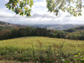
Combining medieval tourism in Rochefort with a walk in the countryside and forest, allow a good two hours for this pleasant short hike in any season, which partly follows the route of the Way of St James. An hour and a half if you don't climb up to the Crêt.
There are lots of ups and downs, sometimes a little steep but never for too long. Feasible by mountain bike with assistance but not recommended for pushchairs (steps and stones).
Circular route from the Signal de Saint-André starting from La Brosse
 3.85 mi
+522 ft
-548 ft
2h 15
Easy
Departure from Saint-Martin-en-Haut (Rhône)
3.85 mi
+522 ft
-548 ft
2h 15
Easy
Departure from Saint-Martin-en-Haut (Rhône)
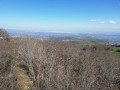
A family walk with a steady climb to the summit of the Monts du Lyonnais and beautiful scenery all along the way. Very little tarmac, forest paths and, of course, the impressive view from the Signal de Saint-André footbridge.
La Chapelle and Grotte de la Baume from Sanilhac-Sagriès
 3.55 mi
+653 ft
-627 ft
2h 10
Moderate
Departure from Sanilhac-Sagriès (Gard)
3.55 mi
+653 ft
-627 ft
2h 10
Moderate
Departure from Sanilhac-Sagriès (Gard)
A lovely walk through the Mediterranean forest to reach the Gardon and enjoy La Chapelle. Please note that the cave is closed from 1 May to 15 August, and from 15 November to 15 March.A gentle descent, followed by a steeper but fairly short climb.Alternatively, set off from Collias to enjoy the Gardon Gorges for longer30/10/2023: I have reclassified this route as ‘medium difficulty’ following several comments about the steep climb on the return journey (+100m over 300m covered)
Cougourlier trail
 3.93 mi
+10 ft
-10 ft
1h 50
Easy
Departure from Saint-Gilles (Gard)
3.93 mi
+10 ft
-10 ft
1h 50
Easy
Departure from Saint-Gilles (Gard)
Discover the Camargue in less than two hours, without any difficulty, ideally in April-May when it is not too hot and the water irises and poppies are in bloom.
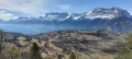
Lovely circuit under the Préaux
 4.32 mi
+676 ft
-676 ft
2h 35
Easy
Departure from Aspres-lès-Corps (Hautes-Alpes)
4.32 mi
+676 ft
-676 ft
2h 35
Easy
Departure from Aspres-lès-Corps (Hautes-Alpes)
Easy walk, 2/3 in the shade and 1/3 with beautiful views over the vast Drac valley and surrounding mountains.
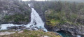
Billingen loop
 1.81 mi
+778 ft
-778 ft
1h 30
Easy
Departure from Norway
1.81 mi
+778 ft
-778 ft
1h 30
Easy
Departure from Norway
A trail through Norwegian forests and moors, crossing two rivers and offering magnificent views, all in just 3 km, with a good restaurant at the end (and free toilets...).
Steep climb (but not difficult) at the start, then crossing a stone bridge, not recommended for people with vertigo; not easy for dogs either (but doable).
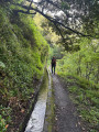
Levada do Castelejo
 4.90 mi
+3,471 ft
-3,428 ft
5h 15
Moderate
4.90 mi
+3,471 ft
-3,428 ft
5h 15
Moderate
From Terra do Baptista to Sao Roque do Faial, along the Castelejo canal, which is not the most spectacular in Madeira, but it is little frequented and offers beautiful scenery in the Ribeiro Frio valley.Comments : - the difference in altitude mentioned is incorrect; it is only 350 m downhill and 400 m uphill. And allow 3 hours- Allow €10 per person to return to the starting point by taxi from Sao Roque.
A short circular loop near Marlhes
3.49 mi
+318 ft
-322 ft
1h 55
Easy
Departure from Saint-Romain-Lachalm (Haute-Loire)
A walk through fields, the Bois des Cartaires and the charming hamlet of Les Chaizes, with some lovely scenery.No particular difficulties, making it ideal for a family outing, including a picnic
Old patrol path on the heights of Risan
 6.07 mi
+1,106 ft
-1,109 ft
3h 45
Moderate
Departure from Montenegro
6.07 mi
+1,106 ft
-1,109 ft
3h 45
Moderate
Departure from Montenegro
This route follows the old Austro-Hungarian watchtower path that linked the strongholds overlooking the Bay of Kotor. It takes a small section of this impressive military line, which is generally shaded and at an altitude of over 1,000 metres, making it very pleasant even in the height of summer. With two cars, it is possible to continue further to see other ruins and enjoy more views of the bay.The path is well marked and signposted but not maintained. There is often wild fennel, irises and even hazelnut trees in the middle of the road, which is made entirely of small rocks carefully piled up without mortar and sometimes roughly cut. Probably intended for transporting weapons and heavy loads, perhaps on rails, this path has little slope.