


Francois Marchais

 Visorando Member
 Premium user
 - Gender: man
Sign up:
Published route(s)
 Tour of Mont Inarte via Mont Cima
 5.51 mi
 +1,768 ft
 -1,781 ft
 4h 05
4h 05
 Moderate
 Departure from Saint-Blaise (Alpes-Maritimes)
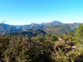
This beautiful route, starting from La Gipasse, goes around Mont Inarte via Mont Cima. It offers views of the Var valley, the Estéron valley, Mont Vial, the peaks of the Mercantour and the Tourette-Levens valley.
From Ascros to the Chapel of Sainte-Baume via Les Chats and Pécogiu
 6.74 mi
+1,411 ft
-1,388 ft
4h 20
Moderate
Departure from Ascros (Alpes-Maritimes)
6.74 mi
+1,411 ft
-1,388 ft
4h 20
Moderate
Departure from Ascros (Alpes-Maritimes)
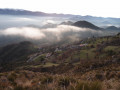
A beautiful circular walk in the heart of the Pré-Alpes d'Azur Regional Nature Park, starting from Ascros and passing through Les Chats, Pécogiu and the Var-Moyen State Forest on the way to the magnificent Sainte-Baume Chapel.
Place Garibaldi to Mont Boron via the Castel des Deux Rois and Cap de Nice
 4.74 mi
+610 ft
-633 ft
2h 45
4.74 mi
+610 ft
-633 ft
2h 45
 Easy
Departure from Nice (Alpes-Maritimes)
Easy
Departure from Nice (Alpes-Maritimes)
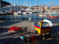
This circular loop takes you from Place Garibaldi to Fort du Mont Boron via Parc du Castel des Deux Rois and Chemin du Fort Thaon, then back along the coast via Cap de Nice, Sentier du Littoral and Port de Nice. You can go for a swim before returning to Place Garibaldi to catch the tram.
In the Fabron district of Nice
 2.63 mi
+463 ft
-463 ft
1h 35
Easy
Departure from Nice (Alpes-Maritimes)
2.63 mi
+463 ft
-463 ft
1h 35
Easy
Departure from Nice (Alpes-Maritimes)
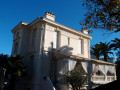
This loop walk through the Fabron neighbourhood takes in the municipal archives, Barla Castle and Roseland Abbey, whilst winding its way through pretty paths and alleyways.
Camp des Fourches - Ferrere Refuge
 6.25 mi
+1,381 ft
-2,615 ft
4h 05
Moderate
Departure from Saint-Dalmas-le-Selvage (Alpes-Maritimes)
6.25 mi
+1,381 ft
-2,615 ft
4h 05
Moderate
Departure from Saint-Dalmas-le-Selvage (Alpes-Maritimes)
This first stage of the Tour du Mont Aiga starts from Camp des Fourches on the Bonette road and, via the Col des Fourches, descends into the large Salso Moreno valley, which you climb back up to the Col de Pouriac. From the Col de Pouriac, you quickly reach Bassa di Colombart and then, after a long descent through the mountain pastures, the charming village of Ferrere. You may encounter flocks of sheep in Salso Moreno and, at night, the wolves that prey on them.
Bacchi Rossi Refuge - Vens Lakes Refuge
 4.60 mi
+2,359 ft
-807 ft
4h 10
Moderate
Departure from Argentera (Cuneo)
4.60 mi
+2,359 ft
-807 ft
4h 10
Moderate
Departure from Argentera (Cuneo)
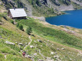
On thissecond day of the Tour of Mount Aiga from the Ferrere Refuge, you will pass through Plan de Belvédère, where there is a tin shelter overlooking the Rio Forneris valley and a fountain. You will also pass below Lake Emma, Monte Peiron at 2,796 m and Pointe Testa di Garbe at 2,749 m, to arrive, after a few hairpin bends, at Col de Fer at 2,584 m. You will then head towards Small Pass of Tortisse and the Vens Refuge, the end of this stage.
Three-day tour of Mont Aiga starting from Camp des Fourches
 18.20 mi
+5,856 ft
-5,873 ft
3 days
18.20 mi
+5,856 ft
-5,873 ft
3 days
 Difficult
Departure from Saint-Dalmas-le-Selvage (Alpes-Maritimes)
Difficult
Departure from Saint-Dalmas-le-Selvage (Alpes-Maritimes)
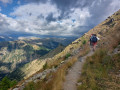
Three days of hiking in Haute-Tinée and Alta Val Stura in Italy, starting from Camp des Fourches, with balanced stages and no technical difficulty. This tour will allow you to discover Salso Moréno, the charming village of Ferrere in Italy and the Refuge des Lac de Vens.
Circular Estéron via Gilette and La Clave
 5.62 mi
+1,191 ft
-1,165 ft
3h 35
Moderate
Departure from Gilette (Alpes-Maritimes)
5.62 mi
+1,191 ft
-1,165 ft
3h 35
Moderate
Departure from Gilette (Alpes-Maritimes)
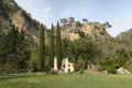
A pleasant little circular loop along the Estéron, passing by the Pont de l'Estéron, the pretty hilltop village of Gilette, its botanical trail, La Clue and La Clave, and returning along the Route de la Clavée. If you are lucky, you can pick wild asparagus in spring or swim in the Estéron in summer.
Tour of Mont Alban and Mont Boron between Nice and Villefranche-sur-Mer
 2.77 mi
+446 ft
-466 ft
1h 40
Easy
Departure from Nice (Alpes-Maritimes)
2.77 mi
+446 ft
-466 ft
1h 40
Easy
Departure from Nice (Alpes-Maritimes)
A tour of the hills and forts of Mont Alban and Mont Boron, offering varied and interesting views of the bay of Villefranche-sur-Mer, Nice and the Baie des Anges. Numerous sections through woodland mean this walk can be enjoyed at any time of day and in any season. Southern plants and the magnificent villas of Mont Boron punctuate this easy walk.
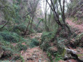
A shaded walk around the Vallon de Porquier in Castagniers
 3.29 mi
+801 ft
-830 ft
2h 15
Moderate
Departure from Castagniers (Alpes-Maritimes)
3.29 mi
+801 ft
-830 ft
2h 15
Moderate
Departure from Castagniers (Alpes-Maritimes)
This short walk starting from the village of Castagniers, around the Vallon de Porquier, offers shaded sections through the forest and the chance to eat a few arbutus berries in season.
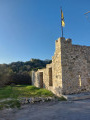
From Colle de Revel to Mont de l'Ubac via the hamlet of Camp Soubran
 4.21 mi
+1,155 ft
-1,132 ft
2h 55
Moderate
Departure from Tourrette-Levens (Alpes-Maritimes)
4.21 mi
+1,155 ft
-1,132 ft
2h 55
Moderate
Departure from Tourrette-Levens (Alpes-Maritimes)
Hike near Nice from Colle de Revel, or Château des Voleurs, to Mont de l'Ubac at an altitude of 651 metres, passing through the hamlet of Camp Soubran and Baisse de Bordinas. This circular hike offers beautiful views of Mont Chauve, Tourette Levens, the Mercantour mountains, Mont Agel and Nice, and takes place on varied terrain.
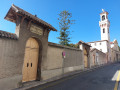
Circular tour of the five churches of Libération at the Palais le Righi.
 3.82 mi
+361 ft
-361 ft
2h 05
Easy
Departure from Nice (Alpes-Maritimes)
3.82 mi
+361 ft
-361 ft
2h 05
Easy
Departure from Nice (Alpes-Maritimes)
This walk through the Libération, Saint-Barthélémy and Saint-Étienne districts of Nice will take you to five churches: the Church of Sainte-Jeanne d'Arc, the Church of Saint-Barthélémy and its cemetery, the Church of Saint-Paul, the Orthodox Cathedral of Saint-Nicolas de Nice and finally the Church of Saint-Étienne. But you can also admire the city from the hill of Pessicart and the Palais Le Righi. Finally, you will pass several times over or near the Train des Pignes railway line, which connects Nice to Digne, from the Gare des Chemins de Fer de Provence railway station.
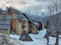
 Circular route from Seignus Haut to La Valau, along the Verdon, in the Val d’Allos
 4.09 mi
+669 ft
-686 ft
2.5 hrs
Easy
Departure from Allos (Alpes-de-Haute-Provence)
4.09 mi
+669 ft
-686 ft
2.5 hrs
Easy
Departure from Allos (Alpes-de-Haute-Provence)
This circular walk in the Val d’Allos, starting from car park no. 1 at the Seignus Haut ski resort and descending to the Verdon before climbing back up to La Valau, can be done in any season on foot or with snowshoes. Alternatively, it can also be started from the Près or Saisonniers car parks in Allos, or from La Valau, on the banks of the Verdon.
Le Piol, Saint-Pierre de Féric, Haut de Magnan and Parc d’Estienne d’Orves
 3.96 mi
+860 ft
-837 ft
2h 35
Moderate
Departure from Nice (Alpes-Maritimes)
3.96 mi
+860 ft
-837 ft
2h 35
Moderate
Departure from Nice (Alpes-Maritimes)
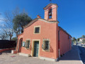
This semi-urban walk offers views of numerous villas as you pass through the Piol neighbourhood, then climb the right-hand slope of the Vallon des Sablières up to the church of Saint-Pierre de Féric. You can admire views of Nice and the Sablières and Sabatiers valleys as you walk around the Conque. From the Church of Saint-Pierre de Féric, the route descends the left-hand slope of the Sabatiers valley, above La Madeleine, before finally crossing the Parc d’Estienne d’Orves at Saint-Philippe.
From the Libération tram stop to the Comte de Falicon stop via Pessicart
 4.46 mi
+919 ft
-715 ft
2h 50
Easy
Departure from Nice (Alpes-Maritimes)
4.46 mi
+919 ft
-715 ft
2h 50
Easy
Departure from Nice (Alpes-Maritimes)
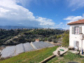
This is the first stage of the Nice hills tour. This semi-urban hike starts at the Libération tram stop in the heart of Nice. It runs alongside the Gare du Sud railway station and then the Chemins de Fer de Provence railway station and railway line with its blue trains. After crossing the Mantega district, below the Palais du Righi, the hike climbs up a somewhat forgotten path on Pessicart hill. After circling Pessicart hill to admire the greenhouses and the Baou de Saint-Jeannet, the hike descends back to Nice. It then crosses the La Clua municipal nature park and passes by the Church of Saint Francis of Assisi in the Saint-Sylvestre neighbourhood, finally arriving at the Comte de Falicon tram stop.
From the St-Charles tram stop to Garibaldi via Mt Vinaigrier and Mt Boron
 6.04 mi
+1,260 ft
-1,335 ft
3h 50
Moderate
Departure from Nice (Alpes-Maritimes)
6.04 mi
+1,260 ft
-1,335 ft
3h 50
Moderate
Departure from Nice (Alpes-Maritimes)
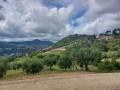
This third stage of the tour of the hills of Nice starts at the Saint-Charles tram stop on line 1 and climbs through the Saint-Charles district on the western flank of Mont Vinaigrier. From Mont Vinaigrier, it descends due south to the Col de Villefranche before climbing back up to Mont Alban and, after a loop around the Fort de Mont Boron, descends again to the port of Nice and finally reaches the Place Garibaldi tram stop via the Port district. The walk follows a beautiful ridge line and is certainly the most ‘natural’ stage of the Tour des Collines de Nice. The views over the bay of Villefranche and Cap Ferrat are magnificent.
From the Comte de Falicon tram stop to St Charles via the Canal de Gairaut
 6.08 mi
+659 ft
-814 ft
3h 20
Moderate
Departure from Nice (Alpes-Maritimes)
6.08 mi
+659 ft
-814 ft
3h 20
Moderate
Departure from Nice (Alpes-Maritimes)
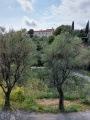
This walk is a variation on the second stage of the four-stage tour of the hills of Nice. It allows you to shorten this second stage slightly and admire the Jardin des Arènes de Cimiez and the Monastery of Cimiez. Starting from the Comte de Falicon tram stop, you first walk along the Place de la Fontaine du Temple and cross the Maurice Mouchan Garden and the new Parc du Ray. After crossing Avenue du Ray, you reach Parc Chambrun from the south and, via the Saint-Maurice district, the Vieux Chemin de Gairaut and theGRP® Les Collines de Nice, which climb northwards. Much of the walk then follows the Canal de Gairaut eastwards and descends due south towards Nice through the Quatre Chemins district. Finally, you cross the Jardin des Arènes to reach the Monastery of Cimiez and head down to the Pasteur University Hospital to catch the tram either at Pasteur or Saint-Charles.
Refuge de Vens - Camp des Fourches
 7.34 mi
+2,090 ft
-2,441 ft
5h 10
Moderate
Departure from Saint-Étienne-de-Tinée (Alpes-Maritimes)
7.34 mi
+2,090 ft
-2,441 ft
5h 10
Moderate
Departure from Saint-Étienne-de-Tinée (Alpes-Maritimes)
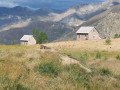
Thisthird and final stage of the Tour du Mont Aiga starts from the Refuge de Vens and crosses a balcony below the slopes of the Aiguilles de Tortisse to the north-east of the Lacs de Vens. After passing the Crête de la Côte and descending to the Maisons Forestières de Tortisse, you will walk along a balcony path beneath the slopes of the Tête des Mourres to reach the Morgon plateau and climb back up to Laussets and finally to the Lacs de Morgon. At the large Morgon lake, you will descend eastwards into Salso Moréno to rejoin the path of thefirst stage and Camp des Fourches. It is possible to see chamois early in the morning and, of course, marmots throughout the day.
Tour of the upper Magnan valley via Saint-Pancrace and the hamlet of La Sirole
 4.28 mi
+1,043 ft
-1,033 ft
2h 55
Moderate
Departure from Nice (Alpes-Maritimes)
4.28 mi
+1,043 ft
-1,033 ft
2h 55
Moderate
Departure from Nice (Alpes-Maritimes)
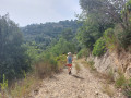
This easy walk, partly through woodland, follows the right bank of the upper Magnan valley via the Pont and the Chemin du Génie to Saint-Pancrace, before crossing to the right bank via the Pont du Pommier. After the Pont du Pommier and having crossed the Route de Sirole, you join the Chemin des Crêtes de Bergiade and the Chemin de Bergiade to descend the right bank of the Vallon de Magnan and reach the Boulevard de la Madeleine, after crossing the Ravin des Vallières. This walk can be combined with an exploration of the hidden valleys of Magnan and the Ravin des Vallières.
Circular route below Mont Chauve de Tourrette from Gheirart
 3.70 mi
+1,145 ft
-1,142 ft
2h 40
Moderate
Departure from Tourrette-Levens (Alpes-Maritimes)
3.70 mi
+1,145 ft
-1,142 ft
2h 40
Moderate
Departure from Tourrette-Levens (Alpes-Maritimes)
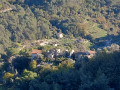
This largely shaded circular route, starting from Gheirart (or Gueirar on the IGN map), will take you along the eastern flank of Mont Chauve de Tourette, above La Condamine, and offer views of most of the major peaks of the Mercantour and the villages of the Nice hinterland.
The use of a GPS or the Visorando app is recommended.
Tour and ascent of Pointe Siricocca from Col des Banquettes
 4.64 mi
+1,348 ft
-1,358 ft
3h 20
Moderate
Departure from Sainte-Agnès (Alpes-Maritimes)
4.64 mi
+1,348 ft
-1,358 ft
3h 20
Moderate
Departure from Sainte-Agnès (Alpes-Maritimes)
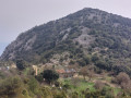
From Col des Banquettes, this beautiful circular hike takes you to Ravin de Verroux, Ravin de Merthéa and Ruisseau du Borrigo. It also gives you the opportunity to pass by numerous fortifications overlooking the valleys below. From Pointe Siricocca, you can admire Menton and the village of Sainte-Agnès.
Circular above Gattières via the Canal de la Gravière
 3.98 mi
+1,289 ft
-1,289 ft
2h 55
Moderate
Departure from Gattières (Alpes-Maritimes)
3.98 mi
+1,289 ft
-1,289 ft
2h 55
Moderate
Departure from Gattières (Alpes-Maritimes)
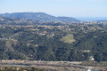
This circular loop above Gattières runs along the eastern slopes of La Bessière (818 m) and Le Pességuier (902 m), alongside the Canal de la Gravière. It allows you to explore the village and offers beautiful views of olive groves, the Var plain, the Bellet vineyards and the peaks of the Mercantour.
The short tour of Mont Panard from Touët de l'Escarène station
 6.71 mi
+2,008 ft
-2,008 ft
4h 50
Moderate
Departure from Touët-de-l'Escarène (Alpes-Maritimes)
6.71 mi
+2,008 ft
-2,008 ft
4h 50
Moderate
Departure from Touët-de-l'Escarène (Alpes-Maritimes)
A beautiful walk starting from the station in the charming village of Touët de l'Escarène around Mont Panard, mostly through undergrowth. After crossing the tracks of the Train des Merveilles, the route climbs up the left bank of the Ravin d'Estiou and winds clockwise around Mont Panard. Beautiful views of the Mercantour peaks, the rocks of Saint Sauveur and Mont Brec.