Le Piol, Saint-Pierre de Féric, Haut de Magnan and Parc d’Estienne d’Orves

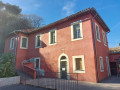
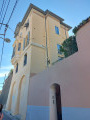
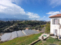
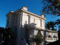
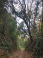
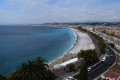
This semi-urban walk offers views of numerous villas as you pass through the Piol neighbourhood, then climb the right-hand slope of the Vallon des Sablières up to the church of Saint-Pierre de Féric. You can admire views of Nice and the Sablières and Sabatiers valleys as you walk around the Conque. From the Church of Saint-Pierre de Féric, the route descends the left-hand slope of the Sabatiers valley, above La Madeleine, before finally crossing the Parc d’Estienne d’Orves at Saint-Philippe.

Details

31387565
Creation:
Last update:
Last review:
  • Walking
    Activity: Walking
  • ↔
    Distance: 3.96 mi
  • ◔
    Average duration: 2h 35 
  • ▲
    Difficulty: Moderate

  • ⚐
    Back to start: Yes
  • ↗
    Ascent: + 860 ft
  • ↘
    Descent: - 837 ft

  • ▲
    Highest point: 804 ft
  • ▼
    Lowest point: 128 ft

Photos

Description of the walk

Start from the small free car park at Parc d’Estienne d’Orves. Plan to arrive early or come by bus.

(S/E) Cross Avenue d’Estienne d’Orves via a pedestrian crossing and take Rue Beau Site, then the steps on the right.

(1) At the top, continue to the right (Avenue Beau Site). Opposite the Saint-Philippe Primary School, you can admire a mural dating from 1927. Continue along Avenue Primerose, past the Square du Dauphiné, until you reach the steps on either side of the street, at the corner of No. 10.

(2) Take the steps on the left, which cross a street (Avenue du Dauphiné) twice, and at thethird set of steps, at the top, turn right and head downhill.

(3) At the hairpin bend, turn onto Avenue du Bois de Cythère and, after two hairpin bends, leave it to join Rue René Béhaine. You will then come across some steps leading up from Rue des Œillets, which allow you to join the walk from the Libération neighbourhood, the Gare des Chemins de Fer de Provence railway station or the Libération tram stop.

(4) At Avenue du Domaine du Piol, continue right downhill, then, at the hairpin bend, head straight on along Passage des Lilas. Join the steps of shortcut no. 1 on the Ancien Chemin de Saint-Pierre de Féric, which climb to the left. The steps are in the shade in the afternoons during winter and early spring. Continue along the footpath and then along the street until you reach the Route de Saint-Pierre de Féric.

(5) Follow it to the right for 100 m before turning right onto shortcut no. 2, the Ancien Chemin de Saint-Pierre de Féric. At the bottom of the steps, cross the Route de Saint-Pierre de Féric and take the tarmac road opposite for 70 m, leading to a care home.

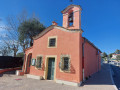
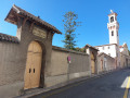
(6) At the end of the few parking spaces on your left, turn right, then immediately left. Walk alongside a property along a path to the right of its gate and turn right onto a path that climbs up to join a side street (Allée de la Chapelle Saint-Pierre). Turn left and you will soon reach the Chapel of Saint-Pierre de Féric.

(7) Opposite the chapel, go down the steps on the left, heading west, then continue along the road (Corniche de Magnan) for about 150 m and take the Chemin du Haut-Magnan at thefirst hairpin bend. Head southwards and, at the end of the path, continue along the road again; at the Fork in the road at No. 295, rejoin the Chemin du Haut-Magnan on the right.

(8) Follow this path (central lane), first uphill and then downhill, until you reach the Chemin des Oeillets and the Colle bus stop.

(9) Carry on straight ahead for a few metres to No. 278, then turn right back onto the Chemin du Haut-Magnan. Head down onto the Corniche one last time (bus stop), leave the Chemin de la Conque on your left and continue along the Corniche de Magnan until you reach the Parc d’Estienne d’Orves.

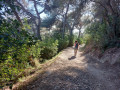
(10) Walk through the woods of the Parc d’Estienne d’Orves, keeping to the left, to return to the car park at the Parc d’Estienne d’Orves (S/E).

Waypoints

  1. S/E : mi 0 - alt. 128 ft - Parc d’Estienne d’Orves car park
  2. 1 : mi 0.09 - alt. 187 ft - Avenue Primerose and Saint-Philippe School
  3. 2 : mi 0.35 - alt. 230 ft - Stairs at Square du Dauphiné
  4. 3 : mi 0.55 - alt. 443 ft - Avenue du Bois de Cythère
  5. 4 : mi 0.85 - alt. 315 ft - Avenue du Domaine du Piol
  6. 5 : mi 1.39 - alt. 633 ft - Route de Saint-Pierre de Féric
  7. 6 : mi 1.71 - alt. 771 ft - End of the car park on the left-hand side
  8. 7 : mi 1.91 - alt. 801 ft - Chapel of Saint-Pierre de Féric
  9. 8 : mi 2.33 - alt. 633 ft - Chemin du Haut Magnan
  10. 9 : mi 2.71 - alt. 587 ft - La Colle bus stop
  11. 10 : mi 3.21 - alt. 502 ft - North entrance to the Parc d’Estienne d’Orves
  12. S/E : mi 3.97 - alt. 128 ft - Parc d’Estienne d’Orves car park

Notes

This walk can also be started from the Chemins de Fer de Provence railway station or the Gare du Sud tram stop.

Reviews and comments

4.2 / 5
Based on 4 reviews

Reliability of the description
4 / 5
Ease of following the route
4 / 5
Route interest
4.5 / 5
Mimie Lemoine
Mimie Lemoine

Thank you, Denis26. I think the changes you’ve made to the PDF will enable walkers to make the most of what this walk has to offer.

Machine-translated

Denis26
Denis26 ★
• Edited:

Thank you, Mimie Lemoine and Viso06, for your comments. I’ve just added some further details to the description and included some waypoints.

Machine-translated

Viso06
Viso06

Overall rating : 3.3 / 5

Date of your route : Feb 02, 2025
Reliability of the description : ★★☆☆☆ Disappointing
Ease of following the route : ★★★☆☆ Average
Route interest : ★★★★★ Very good
Very busy route : No

Some of the street names shown on the PDF are incorrect
To find your way, you need to follow the GPS on the app on your phone

Machine-translated

Mimie Lemoine
Mimie Lemoine

Overall rating : 4.3 / 5

Date of your route : May 16, 2024
Reliability of the description : ★★★★☆ Good
Ease of following the route : ★★★★☆ Good
Route interest : ★★★★★ Very good
Very busy route : No

Part 1 (up to the Saint-Pierre de Féric chapel). I was surprised by the elevation gain and the climb seemed long to me. But it passes through some picturesque spots.
Part 2 (up to the entrance to Estiennes d’Orves Park). It’s worth noting that the staircase for the descent is on the left-hand side of the chapel. I was misled by the signposts and missed the footpaths (no doubt partly due to fatigue from the climb). I made my way down via the road to the park, which isn’t ideal.
Part 3 (crossing the park). A lovely surprise!

Machine-translated

Pat 06
Pat 06

Overall rating : 4.3 / 5

Date of your route : May 05, 2023
Reliability of the description : ★★★★★ Very good
Ease of following the route : ★★★★☆ Good
Route interest : ★★★★☆ Good
Very busy route : No

For once, the walk goes right past my house...
It’s a lovely walk near the town with some stunning views...
Estienne d’Orves Park doesn’t open until 9 am for those who want to use the car park.
Thank you for suggesting this walk.

Machine-translated

Espedaillac
Espedaillac

Overall rating : 4.7 / 5

Date of your route : Apr 11, 2023
Reliability of the description : ★★★★★ Very good
Ease of following the route : ★★★★★ Very good
Route interest : ★★★★☆ Good
Very busy route : No

You always discover your city from unusual angles, and that’s interesting. Thank you for this semi-urban walk.

Machine-translated

Other walks in the area

For more walks, use our search engine .

The GPS track and description are the property of this route's author. Please do not copy them without permission.