


 Country:

 City:
City:


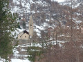
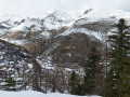
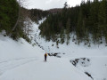
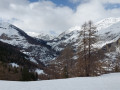
Head to Saint-Dalmas-le-Selvage via the M63. You must park in the communal car park, below the village, on the left, towards the Gialorgues valley.
(S/E) Head down towards the south-east, along the left bank of the Torrent de Sestrière, and pass beneath the church of Saint-Dalmas-le-Selvage. Walk past the inconspicuous sewage treatment plant and reach the bridge over the Vallon de Saint-Dalmas or Torrent de Gialorgues to join the Via Alpina or Grande Traversée des Alpes.
(1) Cross the Torrent de Gialorgues and continue along a track. Leave a path on your left heading towards Saint-Étienne-de-Tinée and continue towards the Col d’Anelle.
(2) Pass the path on your right leading up to the Claffournier viewpoint and cross over the Aigue Douce ravine for the first time. The track then turns right towards the south-east and crosses the Combe d’Aunos. Continue along this track until the next junction.
(3) Again, leave the path to the Claffournier viewpoint on your right and head left to pass above two barns on the right.
(4) Head up to the right, due south, towards the Col d’Anelle, which you’ll reach quickly.
(5) Head north along the Bois d’Anelle route. After a few metres, you’ll find the Anelle shelter on the right, where you can take shelter for lunch and even warm up by the wood-burning stove, provided you’ve brought some paper and a lighter or matches. The path ends at a bend to the right.
(6) Head north and then west to reach the junction with the Col d’Anelle circular loop.
(4) Carry on straight ahead, passing the two barns on your left, and return to the junction with the track leading to the Claffournier viewpoint.
(3) Follow this track, which climbs gently, for about one kilometre, passing the Ruisseau de l’Adret Blanc and then the Combe d’Aunos. Reach the 1804-metre mark.
(7) Leave the track to the right and follow the path to reach the Claffournier viewpoint, from where you look down on the village of Saint-Dalmas-le-Selvage from a height of 200 metres.
(8) Head east, cross the Aigue Douce ravine for the first time, then turn north-west, following the yellow markings on the trees and the path which descends steeply towards the valley. Cross the Aigue Douce ravine a second time and continue descending north-west until you rejoin the original track on the right.
(2) Turn left and follow this track in the opposite direction to the way out, until you reach the bridge over the Torrent de Gialorgues.
(1) After crossing the bridge, keep to the left to reach the village car park (S/E).
 Visorando Member
 Easy
Easy 
 Difficult
