In the Fabron district of Nice

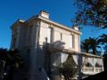
This loop walk through the Fabron neighbourhood takes in the municipal archives, Barla Castle and Roseland Abbey, whilst winding its way through pretty paths and alleyways.

Details

5156165
Creation:
Last update:
Last review:
  • Walking
    Activity: Walking
  • ↔
    Distance: 2.63 mi
  • ◔
    Average duration: 1h 35 
  • ▲
    Difficulty: Easy

  • ⚐
    Back to start: Yes
  • ↗
    Ascent: + 463 ft
  • ↘
    Descent: - 463 ft

  • ▲
    Highest point: 413 ft
  • ▼
    Lowest point: 43 ft
  • ⚐ Country: France
  • ⚐
    Area: Alps
  • ⚐ City: Nice (06100|06300|06200|06)
  • ⚑
    Start/End: N 43.688229° / E 7.234585°
  • ❏
    IGN map(s): Ref. 3742OT
  • Hour-by-hour weather

Photos

Description of the walk

Park where you can on Avenue de Fabron.

(S/E) Start at the junction of Avenue de Fabron and Chemin de l’Archet. Walk 100 metres up Avenue de Fabron on the left until you reach the entrance to the municipal archives park.

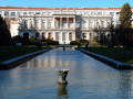
(1) Walk round the park and the pond opposite the municipal archives.

(1) Exit via the same gate and turn left back onto Avenue de Fabron until you reach a roundabout. Here, you can visit the Anatole Jakovsky Museum of Naïve Art and admire the many sculptures in the park, which is open to the public.

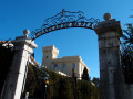
(2) At the roundabout, take the second street on the left and continue to the gate of Barla Castle, which is now the headquarters of the Peruvian Consulate. Retrace your steps back to the roundabout.

(2) Turn left into the Carol of Romania Park. Follow a tarmac road that runs alongside the park on the right and exit via the mini-golf restaurant.

Follow Avenue de Fabron to the right and cross it carefully to reach Boulevard Napoléon III. At the T-junction, turn right, staying on Boulevard Napoléon III.

(3) Cross over Chemin de l’Archet and take Avenue de Mesnil on the right at the end of Boulevard Napoléon III. Walk down Avenue de Mesnil to reach Avenue de Fabron, which you leave immediately to turn left onto Chemin des Grottes. At the end of this path, turn left onto a flight of steps leading to Boulevard de l’Impératrice Eugénie.

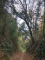
(4) Walk up the Boulevard de l’Impératrice Eugénie and, at a right-hand bend, you’ll reach the top of a flight of steps on the left, which is in fact the Chemin de l’Archet.

Go down these steps and follow the path as it winds between two residential buildings. After a few bends, you’ll find yourself alongside the Résidence de l’Abbaye de Roselonad.

(5) Turn right and cross the road. Turn left onto the Chemin de l’Archet and walk alongside the Abbaye de Roseland, a listed historic monument owned by the city of Nice.

Cross the road again and go down some more steps to reach the Chemin de l’Archet.

(3) Pass under Boulevard Napoléon III and follow Chemin de l’Archet until you reach Avenue de Fabron and the car park (S/E).

Waypoints

  1. S/E : mi 0 - alt. 62 ft - Avenue de Fabron
  2. 1 : mi 0.06 - alt. 75 ft - Entrance to the municipal archives
  3. 2 : mi 0.48 - alt. 108 ft - Roundabout on Avenue de Fabron
  4. 3 : mi 1.05 - alt. 138 ft - Boulevard Napoléon III – Chemin de l’Archet
  5. 4 : mi 1.65 - alt. 177 ft - Arrival on Boulevard Impératrice Eugénie
  6. 5 : mi 2.28 - alt. 276 ft - Abbaye de Roseland (Nice)
  7. S/E : mi 2.63 - alt. 62 ft - Avenue de Fabron

Notes

Bus 34 stop at the bottom of Boulevard de Cambrai.
Tram stop on Avenue de la Californie.

Worth a visit

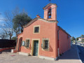
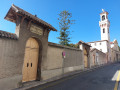
(1) Municipal Archives: the archives building was constructed from 1873 onwards by the Nice-based architect Biasini.

Reviews and comments

4.1 / 5
Based on 3 reviews

Reliability of the description
4.3 / 5
Ease of following the route
4 / 5
Route interest
4 / 5
severine-67
severine-67
• Edited:

Overall rating : 3 / 5

Date of your route : May 30, 2026
Reliability of the description : ★★★☆☆ Average
Ease of following the route : ★★★☆☆ Average
Route interest : ★★★☆☆ Average
Very busy route : No

The downsides:
I spent quite a while wandering around trying to find the entrance to the first park (the one with the Municipal Archives), without success.
The same goes for the Abbey at the end of the route.
You walk alongside busy roads quite regularly.
The climb in hot, sunny weather (25–30°C) makes the hike – uphill – quite challenging in places.

Highlights:
The quiet, flower-filled alleyways (in spring) are lovely.
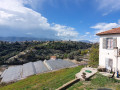
At one point, you can reach a lovely viewpoint over the mountains of the Nice hinterland.

I think this walk is of more interest to locals who know this hillside neighbourhood well; best avoided during the hottest periods.
Suggestion: include the exact names of the parks on the written map.

Machine-translated

sauvage
sauvage

Overall rating : 5 / 5

Date of your route : Jul 30, 2025
Reliability of the description : ★★★★★ Very good
Ease of following the route : ★★★★★ Very good
Route interest : ★★★★★ Very good
Very busy route : No

Thank you for this enjoyable city tour.
There are some beautiful buildings and houses in this neighbourhood of western Nice.
At point 4, the Chemin de l'Archet winding between two apartment buildings is refreshing at this time of year.

Machine-translated

mtnice
mtnice

Overall rating : 4.5 / 5

Date of your route : Apr 10, 2021
Reliability of the description : ★★★★★ Very good
Ease of following the route : Not used / Not applicable
Route interest : ★★★★☆ Good
Very busy route : No

A lovely discovery of a neighbourhood in Nice, with beautiful buildings and a country lane right in the city!

Machine-translated

Other walks in the area

For more walks, use our search engine .

The GPS track and description are the property of this route's author. Please do not copy them without permission.