Tour of Mont Alban and Mont Boron between Nice and Villefranche-sur-Mer

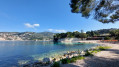
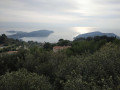
A tour of the hills and forts of Mont Alban and Mont Boron, offering varied and interesting views of the bay of Villefranche-sur-Mer, Nice and the Baie des Anges. Numerous sections through woodland mean this walk can be enjoyed at any time of day and in any season. Southern plants and the magnificent villas of Mont Boron punctuate this easy walk.

Details

22742595
Creation:
Last update:
Last review:
  • Walking
    Activity: Walking
  • ↔
    Distance: 2.77 mi
  • ◔
    Average duration: 1h 40 
  • ▲
    Difficulty: Easy

  • ⚐
    Back to start: Yes
  • ↗
    Ascent: + 446 ft
  • ↘
    Descent: - 466 ft

  • ▲
    Highest point: 722 ft
  • ▼
    Lowest point: 381 ft
  • ⚐ Country: France
  • ⚐ City: Nice (06100|06300|06200|06)
  • ⚑
    Start/End: N 43.695998° / E 7.299243°
  • ❏
    IGN map(s): Ref. 3742OT
  • Hour-by-hour weather

Photos

Description of the walk

The starting point of the walk is the Mont Boron car park on the Chemin du Fort du Mont Alban. Parking there is free of charge. By public transport, take bus number 33 on Rue Barla towards Mont Boron and get off at Chemin du Fort.

(S/E) From the car park, cross the tarmac path of the Fort du Mont Alban and take the red and yellow-marked dirt track that crosses the picnic area. Join the tarmac path of the Fort du Mont Alban and follow it to the turning area. You’ll pass by beautiful villas surrounded by greenery.

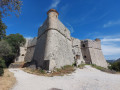
At the viewpoint overlooking the bay of Villefranche-sur-Mer, head north to go round Fort du Mont Alban to the east. Walk past Fort Mont Alban. Take the path heading west and, at the north-west corner of the fort, take a narrow track which, via a short steep climb, joins the Chemin du Fort du Mont Alban heading towards the Col de Villefranche-sur-Mer. Then head north along the Chemin du Fort du Mont Alban (concrete surface).

(1) After 200 metres, turn left onto the first dirt track heading south-west. The dirt track joins the Route Forestière du Mont Boron (tarmac) after 400 metres. Cross the road.

Take the path that descends to the right of the forest road and goes round the water tanks belonging to the city of Nice. Take the Chemin du Fort Thaon, which climbs southwards beneath the Route Forestière du Mont Boron and joins it at a bend.

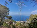
(2) Go down the steps to the right of the forest road and continue south-southeast through the forest. After passing a magnificent villa overlooking Nice and the Baie des Anges, take a tarmac road which joins the Mont Boron Forest Road at a bend. Follow the road to the right and, after 100 metres, you will reach marker 713 at the start of the Chemin du Mont Boron.

(3) Go round Mont Boron to the south to reach marker 715.

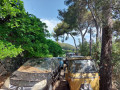
(4) At the marker, take a path heading north that runs alongside the road. Cross it to the right after 300 metres and join the Chemin de la Borne. Take this path, which descends gently towards Villefranche-sur-Mer. Pass between two rows of vintage cars parked on the Chemin de la Borne and then join the Avenue des Hespérides. Walk northwards along the Avenue des Hespérides to reach marker 711.

(5) At the marker, turn left onto Chemin des Cistes, which winds its way up to the Mont Boron car park (S/E).


Waypoints

  1. S/E : mi 0 - alt. 614 ft - Mont Boron car park Chemin du Fort du Mont Alban
  2. 1 : mi 0.54 - alt. 607 ft - Mont Alban Trail
  3. 2 : mi 1.07 - alt. 617 ft - Chemin de Cèdres
  4. 3 : mi 1.43 - alt. 515 ft - Marker 713
  5. 4 : mi 1.86 - alt. 430 ft - Marker 715
  6. 5 : mi 2.44 - alt. 417 ft - Marker 711 Sentier des Cistes
  7. S/E : mi 2.77 - alt. 614 ft - Mont Boron car park Chemin du Fort du Mont Alban

Notes

Trainers are suitable. The walk alternates between dirt tracks, stony paths, tarmac and concrete. Don’t forget your sunglasses, hat and sun cream.

Worth a visit

Fort du Mont Alban. Fort du Mont Boron.

Reviews and comments

4.3 / 5
Based on 6 reviews

Reliability of the description
4.5 / 5
Ease of following the route
4.3 / 5
Route interest
4 / 5
IPOZOUZOU
IPOZOUZOU
• Edited:

Overall rating : 3 / 5

Date of your route : May 13, 2025
Reliability of the description : ★★★☆☆ Average
Ease of following the route : ★★★☆☆ Average
Route interest : ★★★☆☆ Average
Very busy route : Yes

A magnificent walk, but the information differs from that on the local signposts. Fortunately, it’s impossible to get lost on this short, well-used route, but the route description is difficult to follow. No problem finding a place to park.
The route description needs reviewing....

Machine-translated

neufeglise
neufeglise

Overall rating : 4 / 5

Date of your route : Oct 12, 2024
Reliability of the description : ★★★★☆ Good
Ease of following the route : ★★★☆☆ Average
Route interest : ★★★★★ Very good
Very busy route : Yes

A lovely walk very close to Nice
no parking problems
magnificent view
No difficulties apart from finding the trail – thank goodness for GPS

Machine-translated

Vir go
Vir go

Overall rating : 5 / 5

Date of your route : Sep 06, 2024
Reliability of the description : ★★★★★ Very good
Ease of following the route : ★★★★★ Very good
Route interest : ★★★★★ Very good
Very busy route : Yes

This is the second time I’ve done it and it’s absolutely brilliant… the view is magnificent; I could never get tired of it. That said, if you’re doing it outside the summer months, there isn’t much shade.
Dogs are allowed. It’s just a shame that between points 4 and 5, the GPS map shows ‘no entry’ – it’s a private road.
I took a different path instead. The GPS route was spot on 👌

Machine-translated

lefranc
lefranc
• Edited:

Overall rating : 4.3 / 5

Date of your route : Oct 06, 2023
Reliability of the description : ★★★★★ Very good
Ease of following the route : ★★★★★ Very good
Route interest : ★★★☆☆ Average
Very busy route : Yes

A lovely little walk with no difficulty at all.

Machine-translated

danielaime06
danielaime06

Overall rating : 4.7 / 5

Date of your route : Nov 27, 2022
Reliability of the description : ★★★★★ Very good
Ease of following the route : ★★★★★ Very good
Route interest : ★★★★☆ Good
Very busy route : No

Thank you for this route. I was already familiar with the area, but this short walk around Mont Boron takes you along picturesque paths that often stray from the usual route. There are some lovely views too.

Machine-translated

jmferri83
jmferri83

Overall rating : 4.7 / 5

Date of your route : Sep 12, 2022
Reliability of the description : ★★★★★ Very good
Ease of following the route : ★★★★★ Very good
Route interest : ★★★★☆ Good
Very busy route : No

Beautiful views of Nice and Villefranche. No particular difficulties.
The walk is the perfect way to make the most of a stopover in Nice... at the airport, for example...

Machine-translated

Other walks in the area

For more walks, use our search engine .

The GPS track and description are the property of this route's author. Please do not copy them without permission.