


Refine your search for walks in Waldbrunn
Waldbrunn walks


 On the roof of the Odenwald, Waldbrunn
 Tourism professional
 6.18 mi
 +535 ft
 -564 ft
 3h 20
 Easy
 Departure from Waldbrunn (Regierungsbezirk Karlsruhe)
Around the Katzenbuckel, a varied hike awaits you through tranquil beech forests, along sunny meadows and with sweeping views from the hillside. A particular highlight is the detour to the highest point in the Odenwald: on top of the extinct volcano, the viewing tower and fascinating nature trails invite you to discover nature and the Earth’s history in a truly impressive way.
Western Limes Trail (E4) from Limbach-Wagenschwend to Neckarburken
 Visorando Member
 10.06 mi
+499 ft
-1,575 ft
5h 05
 Moderate
Departure from Limbach (Regierungsbezirk Karlsruhe)
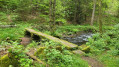
After conquering France, the Romans advanced across the Rhine. The Odenwald Limes was built to secure the route between the Main and Neckar rivers, which were considered natural borders. Built around 85 AD, this border wall was intended to protect the Roman province of Germania Superior.
The fourth stage of your hike takes you along the former border line from Limbach-Wagenschwend to Neckarburken.
During this scenically and culturally enriching tour, you will pass the remains of Roman watchtowers, forts (troop quarters), bathing facilities and border fortifications. Informative boards point out the sights and provide insights into life in the former border region.
Neckarsteig (E5 & E6) from Eberbach via Neunkirchen to Neckargerach
 14.85 mi
+2,287 ft
-2,205 ft
8h 50
 Difficult
Departure from Eberbach (Regierungsbezirk Karlsruhe)
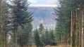
Through the Neckar Valley along the Neckarsteig, a quality hiking trail (Qualitätsweg Wanderbares Deutschland) covering around 128 km from Heidelberg to Bad Wimpfen. The long-distance hiking trail can be hiked as a multi-day or day tour.
To ensure that this section remains walkable in terms of length, we have made a few adjustments to the route.
In 7 stages through the Neckar Valley from Heidelberg to Bad Wimpfen
22.62 mi
+3,684 ft
-3,589 ft
7 days
Difficult
Departure from Hirschhorn (Regierungsbezirk Karlsruhe)
The Neckarsteig stretches over 128 kilometres from Heidelberg to Bad Wimpfen, winding its way along the majestic Neckar River through the picturesque region of Baden-Württemberg. This route promises an unforgettable journey through a variety of landscapes, from gentle vineyards to imposing rock formations.
Along the route, you can expect challenging climbs as well as relaxed sections along the river. You can look forward to varied landscapes ranging from wooded slopes in the Neckar Valley to charming half-timbered towns and historic castles.
We have designed the sections so that you can reach every start and end point of a stage by public transport.
The Katzensteig – an alternative to stages 5 & 6 of the Neckarsteig
 16.33 mi
+3,114 ft
-2,992 ft
10h 15
Difficult
Departure from Eberbach (Regierungsbezirk Karlsruhe)
The Katzensteig connects the towns of Eberbach and Neckargerach. This route, which is around 26 kilometres long, is an interesting alternative to stages 5 and 6 of the Neckarsteig and offers a mix of nature, impressive views and cultural attractions.
Westlicher Limesweg (E5) from Neckarburken to Neckarzimmern
 9.15 mi
+919 ft
-1,024 ft
5h 00
Moderate
Departure from Elztal (Regierungsbezirk Karlsruhe)
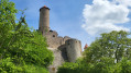
After conquering France, the Romans advanced across the Rhine. The Odenwald Limes was built to secure the route between the Main and Neckar rivers, which were considered natural borders. Built around 85 AD, this border wall was intended to protect the Roman province of Germania Superior.
The fifth and final stage of your hike takes you along the former border line from Neckarburken to Neckarzimmern.
During this scenically and culturally enriching tour, you will pass the remains of Roman watchtowers, forts (troop quarters), bathing facilities and border fortifications. Informative boards point out the sights and provide insights into life in the former border region.
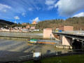
Hirschhorn Castle and views of the Neckar River
 Association / Club / Walk leader
 2.11 mi
+410 ft
-187 ft
1h 20
Moderate
Departure from Hirschhorn (Regierungsbezirk Darmstadt)
This walk will bring you to some great panorama over the Neckar River where you can enjoy watching the boats (peniches) and the old Hirschhorn village and its nice castle. Along the way, you will find benches to enjoy the views and bring some picnic with you.
“Die Bach nab” – Three footbridges in the Elz Valley
7.03 mi
+548 ft
-535 ft
3h 45
Moderate
Departure from Buchen (Odenwald) (Regierungsbezirk Karlsruhe)
A varied walk through the tranquil Elz Valley: from Einbach, the route follows historic paths over panoramic heights, past old mills, wayside shrines and small cultural monuments, all the way to the ‘Dreistegen’ near Scheringen. Time and again, beautiful views open up over the Wiesental valley and the stream that winds its way through the valley. Anyone who enjoys nature, history and quiet paths will find this a particularly charming route.
Neckarsteig (E4) from Hirschhorn to Eberbach
7.77 mi
+1,398 ft
-1,385 ft
4h 50
Moderate
Departure from Hirschhorn (Regierungsbezirk Darmstadt)
Through the Neckar Valley along the Neckarsteig, a quality hiking trail (Qualitätsweg Wanderbares Deutschland) covering around 128 km from Heidelberg to Bad Wimpfen. The long-distance hiking trail can be hiked as a multi-day or day tour. This stage takes you from Hirschhorn to Eberbach.
Nibelungensteig (7): Hesselbach - Kirchzell-Preunschen
 7.56 mi
+1,417 ft
-1,499 ft
4h 45
Moderate
Departure from Oberzent (Regierungsbezirk Darmstadt)
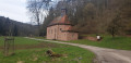
The Nibelungensteig is a certified Qualitätsweg "Wanderbares Deutschland" (Quality Trail "Hiking in Germany") that runs for 130 km in several stages, some of which are very strenuous, with a total of more than 4,000 metres of elevation gain from west to east across the Odenwald and thus through three federal states (Hesse, Bavaria, Baden-Württemberg). Our division differs from the official stages. We have chosen some shorter tours, added a few extra metres and stayed overnight in different places in some cases. When planning your tour, please note that accommodation, refreshment and catering facilities are not always available.
Western Limes Trail (E3) from Hesselbach to Limbach-Wagenschwend
 11.59 mi
+1,073 ft
-1,004 ft
6h 15
Moderate
Departure from Oberzent (Regierungsbezirk Darmstadt)
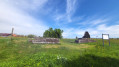
After conquering France, the Romans advanced across the Rhine. The Odenwald Limes was built to secure the route between the Main and Neckar rivers, which were considered natural borders. This border wall, built around 85 AD, was intended to protect the Roman province of Germania Superior.
The third stage of your hike takes you along the former border line from Hesselbach to Limbach-Wagenschwend.
During this scenically and culturally enriching tour, you will pass the remains of Roman watchtowers, forts (troop quarters), bathing facilities and border fortifications. Informative boards point out the sights and provide insights into life in the former border region.
From Hetzbach via the Marbach Reservoir to the beautiful view at Etzean
 5.28 mi
+591 ft
-607 ft
2h 55
Easy
Departure from Oberzent (Regierungsbezirk Darmstadt)
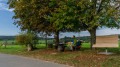
The walk starts in Hetzbach and leads to the nearby Marbach Reservoir. Swimming enthusiasts should pack their swimwear in summer. The route takes you almost directly to the bathing spot by the lake. From the Marbach Reservoir, the path leads through the woods, up to one of the Odenwald’s characteristic open hilltops.
At the turning point, a lovely rest area with a view and a ‘bird box’ awaits the walkers. The return route takes you through the fields back to the starting point in Hetzbach.
Nibelungensteig (8): Preunschen – Amorbach
 8.08 mi
+823 ft
-1,837 ft
4h 25
Moderate
Departure from Kirchzell (Lower Franconia)
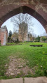
The Nibelungensteig is a certified Qualitätsweg "Wanderbares Deutschland" (Quality Trail "Hikeable Germany") that runs for 130 km in several stages, some of which are very strenuous, with a total of more than 4,000 metres of elevation gain from west to east across the Odenwald and thus through three federal states (Hesse, Bavaria, Baden-Württemberg). Our division differs from the official stages. We have chosen some shorter tours, added a few extra metres and stayed overnight in different places in some cases. When planning your tour, please note that accommodation, refreshment and catering facilities are not always available.
Nibelungensteig (6): Bullau – Hesselbach
 11.13 mi
+1,155 ft
-1,247 ft
6h 05
Moderate
Departure from Erbach (Regierungsbezirk Darmstadt)
The Nibelungensteig is a certified Qualitätsweg "Wanderbares Deutschland" (Quality Trail "Hikeable Germany") that runs for 130 km in several stages, some of which are very strenuous, with a total of more than 4,000 metres of elevation gain from west to east across the Odenwald and thus through three federal states (Hesse, Bavaria, Baden-Württemberg). Our division differs from the official stages. We have chosen some shorter tours, added a few extra metres and stayed overnight in different places in some cases. When planning your tour, please note that accommodation, refreshment and catering facilities are not always available.
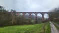
From the Himbächel Viaduct to Beerfelden
 4.93 mi
+837 ft
-358 ft
3h 00
Easy
Departure from Oberzent (Regierungsbezirk Darmstadt)
A varied walking tour from the Marbach Reservoir – artificially created for flood protection – up to the panoramic heights of the Odenwald.
Once you reach Beerfelden at the top, the Odenwald slopes from north to south, dividing the flowing waters towards the Main and Neckar rivers.
Mountains by the River, Neckarsteinach
14.25 mi
+2,073 ft
-2,077 ft
8h 20
Difficult
Departure from Neckarsteinach (Regierungsbezirk Darmstadt)
This walk runs from Neckarsteinach, the ‘town of four castles’, to the picturesque village of Dilsberg, which has retained its medieval charm with its castle complex and winding alleyways. As the route continues, we pass through Mückenloch and walk through the Sotten nature reserve and via Haag to Schönbrunn. The tour ends in Hirschhorn, where we have the opportunity to visit the well-preserved Hirschhorn Castle complex.
Nibelungensteig (5): Güttersbach – Bullau
 14.50 mi
+2,251 ft
-1,585 ft
8h 40
Difficult
Departure from Mossautal (Regierungsbezirk Darmstadt)
The Nibelungensteig is a certified Qualitätsweg "Wanderbares Deutschland" (Quality Trail "Hikeable Germany") that runs for 130 km in several stages, some of which are very strenuous, with a total of more than 4,000 metres of elevation gain from west to east across the Odenwald and thus through three federal states (Hesse, Bavaria, Baden-Württemberg). Our division differs from the official stages. We have chosen some shorter tours, added a few extra metres and stayed overnight in different places in some cases. When planning your tour, please note that accommodation, refreshment and catering facilities are not always available.
Nibelungensteig (9): Amorbach - Miltenberg
 7.97 mi
+1,329 ft
-1,381 ft
4h 50
Moderate
Departure from Amorbach (Lower Franconia)
The Nibelungensteig is a certified Qualitätsweg "Wanderbares Deutschland" (Quality Trail "Hiking in Germany") that runs for 130 km in several stages, some of which are very strenuous, with a total of more than 4,000 metres of elevation gain from west to east across the Odenwald and thus through three federal states (Hesse, Bavaria, Baden-Württemberg). Our division differs from the official stages. We have chosen some shorter tours, added a few extra metres and stayed overnight in different places. When planning your tour, please note that accommodation, refreshment and catering facilities are not always available.
Nibelungensteig (4): Grasellenbach – Güttersbach
 4.56 mi
+682 ft
-902 ft
2h 40
Easy
Departure from Grasellenbach (Regierungsbezirk Darmstadt)
The Nibelungensteig is a certified Qualitätsweg "Wanderbares Deutschland" (Quality Trail "Hiking in Germany") that runs for 130 km in several stages, some of which are very strenuous, with a total of more than 4,000 metres of elevation gain from west to east across the Odenwald and thus through three federal states (Hesse, Bavaria, Baden-Württemberg). Our division differs from the official stages. We have chosen some shorter tours, added a few extra metres and stayed overnight in different places in some cases. When planning your tour, please note that accommodation, refreshment and catering facilities are not always available.