


 Country:
 City:
City:


(S/E) The tour begins at the E3 hiking trail near the former school building. From there, the route continues along the E3 at the junction with Langenelzer Straße. This path is an old long-distance trail, the Main-Neckar Long-Distance Trail, which formerly ran from Wimpfen im Tal across the then-uninhabited heights of the Odenwald to the River Main near Miltenberg.
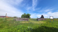
At the junction at the top, there is a lovely view over large parts of the small village. Einbach was first mentioned in 1306, but it is believed to have been founded even before the year 1000 by a representative of the Benedictine monastery and farmers wishing to settle there. To the west of the long-distance path, on the opposite side, residential and farm buildings can be seen, some of which date back to the noble estate or manorial farmstead. In 1306, the owner was Rüdt von Bödigheim, who, however, transferred the estate to the Archbishop of Mainz around 1500. Since the Thirty Years’ War, the Henn family has lived on the estate, and their descendants still reside there today.
The E3 continues northwards towards the Main along the “Langenelzer Weg”. Above the village, you can see the Odenwald plateaus, into which the River Elz has carved its valley. Varved sandstone and slab sandstone on the valley slopes are typical of the area. On the right, in the first patch of woodland, there are water-filled depressions, which is why the area in Einbach is also known as the ‘Lehmegrube’. In the past, yellow clay was quarried there for building houses. The trail continues into the Langenelz district and the “Mostenbach” field with its many clearings. “Mostenäcker” were meadows that were once typical of the Odenwald landscape and could only be mown once a year. Passing small monuments and a so-called ‘orientation post’, the route leads to the ‘Schlagbaum’ field. At this spot, travellers were once checked by means of a 1.5-metre-deep ditch and an almost impassable hedge of hornbeams and thorny bushes behind it. There were several such barriers around the Mudauer Heerhag.
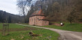
At this point, you leave the former long-distance path and continue to follow the E3 to the left into the Elz Valley. Along the way, you’ll enjoy a wonderful view of the Wiesental valley, through which the stream meanders. The route now switches to the Le2 path and finally to the E1. After a while, you’ll reach the Einbach–Laudenberg local road and the Einbach Mill. The route continues over the bridge onto the La5 path, which leads to the next mill (‘Schneidemühle’). This is a sawmill that was built shortly after 1700 by the millers of the Einbach Mill. In the mill’s courtyard stands a beautiful wayside shrine, intended to commemorate a workplace accident that occurred at the mill in 1836. At that time, a 24-year-old miller’s son had his chest crushed by a cutting block.
The La5 path now leads up the Hainberg until, on path V, you cross the Laudenbächle via a bridge and reach the district road between Laudenberg and Scheringen. Follow this road until the long-distance walking trail, marked with a blue triangle, branches off to the right. It leads into the woods and up the slope. You’ll come across an old long-distance route that linked the Neckar Valley from Neckargerach via Limbach and Buchen to the Tauber Valley. Until 1426, the people of Limbach used this path to reach their parish church in Hollerbach. At a wayside shrine, leave the path and take the S2 church path down to the “Dreistege” cultural monument. At this point, the River Elz is spanned by sandstone footbridges. You then reach the village of Scheringen via the L584, which consists of two districts: Ober- and Unterscheringen.
Continuing along the S2 path, you return to Einbach. The path leads over the Einbacher Höhe, from where you have a sweeping view of the countryside, and past the so-called ‘Hohlbrunnen’. It was built in 1870 to ensure the water supply could continue. Since 1968, Einbach, as well as Hollerbach and Oberneudorf, have been supplied by the Steinkautzen spring, unlike Buchen and the other districts, which are all connected to the Lake Constance water supply. (S/E)
 Visorando Member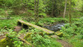


 Difficult
