On the roof of the Odenwald, Waldbrunn

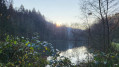
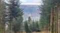
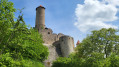
Around the Katzenbuckel, a varied hike awaits you through tranquil beech forests, along sunny meadows and with sweeping views from the hillside. A particular highlight is the detour to the highest point in the Odenwald: on top of the extinct volcano, the viewing tower and fascinating nature trails invite you to discover nature and the Earth’s history in a truly impressive way.

Details

n°110337344
Creation:
Last update:
–
Last review:
–
  • Walking
    Activity: Walking
  • ↔
    Distance: 6.18 mi
  • ◔
    Average duration: 3h 20 
  • ▲
    Difficulty: Easy

  • ⚐
    Back to start: Yes
  • ↗
    Ascent: + 535 ft
  • ↘
    Descent: - 564 ft

  • ▲
    Highest point: 1,788 ft
  • ▼
    Lowest point: 1,522 ft

Description of the walk

Start: We begin this tour at the Waldbrunn holiday village

(S/E) We walk north-west uphill towards the sports ground.

(1) Behind the sports ground, we turn right and follow Rathausstraße to the right through the village.

(2) At the T-junction in the centre, we keep to the left and, on the road called ‘Schöne Aussicht’, keep left again and walk slightly uphill along the edge of the forest.

(3) Our path now curves to the left and we follow the signposted ‘Katzenpfad’. To our left, we are treated to a view of the meadows and paddocks on the hillside before we enter the dense beech forest. The path now climbs a little more steeply and we walk along the gravel road past information boards on a nature trail, which provide information on topics such as bird conservation and forest regeneration.

(4) It’s well worth taking a detour up to the viewing tower on the Katzenbuckel (see the ‘Worth a visit’ section).
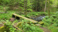
Our actual route now winds its way through the forest for quite some time. First, we keep to the right twice and, after a large left-hand bend, we turn left, heading south-east. We continue straight on until we reach a T-junction with the Curt-Brand Hütte.

(5) We turn left and, after 300 metres, turn right. From the road, we follow the footpath to Oberdielbach. We walk into the village along the Meisentalweg.

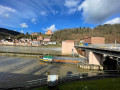
(6) In front of the large Protestant church, built in 1903, we turn left. At the next opportunity, we head back up the road to the left towards our starting point, the holiday village. (S/E)

Waypoints

  1. S/E : mi 0 - alt. 1,663 ft - Waldbrunn Holiday Village
  2. 1 : mi 0.55 - alt. 1,696 ft - Turn right after the sports ground
  3. 2 : mi 1.03 - alt. 1,604 ft - Keep left at the T-junction
  4. 3 : mi 1.95 - alt. 1,598 ft - Links to the “Katzenpfad”
  5. 4 : mi 2.49 - alt. 1,778 ft - Take a detour to the left to the viewing tower
  6. 5 : mi 4.18 - alt. 1,591 ft - Turn left at the Curt-Brand hut, then take the next right
  7. 6 : mi 5.51 - alt. 1,575 ft - At the Protestant church on the left
  8. S/E : mi 6.18 - alt. 1,663 ft - Waldbrunn Holiday Village

Notes

Author: Christiane Bachert

Worth a visit

(S) The holiday village of Waldbrunn is particularly suitable as accommodation for families or groups.

(4) To visit the viewing tower, we take one of the many forest paths to the left and climb all the way to the top, where we can enjoy the wonderful view. The ‘Path of Crystals’ is also located here – an educational trail that explains the formation of the mountain and the supposed crater lake.

Waldkatzenbach lies directly at the foot of the ‘Katzenbuckel’ mountain, which, at 626 metres above sea level, is the highest point in the Odenwald. The crater diameter of the extinct volcano, which formed around 60 million years ago, is approximately 1,000 metres.

Other walks in the area

For more walks, use our search engine .

The GPS track and description are the property of this route's author. Please do not copy them without permission.