


Refine your search for walks in Viviers-du-Lac
Viviers-du-Lac walks


 Tour of Tresserve Hill
 Visorando Member
 7.67 mi
 +404 ft
 -417 ft
 3h 55
3h 55
 Moderate
 Departure from Viviers-du-Lac (Savoie)
This walk allows you to take in the panoramic view of Lake Bourget from the village of Tresserve, then walk around Tresserve Hill and enjoy the lakeside beaches along the cycle path.
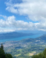
Circular loop: Nivolet, Revard, via the ‘Cheminée’ and the Pas du Rebollion
 19.19 mi
+7,477 ft
-7,477 ft
8 hrs
19.19 mi
+7,477 ft
-7,477 ft
8 hrs
 Very difficult
Departure from Méry (Savoie)
Very difficult
Departure from Méry (Savoie)
Your calves will get a good workout, but you’ll love it! The route takes you via the Malpassant and the Cheminée du Nivolet before reaching the challenging Pas du Rebollion and its arch.
It’s a challenging day, but with magnificent scenery and technically demanding sections on the itinerary.
Please take note of the route description, which highlights the difficulty of certain sections.
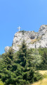
Circular Nivolet cross via the Malpassant
 11.86 mi
+4,554 ft
-4,567 ft
9h 25
11.86 mi
+4,554 ft
-4,567 ft
9h 25
 Difficult
Departure from Méry (Savoie)
Difficult
Departure from Méry (Savoie)
Varied landscapes with lovely views of Lake Bourget and the surrounding mountains. A variation on the famous Croix du Nivolet hike with its 360° panorama, but more physically demanding than it appears.
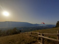
Bois du Fournet
 6.32 mi
+2,306 ft
-2,280 ft
4h 55
Moderate
Departure from Méry (Savoie)
6.32 mi
+2,306 ft
-2,280 ft
4h 55
Moderate
Departure from Méry (Savoie)
Fournet is not the best-known starting point, but this circular route along the cliff edge offers magnificent and varied panoramic views, passing by the paragliding take-off area.
From Mouxy to the Saint-Maurice Chapel
4.83 mi
+673 ft
-679 ft
2h 50
 Easy
Departure from Mouxy (Savoie)
Easy
Departure from Mouxy (Savoie)
A country walk between Lac du Bourget and the foothills of Le Revard. Along the way, you will discover wash houses, a bread oven, a number of metal crosses perched on stone blocks, the slightly secluded Saint-Maurice Chapel, the old village of Clarafond, etc. And, weather permitting, more distant panoramic views.
There are no specific markings, but there are a few mountain bike markers here and there.
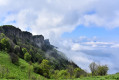
Guard's trail from Pragondran
 5.87 mi
+2,415 ft
-2,392 ft
4h 50
Moderate
Departure from Verel-Pragondran (Savoie)
5.87 mi
+2,415 ft
-2,392 ft
4h 50
Moderate
Departure from Verel-Pragondran (Savoie)
A pleasant hike on the western flank of Mont Nivolet. The route winds its way through the Passage du Croc to cross the cliff and reach Le Sire. Beautiful panorama of the region. The Sentier du Garde was part of the network of trails that criss-crossed the mountainside, allowing forest rangers to travel through the mountainous terrain.
Croix du Nivolet
 6.68 mi
+2,841 ft
-2,838 ft
5h 35
Moderate
Departure from Verel-Pragondran (Savoie)
6.68 mi
+2,841 ft
-2,838 ft
5h 35
Moderate
Departure from Verel-Pragondran (Savoie)
A must-do hike for locals, this short trip to the Dent du Nivolet offers a beautiful 360° panorama of Lac du Bourget, Chartreuse, Belledonne, Beaufortain and Mont Blanc.
On the route of the old rack railway between Mouxy and Pugny Chatenod
 Tourism professional
 2.33 mi
+748 ft
-741 ft
1h 50
Easy
Departure from Mouxy (Savoie)
2.33 mi
+748 ft
-741 ft
1h 50
Easy
Departure from Mouxy (Savoie)
This walk follows the route of the Crémaillère, a railway line that opened on 15 August 1892 and once linked the spa town of Aix-les-Bains to Mont-Revard. It’s a very pleasant walk in summer, as it mainly passes through woodland and the mountain pastures of Mont-Revard.
It was in 2001 that the ‘Association Tourisme et Culture Autour de la Crémaillère’ began developing the Sentier de la Crémaillère, starting from Mouxy. Originally, the first station was situated in the centre of the spa town, very close to the Hôtel Bernascon. This walk covers the first section, between Mouxy and Pugny-Chatenod.
 The Croix du Nivolet From Le Sire
 Association / Club / Walk leader
 3.78 mi
+997 ft
-988 ft
3 hrs
Moderate
Departure from Les Déserts (Savoie)
3.78 mi
+997 ft
-988 ft
3 hrs
Moderate
Departure from Les Déserts (Savoie)
A magnificent snowshoe hike offering 360° panoramic views of the Alps, the Épine massif, Chartreuse and Bugey throughout the route, particularly at the Croix du Nivolet...
The Croix du Nivolet, the final destination, proudly overlooks Chambéry.
The return journey follows the same route, but is always different given the magical landscape in good weather.
Around Mont Nivolet
 8.08 mi
+2,881 ft
-2,871 ft
6h 15
Difficult
Departure from Les Déserts (Savoie)
8.08 mi
+2,881 ft
-2,871 ft
6h 15
Difficult
Departure from Les Déserts (Savoie)
This hike takes you along a path through mountain pastures and woods that is quiet at the start, offering magnificent views of the surrounding valleys and mountain ranges. You can visit the cave and waterfalls before reaching the summit of the Nivolet and its cross. If you keep an eye out for the plants along the way, you may be able to spot the rare and protected Martagon lily.
Le Revard via Pas de Rebollion and Col du Pertuiset
 8.35 mi
+3,241 ft
-3,232 ft
6h 40
Very difficult
Departure from Mouxy (Savoie)
8.35 mi
+3,241 ft
-3,232 ft
6h 40
Very difficult
Departure from Mouxy (Savoie)
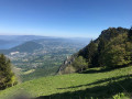
Le Revard is a plateau offering magnificent views of both the Northern Alps around Mont Blanc and Lake Bourget at its feet. This circular route climbs from the edge of the old cable car station, ascending the very steep Pas du Rebollion off-trail, then, after a route passing through several bumps on the plateau, descends via the classic Pertuiset trail.Route modified on 3/07/2023 between (6) and (9) to avoid private land, then on 20/10/2025 between (4) and (5) to take into account changes in the equipment.
Le Revard from Mouxy
 10.90 mi
+3,573 ft
-3,573 ft
8h 05
Difficult
Departure from Mouxy (Savoie)
10.90 mi
+3,573 ft
-3,573 ft
8h 05
Difficult
Departure from Mouxy (Savoie)
This circuit takes you to Le Revard via the Chemin de la Crémaillère and back down via the Pas du Rebollion and the Col du Pertuiset. There are a few variations that add extra difficulty to this circuit. This circuit can be done in the opposite direction to the description.
Circular of Chapelle Saint-Victor
 3.68 mi
+1,490 ft
-1,496 ft
3h 00
Moderate
Departure from Mouxy (Savoie)
3.68 mi
+1,490 ft
-1,496 ft
3h 00
Moderate
Departure from Mouxy (Savoie)
A half-day walk to discover the tourist heritage, a chapel and panoramic views. The yellow-marked route runs below Mont Revard. This circular walk can be practiced in either direction.
Les Échelles de Château Richard and the Croix du Signal via La Serraz
 9.85 mi
+3,737 ft
-3,720 ft
7h 45
Difficult
Departure from Le Bourget-du-Lac (Savoie)
9.85 mi
+3,737 ft
-3,720 ft
7h 45
Difficult
Departure from Le Bourget-du-Lac (Savoie)
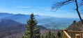
A walk through the woodland on the hills above Bourget-du-Lac, very pleasant in hot weather! Superb views from the summit over Lakes Bourget and Aiguebelette, as well as over Chambéry.
Circuit de la Chapelle du Mont-du-Chat
 5.04 mi
+1,529 ft
-1,496 ft
3h 40
Difficult
Departure from Bourdeau (Savoie)
5.04 mi
+1,529 ft
-1,496 ft
3h 40
Difficult
Departure from Bourdeau (Savoie)
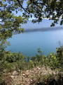
This hike takes place in a setting dear to Lamartine. The first part, which runs alongside Lac du Bourget, offers beautiful views, and a good climb leads to the Chapelle Notre-Dame de l'Étoile. Be sure to linger around the building and take advantage of the facilities to admire the panorama.
On the way back through the forest, there are other viewpoints over the Savoyard countryside. Finally, the descent to Bourdeau also offers some sought-after views.
19/09/2023 Message from the moderator: the section between (2) and (3) is very steep and slippery on the way up and requires a good level of fitness for around 500 m. Some sections between (8) and (9) are also slippery on the way down. This route should be attempted in dry weather. Not recommended for young children.
From Bourdeau to Hautecombe overlooking Lake Bourget
 13.41 mi
+3,802 ft
-3,799 ft
9h 30
Difficult
Departure from Bourdeau (Savoie)
13.41 mi
+3,802 ft
-3,799 ft
9h 30
Difficult
Departure from Bourdeau (Savoie)
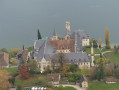
Here is a good route connecting Bourdeau to Hautecombe Abbey.
The outward journey takes you above the wild shores of Lake Bourget with numerous viewpoints, all on a somewhat rugged route.
After climbing a little higher, the return route takes you in the shadow of Mont de la Charvaz before coming back via the Col du Chat.
The Saint-Alban tour
 3.93 mi
+1,001 ft
-1,001 ft
2h 40
Easy
Departure from Le Bourget-du-Lac (Savoie)
3.93 mi
+1,001 ft
-1,001 ft
2h 40
Easy
Departure from Le Bourget-du-Lac (Savoie)
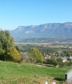
An easy walk at the foot of the Montagne de l'Epine, enhanced by a waterfall and panoramic views of Lac du Bourget and Les Bauges. Markings are inconsistent.
Cat Tunnel Circular Loop
 4.54 mi
+2,546 ft
-2,539 ft
4h 20
Moderate
Departure from Bourdeau (Savoie)
4.54 mi
+2,546 ft
-2,539 ft
4h 20
Moderate
Departure from Bourdeau (Savoie)
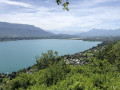
Exploring the Cat Tunnel via the safety gallery. This gallery, running parallel to the road tunnel, serves as an emergency exit in the event of an incident. Normally, this passage is used by many cyclists as well as pedestrians to get from the Lac du Bourget side to the Yenne Valley and the Chevelu Lakes. The tunnel has been converted into the “Musée du Chat” and features an impressive collection of murals created by contemporary artists, inspired by Savoyard tradition. In my opinion, it is unique in France. A note on the route: you will see an elevation gain of 732 m, which is incorrect, as the software includes the mountain height above the tunnel; you must therefore subtract 321 m, bringing the route’s total elevation gain down to 455 m.
Route through the hamlets of La Motte Servolex
4.09 mi
+692 ft
-692 ft
2h 30
Easy
Departure from La Motte-Servolex (Savoie)
This walk passes through some of the many hamlets of La Motte Sevolex. Although they are gradually being swallowed up by urbanisation, they nevertheless retain their rural character.
Along the way, there are beautiful views of Les Bauge and Lac du Bourget.
Le Revard and Le Pertuiset via the Golet de la Pierre from Pugny-Chatenod
 9.24 mi
+3,261 ft
-3,251 ft
7h 05
Difficult
Departure from Pugny-Chatenod (Savoie)
9.24 mi
+3,261 ft
-3,251 ft
7h 05
Difficult
Departure from Pugny-Chatenod (Savoie)
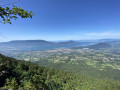
A lovely walk, mainly through woodland, which takes you up the slopes and across the Revard plateau. Throughout this route, there are beautiful views over the Aix-les-Bains basin and Lake Bourget.
The Chemin du Golet de la Pierre, the most direct route to Mont Revard, can be challenging, with an elevation gain of nearly 1,000 metres over the first three kilometres. Make sure you’re wearing suitable footwear and are fit enough to tackle this walk.
From Col du Chat to Petit Villard
 7.35 mi
+1,539 ft
-1,526 ft
4h 45
Moderate
Departure from La Chapelle-du-Mont-du-Chat (Savoie)
7.35 mi
+1,539 ft
-1,526 ft
4h 45
Moderate
Departure from La Chapelle-du-Mont-du-Chat (Savoie)
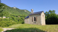
A lovely little walk with lots of views of the lake. Much of the route is in the forest, making this hike ideal on a hot day.
The Dent du Chat and the Roc de Cornillon
 4.25 mi
+2,720 ft
-2,703 ft
4h 20
Difficult
Departure from La Chapelle-du-Mont-du-Chat (Savoie)
4.25 mi
+2,720 ft
-2,703 ft
4h 20
Difficult
Departure from La Chapelle-du-Mont-du-Chat (Savoie)
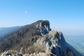
This is a lovely half-day hike with beautiful views of Lac Du Bourget, Aix-Les-Bains and the Chambérien basin, the Belledonne massif and Mont Blanc on one side, and the Savoyard foothills (Yenne, Belley, Grand Colombier) on the other.
Please note: Those who are afraid of heights may be affected by some technical sections equipped with cables or ladders.