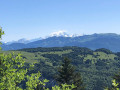
On the route of the old rack railway between Mouxy and Pugny Chatenod

This walk follows the route of the Crémaillère, a railway line that opened on 15 August 1892 and once linked the spa town of Aix-les-Bains to Mont-Revard. It’s a very pleasant walk in summer, as it mainly passes through woodland and the mountain pastures of Mont-Revard.

It was in 2001 that the ‘Association Tourisme et Culture Autour de la Crémaillère’ began developing the Sentier de la Crémaillère, starting from Mouxy. Originally, the first station was situated in the centre of the spa town, very close to the Hôtel Bernascon. This walk covers the first section, between Mouxy and Pugny-Chatenod.

Details

100256579
Creation:
Last update:
Last review:
  • Walking
    Activity: Walking
  • ↔
    Distance: 2.33 mi
  • ◔
    Average duration: 1h 45 
  • ▲
    Difficulty: Easy

  • ⚐
    Back to start: Yes
  • ↗
    Ascent: + 748 ft
  • ↘
    Descent: - 741 ft

  • ▲
    Highest point: 2,077 ft
  • ▼
    Lowest point: 1,352 ft
  • ⚐ Country: France
  • ⚐
    Area: Alps
  • ⚐ City: Mouxy (73100)
  • ⚑
    Start/End: N 45.685765° / E 5.93645°
  • ❏
    IGN map(s): Ref. 3332OT
  • Hour-by-hour weather

Photos

Description of the walk

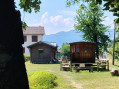
(S/E) The path begins in front of the old Mouxy station, which was restored in 2006. Take the shaded path that winds its way through the trees and crosses the D913 to lead to the foot of Mont-Revard.

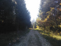
(1) Continue along the wide path through the woodland. You can take a 50-metre detour to go down and see a historic structure built to allow animals to pass through. At Les Barrals (alt. 527 m), you’ll cross the road leading to the Monastery of Bethlehem and the Maison des Corbières, a luxury hotel from the Belle Époque and a former health resort. Carry on straight ahead and you will soon cross the path leading to Le Pertuiset. Carry on straight ahead until you reach Les Maillands.

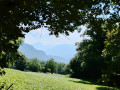
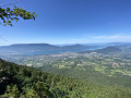
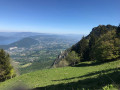
(2) You’ll arrive in the mountain pastures below the Revard. Turn round to admire the Dent du Chat, an iconic peak facing Mont Revard and Lake Bourget. Carry on through the mountain pastures, passing close to a farm – be mindful and keep a low profile, as a herd is resting amidst these wonderful landscapes. You’ll reach Les Grands Prés (alt. 630 m). This is where the Pugny-Chatenod station stood, the third station on the historic route. This is where trains used to stop to refill the locomotive with water.

(3)Turn right towards the Monastery of Bethlehem / Notre-Dame de l’Unité Monastery, a quiet area – please respect this place.

(4) As you approach the monastery gate, turn slightly into the woods and follow the signpost. Continue to the Chapel of Unity, which is currently being restored under the auspices of the Fondation du Patrimoine.

(5) Take the marked path (clearly signposted, just before the lay-by and the area with the information boards) to descend into the woodland. At the junction: Les Corbières (alt. 556 m), continue straight on towards Les Barrals. Turn left andreturn to the starting point by following the route in reverse (S/E).

Waypoints

  1. S/E : mi 0 - alt. 1,352 ft - Former station
  2. 1 : mi 0.25 - alt. 1,490 ft - Facility for animals
  3. 2 : mi 0.79 - alt. 1,995 ft - Les Maillands, altitude 605 m
  4. 3 : mi 0.91 - alt. 2,060 ft - The large meadows
  5. 4 : mi 1.15 - alt. 2,073 ft - Monastery of Bethlehem
  6. 5 : mi 1.32 - alt. 1,998 ft - The Chapel of Unity
  7. S/E : mi 2.33 - alt. 1,352 ft - Former station

Notes

The start of the walk is in Mouxy. You can easily park your car in the car park in front of the chemist’s, at 5 Montée du Crêt, then follow the signs for “Gare de la Crémaillère”. It’s about a 6-minute walk. Continue on foot along Montée du Crêt, turn right and walk for about 50 metres along Chemin du Crêt, then take “Via Dessous” for 150 metres. You’ll soon see Mouxy station on your right.

Worth a visit

The Chapel of Unity
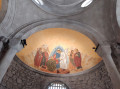
This religious building, constructed in 1927 on the hills overlooking Lake Bourget, is distinguished by its architecture—rare in Savoie—which is inspired by the Christian East, featuring a Greek cross plan and a dome.
It was built on the site of the former Corbières estate, where an orphanage for disadvantaged girls was founded in the early 1900s.

Further reading
I have published an article on my website about the history of the Sentier de la Crémaillère. To read it

Other walks in the area

For more walks, use our search engine .

The GPS track and description are the property of this route's author. Please do not copy them without permission.