Country:

 City:
City:


Small car park before the Serraz Waterfall.
(S/E) Head towards the waterfall.
(1) Take the footpath that climbs to the left of the waterfall and join the county road. Turn right.
(2) When you can see the chapel, turn left at the junction and carry on until you come to the gate of a private property.
(3) Follow the path that branches off to the right and eventually leads onto the Chemin de la Montagne.
(4) Turn left and stay on the same path heading due south: be careful, as the signposts are not always clear.
(5) Take the path on the right that goes uphill.
(6) Keep to the right, ignoring the path that branches off to the left. A little further on, first turn right then left and continue uphill through a series of hairpin bends. You’ll arrive at the Combe d’Armée car park.
(7) Turn left onto the Chemin de Château Richard. Further up, let a path branch off to the right and you’ll reach a junction.
(8) At this point, you have two options for reaching the Château Richard viewpoint: via Les Échelles (a slightly technical section with three ladders – choose your route), or via a gentle path that goes round to the right. Climb the ladders and head for the viewpoint.
(9) Then continue towards the Croix du Signal, making sure to head north.
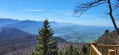
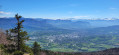
(10) There’s a stunning view from the summit over Lakes Bourget and Aiguebelette, as well as the Chambéry valley. Carry on in the same direction.
(11) Head back down via the Chemin du Signal, which branches off to the right. Cut across a forest track and continue straight ahead along the path, which winds its way down in several hairpin bends.
(12) First turn right then left to stay on the path and join the Chemin de la Montagne right at the bottom.
(13) Turn sharply right and join a road.
(14) Turn left onto the road towards La Roche-Saint-Alban, keeping to the right at every junction you come to.
(2) Turn left at the chapel, then turn left again onto the path that leads back down to the waterfall.
(1) Continue to the right to reach the small car park (S/E).



 Visorando Member
 Easy
Easy 
 Association / Club / Walk leader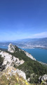
 Moderate