


Refine your search for walks in Vareilles (Yonne)
Vareilles (Yonne) walks


 Between Vareilles and Pont-sur-Vanne via Chigy
 Visorando Member
 7.76 mi
 +49 ft
 -49 ft
 1.5 hrs
 Easy
Easy
 Departure from Vareilles (Yonne) (Yonne)
A short, flat, easy walk or cycle (suitable for all types of bikes).Along the way, you’ll discover, amongst other things: the Ferme des Prés (a listed dovecote), the Ru de Vareilles, the village of Pont-sur-Vanne, the old railway line from Sens to Troyes, the Vanne (a Category 1 river), the Paris water pumping station in Chigy, the Lavoir à Moutons, the narrow streets of Chigy, the Fontaine Saint-Léger, and the church in Vareilles.
Vaudeurs and the hilltop hamlets from Vareilles
 15.42 mi
+715 ft
-715 ft
2.5 hrs
15.42 mi
+715 ft
-715 ft
2.5 hrs
 Difficult
Departure from Vareilles (Yonne) (Yonne)
Difficult
Departure from Vareilles (Yonne) (Yonne)
A walk through the Vareilles Valley to Vaudeurs along a quiet little road, then back via the hilltop hamlets surrounding this pretty valley. A few disused wells along the route, a Bollée windmill and a medieval tower, the Salazar Tower.
 Discovering Vareilles
 3.85 mi
+138 ft
-138 ft
1h 55
Easy
Departure from Vareilles (Yonne) (Yonne)
3.85 mi
+138 ft
-138 ft
1h 55
Easy
Departure from Vareilles (Yonne) (Yonne)
All around this route, you will find signs with QR codes telling you about the history of the places you encounter.
The Champ-Fêtu Forest
 7.56 mi
+538 ft
-525 ft
3h 55
7.56 mi
+538 ft
-525 ft
3h 55
 Moderate
Departure from Vareilles (Yonne) (Yonne)
Moderate
Departure from Vareilles (Yonne) (Yonne)
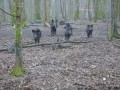
From Vareilles, discover the beautiful Champs-Fêtu forest, reforested at the end of the 18th century. You will walk along the wild boar park and arrive at the old Champ-Fêtu farm and its 35-metre giant sequoia.
The Vanne Hills circular route
 5.65 mi
+479 ft
-476 ft
3h 00
Easy
Departure from Chigy (Yonne)
5.65 mi
+479 ft
-476 ft
3h 00
Easy
Departure from Chigy (Yonne)
From Chigy (Les Vallées de la Vanne) to Pont-sur-Vanne, this trail passes through natural sites included in the European Natura 2000 network, which recognises the richness of their flora and fauna.
The dry grasslands on chalk offer significant and unique floral diversity. The view over the Vanne valley is breathtaking.
Information boards along the route explain the site’s natural riches.
The cider route starting from Cerisiers
 9.69 mi
+479 ft
-459 ft
4h 50
Moderate
Departure from Cerisiers (Yonne)
9.69 mi
+479 ft
-459 ft
4h 50
Moderate
Departure from Cerisiers (Yonne)
You will discover the village of Cerisiers, the old brick dryer and the Villechétive stud farm. It is a beautiful walk in the forest with a recommended detour to Les Brissots, a museum and cider producer.
Montagne Julien Trail
 Tourist office
 5.89 mi
+620 ft
-597 ft
3h 15
Easy
Departure from Villiers-Louis (Yonne)
5.89 mi
+620 ft
-597 ft
3h 15
Easy
Departure from Villiers-Louis (Yonne)
This circular walk, which presents no major difficulties, offers varied and picturesque scenery (open views and woodland) along minor roads, tracks and forest paths.
A walk through the heart of the Grande Vallée woodland
 6.39 mi
+528 ft
-505 ft
3h 25
Moderate
Departure from Malay-le-Grand (Yonne)
6.39 mi
+528 ft
-505 ft
3h 25
Moderate
Departure from Malay-le-Grand (Yonne)
This lovely route, which runs largely through woodland, presents no major difficulties, despite a fairly steep climb at the start and end of the walk. It offers fine views over the Vanne valley and the Eaux de Paris aqueduct, as well as the Yonne valley, where, against the backdrop of the Côte de Paron and the distinctive silhouette of Sens Cathedral (Saint-Étienne), stands the first Gothic cathedral ever built.
A walk along the river between Malay-le-Grand and Maillot
 4.68 mi
+23 ft
-23 ft
2h 10
Easy
Departure from Malay-le-Grand (Yonne)
4.68 mi
+23 ft
-23 ft
2h 10
Easy
Departure from Malay-le-Grand (Yonne)
This route, which alternates between sections through woodland, along stream banks and across fields, offers sunshine in autumn and cool shade in summer. It takes us on a journey of discovery through Malay-le-Grand and the Vanne aqueduct. A good opportunity to remember that some of the watercourses in the Sénonais region supply Paris with drinking water.
Route of Resistance between Les Bordes and Dixmont
 12.90 mi
+876 ft
-850 ft
6h 40
Moderate
Departure from Les Bordes (Yonne) (Yonne)
12.90 mi
+876 ft
-850 ft
6h 40
Moderate
Departure from Les Bordes (Yonne) (Yonne)
This trail takes you on a discovery of Dixmont and Les Bordes via a themed route (marked in green) dedicated to the Resistance; it is dotted with information panels. It recounts the story of the two maquis groups known as “Bourgogne”, which were based in this part of the Othe Forest during the winter and spring of 1944. Walkers will thus learn about the lives and struggles of the maquis fighters, as well as the ‘sedentary’ Resistance fighters, who were numerous in the farms, hamlets and villages.
Route du Maquis de Bourgogne autour de Les Bordes
 5.70 mi
+489 ft
-466 ft
3h 05
Easy
Departure from Les Bordes (Yonne) (Yonne)
5.70 mi
+489 ft
-466 ft
3h 05
Easy
Departure from Les Bordes (Yonne) (Yonne)
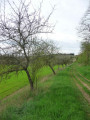
This easy walk takes you on a journey of discovery through Les Bordes and its hamlets. Above all, it allows you to step back in time to the summer of 1944, to follow in the footsteps of one of the maquis groups known as ‘Bourgogne’. This route, marked in yellow and dotted with historical information panels, recounts the attack of 3 August 1944, the lives and struggles of the maquis fighters, as well as the ‘sedentary’ resistance fighters, who were numerous in the farms, hamlets and villages.
Around Dixmont, from the mine to the Priory of L'Enfourchure
 8.04 mi
+541 ft
-528 ft
4h 10
Moderate
Departure from Dixmont (Yonne)
8.04 mi
+541 ft
-528 ft
4h 10
Moderate
Departure from Dixmont (Yonne)
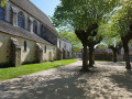
This varied route allows you to explore the commune of Dixmont – the seat of a royal castellany in the12th century – and its surroundings. Of particular interest: the Priory of L'Enfourchure, founded by the Counts of Joigny in 1209. Ruined by the wars ofthe 15th and16th centuries, it was rebuilt in the16th century. Also visible along the route is the entrance to a former lignite mine, which was in operation duringthe 19th century.
Route du Maquis de Bourgogne autour de Dixmont
 4.36 mi
+269 ft
-269 ft
2h 15
Easy
Departure from Dixmont (Yonne)
4.36 mi
+269 ft
-269 ft
2h 15
Easy
Departure from Dixmont (Yonne)
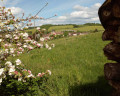
This easy route takes you on a journey of discovery through Dixmont and its surroundings. Above all, it allows you to step back in time to the spring of 1944 and walk in the footsteps of a member of the Maquis known as "Bourgogne". This route, marked in red and dotted with historical information panels, recounts the attack of 15 May 1944, the lives and struggles of the maquis fighters, as well as the sedentary resistance fighters, who were numerous in the farms, hamlets and villages.
The Bezeaux Spring and Les Hauts de Flacy
6.28 mi
+397 ft
-397 ft
3h 15
Moderate
Departure from Flacy (Yonne)
After admiring the church dedicated to Saint-Loup and the wash house dating from 1877, head towards the Hauts de Flacy via the Source Bézeaux and the Flacy forest.
Discovering the Postolle
2.25 mi
+217 ft
-217 ft
1h 15
Easy
Departure from La Postolle (Yonne)
Discover the village of La Postolle: the Church of Saint Joseph and Saint Fiacre, the Bollée windmill built in 1898, and its remarkable trees.
Discovering the landscapes around Rosoy
 5.65 mi
+528 ft
-509 ft
3h 05
Easy
Departure from Yonne
5.65 mi
+528 ft
-509 ft
3h 05
Easy
Departure from Yonne
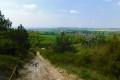
This looping route in and around Rosoy takes in the countryside around Sens, alternating between farmland and woodland. It offers beautiful views of the Yonne valley, as well as the city of Sens and its Cathedral of Saint-Étienne, the first Gothic cathedral. There is also a water collection aqueduct. Don't forget that some of the rivers in the Sénonais region supply Paris with drinking water.
Around Courgenay
5.32 mi
+308 ft
-322 ft
2h 45
Easy
Departure from Courgenay (Yonne)
Listening to the Cistercian Abbey of Vauluisant, discover the monks’ irrigation system, the old flour mill, the Saint-Thomas gate, the old farms of Vauluisant, La Singerie and the Vauluisant State Forest.
The Lancy Dolmen
 4.11 mi
+135 ft
-131 ft
2h 00
Easy
Departure from Saint-Maurice-aux-Riches-Hommes (Yonne)
4.11 mi
+135 ft
-131 ft
2h 00
Easy
Departure from Saint-Maurice-aux-Riches-Hommes (Yonne)
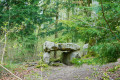
A discovery route around the Lancy Dolmen, situated in the Vauluisant State Forest.
The coat-of-arms-adorned boundary stones of the Vauluisant Forest
 3.77 mi
+266 ft
-285 ft
2h 00
Easy
Departure from Saint-Maurice-aux-Riches-Hommes (Yonne)
3.77 mi
+266 ft
-285 ft
2h 00
Easy
Departure from Saint-Maurice-aux-Riches-Hommes (Yonne)
In this forest, the boundary markers bear the coats of arms of three lords: Cardinal Louis de Bourbon-Vendôme, the Briçonnet-Raguier couple and the de Belleville brothers. These boundary markers must have been set in the ground around 1550, following disputes over the respective boundaries of their estates.
In the deep forest, from Valprofonde to Corvisard
 Association / Club / Walk leader4.94 mi
+305 ft
-282 ft
2h 30
Easy
Departure from Villeneuve-sur-Yonne (Yonne)
Association / Club / Walk leader4.94 mi
+305 ft
-282 ft
2h 30
Easy
Departure from Villeneuve-sur-Yonne (Yonne)
The path reveals the intertwining of the forest and human activities, agricultural enclaves, hamlets, logging areas, always close to the majestic atmosphere of the forest. From the top of these tall trees, centuries contemplate us.
It also shows the first impacts of climate change, with dry ponds, emaciated trees and new species. It invites us to give the forest back its freedom to adapt and migrate at its own pace, to let it take control. The trail aims to restore a sense of confidence in what nature and the forest can achieve with and even without us.
It is this forest that the Ruban Vert wishes to help migrate to the next forest massifs of the woods and ponds of the Gâtinais in Burgundy.
Bois de Saint-Martin circuit on the heights of Villeneuve-sur-Yonne
 3.58 mi
+335 ft
-335 ft
1h 55
Easy
Departure from Villeneuve-sur-Yonne (Yonne)
3.58 mi
+335 ft
-335 ft
1h 55
Easy
Departure from Villeneuve-sur-Yonne (Yonne)
This pleasant circuit offers beautiful views of the town of Villeneuve-sur-Yonne, thanks to its small climbs. The path across woodland provides shade on one-third of the route during sunny weather.
Route from Villeneuve-sur-Yonne to Passy - La Chaume
 6.98 mi
+472 ft
-463 ft
3h 35
Moderate
Departure from Villeneuve-sur-Yonne (Yonne)
6.98 mi
+472 ft
-463 ft
3h 35
Moderate
Departure from Villeneuve-sur-Yonne (Yonne)
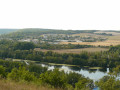
This route, which alternates between sections along cultivated fields and sections through woodland, offers beautiful views of the village of Passy, the Yonne valley, the lakes of Villeneuve-sur-Yonne and the town itself. On a clear day, you can even see the bell tower of Saint-Étienne Cathedral in Sens.
From La Haute Épine to La Fontaine Rouge
 10.19 mi
+968 ft
-961 ft
5h 30
Moderate
Departure from Villeneuve-sur-Yonne (Yonne)
10.19 mi
+968 ft
-961 ft
5h 30
Moderate
Departure from Villeneuve-sur-Yonne (Yonne)
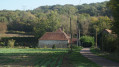
This beautiful route on the hills above Villeneuve takes you through the lands of the Thénard bequest, whose properties were used to provide for orphans. The route follows theGR®213trail and then theGRP® Tour de l’Orvanne trail, and runs mostly through woodland. However, the very beginning and the very end offer lovely views over Villeneuve-sur-Yonne. The sites of the headwaters of the Ru de Bourienne and the Fontaine Rouge are well worth a visit.
From Villeneuve-sur-Yonne to the hamlet of Château
 5.03 mi
+335 ft
-335 ft
2h 35
Easy
Departure from Villeneuve-sur-Yonne (Yonne)
5.03 mi
+335 ft
-335 ft
2h 35
Easy
Departure from Villeneuve-sur-Yonne (Yonne)
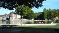
The route offers a pleasant walk along the banks of the Yonne, then through woodland (a third of the route on forest tracks) or along small country lanes (a third of the route). A pleasant walk through the hamlet of Château, whose site – known for having been home to a powerful oppidum of the Senones Gauls – rises some 100 metres above a bend in the River Yonne, offering beautiful views over the valley and the neighbouring hillsides.
From the Champ du Guet to Passy Castle
 10.25 mi
+860 ft
-830 ft
5h 30
Moderate
Departure from Villeneuve-sur-Yonne (Yonne)
10.25 mi
+860 ft
-830 ft
5h 30
Moderate
Departure from Villeneuve-sur-Yonne (Yonne)
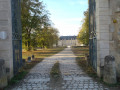
This beautiful route, which winds its way through the hills above Villeneuve-sur-Yonne, offers magnificent panoramic views of the town and the Yonne valley. It allows you to discover some of the many hamlets of Villeneuve-sur-Yonne, as well as the town’s rich heritage.
Beaudemont Route
 3.81 mi
+318 ft
-318 ft
2h 00
Easy
Departure from Villeneuve-sur-Yonne (Yonne)
3.81 mi
+318 ft
-318 ft
2h 00
Easy
Departure from Villeneuve-sur-Yonne (Yonne)
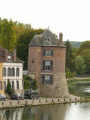
Starting from the medieval village of Villeneuve-sur-Yonne, why not give this easy walk a go? It will take you on a two-hour exploration of the lush countryside, after which you can enjoy a lovely view of the village below.
Around the lakes of Villeneuve-sur-Yonne
 4.79 mi
+13 ft
-13 ft
2h 15
Easy
Departure from Villeneuve-sur-Yonne (Yonne)
4.79 mi
+13 ft
-13 ft
2h 15
Easy
Departure from Villeneuve-sur-Yonne (Yonne)
This pleasant, easy route is partly shaded in summer. The proximity to the water offers lovely views of the River Yonne and the fishing ponds at Villeneuve. You can spot a variety of wildlife and attractions… as well as anglers in action.
The "owl" walk...
 5.59 mi
+230 ft
-220 ft
2h 45
Easy
Departure from Villevallier (Yonne)
5.59 mi
+230 ft
-220 ft
2h 45
Easy
Departure from Villevallier (Yonne)
Animal-themed walking trail created by Year 4-6 pupils at Villevallier Primary School in June 2015 as part of the "Un chemin, une école" (One trail, one school) initiative run by the Yonne branch of the French Hiking Federation.
More walks in Vareilles (Yonne)
Select a point of interest below: