Route of Resistance between Les Bordes and Dixmont

This trail takes you on a discovery of Dixmont and Les Bordes via a themed route (marked in green) dedicated to the Resistance; it is dotted with information panels. It recounts the story of the two maquis groups known as “Bourgogne”, which were based in this part of the Othe Forest during the winter and spring of 1944. Walkers will thus learn about the lives and struggles of the maquis fighters, as well as the ‘sedentary’ Resistance fighters, who were numerous in the farms, hamlets and villages.

Details

1649063
Creation:
Last update:
Last review:
  • Walking
    Activity: Walking
  • ↔
    Distance: 12.90 mi
  • ◔
    Average duration: 6h 40 
  • ▲
    Difficulty: Moderate

  • ⚐
    Back to start: Yes
  • ↗
    Ascent: + 876 ft
  • ↘
    Descent: - 850 ft

  • ▲
    Highest point: 748 ft
  • ▼
    Lowest point: 371 ft

Photos

Description of the walk

The route starts from Les Bordes, at the car park by the wash house (next to the restaurant). There is an information board here.

Green markings throughout the route.

(S/E) With your back to the information sign and the car park, turn left onto Rue du Lavoir, heading towards Les Fourneaux.

Walk past the playground and continue straight on. Leave Rue des Jardins on your right and carry on until you reach the next path on your left. Take this grassy path which climbs to your left and continue until you reach the junction with Route des Fourneaux. Cross the road, staying on the same path which leads to the hamlet of Les Fourneaux.

(1) At the entrance to the hamlet, where the path joins the road, turn right then veer left after a few steps. The road takes a right-angle bend to the right. Take the first road on the left after this bend. It turns into a path as it leaves the hamlet. Stay on this path for several hundred metres, passing the first path on the left.

(2) Take the second path on the left, then continue straight on. Pass the first junction and carry on until you reach information panel No. 2, ‘Maquisards and settlers of the Othe Forest’.

(3) Take the path on the right; follow it to the junction with Route André Dussault, not far from the entrance to the hamlet of Le Chapitre.

(4) Turn left onto this road. Follow it to information panel No. 3, “The attack by the 1st Burgundy Maquis on 15 May 1944”, and the André Dussault memorial.

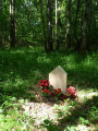
(5) Turn right onto Allée Jack Marsden and follow it for several hundred metres through the woods, then turn right. Walk a few steps further, still through the woods, for about fifty metres to reach the Maquis Bourgogne memorial (signposted).

(6) Then retrace your steps back to signpost No. 3 to continue the walk.

(5) Cross the road and head straight on for a few hundred metres along the path leading to information panel No. 4, ‘Parachute drops arm the Maquis’. Continue straight on until you reach the D122.

(7) Take the D122 on your left. Follow it for about a hundred metres, then turn left. Continue along this path until it joins the Chemin des Misois. Carry on straight ahead, then turn left onto the Route d’Armeau. Follow this road until you reach Rue d’Eichtal (D15) in Dixmont. Turn right and walk past the fountain.

(8) At the start of Rue Saint-Gervais, carry on to the right as far as the church to read information board No. 5, located in the car park at the rear of the church.

(9) Retrace your steps back to the fountain.

(8) Continue straight on along Rue Saint-Gervais. Then take the second street on the left, Rue du Gumery, which then bends to the right. Keep going straight on, heading uphill into the woods.

(10) At the Fork in the road, veer slightly to the left. As you emerge from the woods, leave the path on the left and follow the one on the right, which leads to the Moulin à Vent plateau. Then turn left, walking along the edge of the woods, before continuing across open ground until you reach a road.

(11) Turn right onto this road. Follow it towards the memorial stone, then on to information panel No. 6, ‘The hunt for the Maquis in August 1944’. Walk through the hamlet of Grange Pourrain.

(12) Turn right and carry on to the hamlet’s central square. Leave the road on your right and take the path opposite.
Leave the hamlet, continue for a few hundred metres, then turn left onto the path. After a good hundred metres, turn left and stay on the path that runs alongside the woodland until you reach the hamlet of La Grange aux Malades.

(13) At the next junction, read information panel No. 7: “The attack by the Second Maquis Bourgogne on 3 August 1944”. Leave the road on your right and walk through the hamlet. Pass two ponds, then, on leaving La Grange aux Malades, take the path leading down to the right towards the edge of a woodland. After just over a kilometre, it reaches the hamlet known as Le Charpentier.

(14) Take the road on the right, towards Clos Aubry. Walk through the hamlet until you reach information panel No. 8, “The aftermath of the attack by the second Maquis Bourgogne”.

(15) Retrace your steps and take the first road on the right, which turns into a path after a few strides. After a few dozen metres, the path descends to the left. Then ignore the path branching off to the right and continue straight on along the one that climbs into the woods.

(16) As you emerge from the woods, turn right and follow the edge of the woods until you reach information panel No. 9, “The first location of the Second Maquis Bourgogne”. Then turn left, then right. Further on, ignore a path branching off to the right.

(17) About a hundred metres before the D15, take the path on the right which runs alongside a hedge of thuja trees, then carry on straight ahead to reach Les Bordes. Take Rue des Chevaliers, then turn left into Rue de la Mairie to return to the car park at the starting point (S/E).


Waypoints

  1. S/E : mi 0 - alt. 374 ft - Car park at the wash house (restaurant)
  2. 1 : mi 0.59 - alt. 620 ft - Turn right, then left
  3. 2 : mi 1.07 - alt. 633 ft - T-junction after the hamlet of Les Fourneaux
  4. 3 : mi 1.97 - alt. 673 ft - Junction at information panel No. 2
  5. 4 : mi 2.32 - alt. 696 ft - Junction with Route André Dussault
  6. 5 : mi 2.96 - alt. 702 ft - Junction at information panel No. 3
  7. 6 : mi 3.35 - alt. 656 ft - Maquis Bourgogne memorial
  8. 7 : mi 4.2 - alt. 633 ft - Junction with the D122
  9. 8 : mi 4.96 - alt. 446 ft - Crossroads near the fountain in Dixmont - Église Saint-Gervais et Saint-Protais
  10. 9 : mi 5.03 - alt. 443 ft - Sign no. 5
  11. 10 : mi 5.74 - alt. 669 ft - At the fork in the road, turn left
  12. 11 : mi 7 - alt. 699 ft
  13. 12 : mi 7.51 - alt. 725 ft - Exit onto the road
  14. 13 : mi 8.85 - alt. 676 ft - Junction at La Grange aux Malades (sign No. 7)
  15. 14 : mi 9.76 - alt. 653 ft - T-junction at the hamlet of Le Charpentier
  16. 15 : mi 10.08 - alt. 646 ft - Clos Aubry, sign no. 8
  17. 16 : mi 10.5 - alt. 623 ft - Junction at the edge of the woodland
  18. 17 : mi 11.43 - alt. 433 ft - Junction near the D15 (thuja hedge)
  19. S/E : mi 12.9 - alt. 374 ft - Washing-house car park

Notes

For your safety, please avoid using this route during the traditional hunting season from 1 October to 28 February.

Routes through woods and forests must follow rural tracks; entering any woodland (even communal woodland) is prohibited. Please take care.

Worth a visit

This walk is marked by information panels: “In the Footsteps of the Maquis Bourgogne”. This route invites you to follow in the footsteps of the Maquis fighters who set up camp in this part of the Othe Forest from January to August 1944. Indeed, two Maquis groups established themselves there and fought from that base. They belonged to different organisations but shared the same name: “Bourgogne”. Information boards allow you to discover what life was like for the Maquis fighters and Resistance members, and how they fought, in the farms, hamlets and villages.

Things to see in Dixmont:

The town’s heritage is remarkable and ancient. The two main monuments are the Church of Saint-Gervais and Saint-Protais, dating fromthe 12th century, and the Priory of L’Enfourchure. The church and part of its furnishings have been listed as Historic Monuments since 1967. The Priory of L’Enfourchure, a private property, was founded in 1209 by Count Guillaume de Joigny; it was donated to the Order of Grandmont, a12th-century monastic order. The building has been listed in the Supplementary Inventory of Historic Monuments since 1926.

Nearby attractions include the Bollée windmill and the Apple and Cider Museum in Vaudeurs, as well as the “Cider and Presses Route in the Pays d’Othe”.

Reviews and comments

4.4 / 5
Based on 3 reviews

Reliability of the description
4.7 / 5
Ease of following the route
4.7 / 5
Route interest
4 / 5
hergé89
hergé89

Overall rating : 4.7 / 5

Date of your route : Oct 17, 2021
Reliability of the description : ★★★★★ Very good
Ease of following the route : ★★★★★ Very good
Route interest : ★★★★☆ Good
Very busy route : No

An easy walk, well signposted with boards recounting the history of the local resistance groups.
We also walked beneath chestnut trees, and it was lovely to gather chestnuts at this time of year, especially as we were blessed with lovely weather. The only downside was the presence of hunters (hunting big game) along the edge of a wood, but we got on well with them; nature is open to everyone as long as everyone does their bit.:

Machine-translated

OT Sens
OT Sens ★

Thank you for your feedback!

Machine-translated

parigota
parigota

Overall rating : 4 / 5

Date of your route : Sep 23, 2019
Reliability of the description : ★★★★☆ Good
Ease of following the route : ★★★★☆ Good
Route interest : ★★★★☆ Good

It’s great for trail running too. 80 per cent on trails and a bit on very quiet roads!

Machine-translated

soucy89rando
soucy89rando

Overall rating : 4.7 / 5

Date of your route : Apr 23, 2019
Reliability of the description : ★★★★★ Very good
Ease of following the route : ★★★★★ Very good
Route interest : ★★★★☆ Good

An interesting walk, with lovely views and very well-designed information boards that help you understand the maquis in this region.

Machine-translated

Other walks in the area

For more walks, use our search engine .

The GPS track and description are the property of this route's author. Please do not copy them without permission.