Country:
 City:
City:


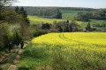
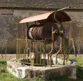
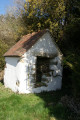
Park in the car park behind Dixmont church.
Red markings.
(S/E) On leaving the car park, turn left into Rue Saint-Protais to reach the fountain. Continue along the extension of Rue Saint-Protais, via Rue Saint-Gervais, for a few hundred metres.
Take the second street on the left, Rue du Gumery, which, further on, turns right and climbs towards a wood. Walk through this wood, passing two paths on the left, then one on the right.
(1) As you leave the woodland, ignore the path on the left and take the one on the right. At the next junction, turn left and then, after a few hundred metres, turn right in front of a small, pointed-shaped copse.
(2) Carry on, passing a path on your right, until you reach the hamlet of Grange Pourrain. The path leads out onto the road; follow this to the right for about a hundred metres.
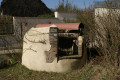
(3) At the next junction, in the square, turn right onto Rue du Puits for a few tens of metres to reach the Grange Pourrain well. Then return to the square and, after a few steps, take the path on the right. Ignore the first path on the right, continue to the left, then turn right at the next junction and follow the path for several hundred metres until it joins a road.
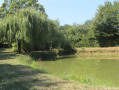
(4) Turn right onto this road, which leads to Bourbuisson. At the entrance to the hamlet, look out for the restored well opposite the pond on the left, on Route de Vaumartin. Carry on, skirting the pond on the right. Pass the first path on the left and take the second one at the place known as La Poste aux Ânes.
(5) Carry on straight ahead for several hundred metres. As you do so, you’ll pass the highest point of the walk (239 m), with the hamlet of Bourbuisson behind you, the locality known as La Renarderie on your left and Champbalai on your right.
(6) Turn right after walking alongside a large fenced-in meadow, then turn left after about a hundred metres. Join the road (the D20) and follow it to the right for a few hundred metres.
(7) Take the path on the left. After a few hundred metres, rejoin the road on the left and follow it to La Borde à La Gousse.
(8) Head straight on along the Chemin de la Forêt to reach the polishing stone.
(9) Retrace your steps back to the start of the Chemin de la Forêt at La Borde à la Gousse.
(8) Turn left onto Rue de la Chapelle, then take the Route de l’École on the left, which is unpaved beyond the old school. Follow the path to La Grande Vallée, passing a track on the right. As you pass, enjoy a lovely view of this hamlet and La Mine, a locality which is the source of drinking water for the two communes of Dixmont and Les Bordes. At the entrance to the hamlet, continue left onto the Route des Marnières until the next junction at La Grande Vallée.
(10) To see the Grande Vallée well, turn right onto the D201 and continue to number 15 on the street; the well is on your right.
(11) Retrace your steps back to the previous junction.
(10) Take the Chemin de la Billarderie on the left. After the climb, on the plateau, at the first junction, turn right and continue for a few hundred metres, passing two paths on the left. You’ll reach a four-way junction south of Grange Bertin.
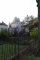
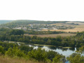
(12) Turn left onto the track that joins the D20. Leave the D20 on your right and turn left onto a grassy track, continuing whilst passing one track on your right and two tracks on your left. There’s a lovely view of the hamlet of Grange Bertin behind you and the hamlets of Les Hâtes to the left. Further down the slope, there’s a lovely view of Dixmont. You’ll reach Dixmont cemetery. Take the road on the left, opposite the entrance to the old cemetery, and follow the descent with the guardrail.
You’ll reach the car park behind the church (S/E) by passing the stone-polishing block beneath the ‘Chêne de la Libération’ (Liberation Oak), near the War Memorial.





 Tourist office

 Easy
Easy 
 Association / Club / Walk leader
 Visorando Member