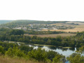
Route du Maquis de Bourgogne autour de Les Bordes

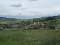
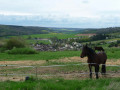
This easy walk takes you on a journey of discovery through Les Bordes and its hamlets. Above all, it allows you to step back in time to the summer of 1944, to follow in the footsteps of one of the maquis groups known as ‘Bourgogne’. This route, marked in yellow and dotted with historical information panels, recounts the attack of 3 August 1944, the lives and struggles of the maquis fighters, as well as the ‘sedentary’ resistance fighters, who were numerous in the farms, hamlets and villages.

Details

1601846
Creation:
Last update:
Last review:
  • Walking
    Activity: Walking
  • ↔
    Distance: 5.70 mi
  • ◔
    Average duration: 3h 05 
  • ▲
    Difficulty: Easy

  • ⚐
    Back to start: Yes
  • ↗
    Ascent: + 489 ft
  • ↘
    Descent: - 466 ft

  • ▲
    Highest point: 699 ft
  • ▼
    Lowest point: 371 ft

Photos

Description of the walk

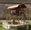
The route starts at Les Bordes, from the car park by the washhouse (next to the restaurant). You’ll find the first information board there.

Yellow markings throughout the route.

(S/E) Head right towards the crossroads, cross the D15 and take Rue de la Mairie (towards Maurepas) as far as the church.

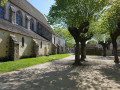
(1) At the junction by Saint-Pierre Church, turn right, walk past the church on the left, and take Rue du Cimetière, between the town hall/school and the church. At the cemetery, turn left onto the path leading uphill. Follow it to the hamlet of Le Clos Aubry. In the centre of the hamlet, read the information board (No. 8) before continuing.

(2) Take the road on the left. After a few metres, leave the road and take a grassy path leading down towards the woods (as you go, pass a dirt track on your right). At the bottom of this path, turn left and walk alongside the woods until you reach the road. Follow it to the right for about 200 metres.

(3) Turn right, then, after a few steps, turn immediately left. Join a road on the left leading to Villefroide. Pass the hamlet of Villefroide on your right and continue straight on to the hamlet of La Grange aux Malades (information board No. 7). Walk through the hamlet.

(4) On leaving the hamlet, take the path leading down to the right. After about a hundred metres, this path branches off to the right, running alongside a woodland, then follows the Val Mathieu before reaching the locality known as Le Charpentier.

(5) On reaching this locality, take the road on the right towards Clos Aubry. Walk through the hamlet, then take the first road on the left, which turns into a track after a few steps. Continue to the next junction.

(6) Turn left. Walk a few metres along the path ahead, then turn left again to head downhill to a Fork in the road. Turn right onto the path that crosses the woodland (Bois Rivière). After about one kilometre, ignore a path leading uphill to the right and carry on straight ahead.

(7) At the crossroads, turn right to reach the village of Les Bordes. Follow Rue des Chevaliers until you reach the junction with Rue de la Mairie. Turn left to return to the car park at the starting point (S/E).

Waypoints

  1. S/E : mi 0 - alt. 371 ft - Washing-up area car park (near the restaurant)
  2. 1 : mi 0.18 - alt. 384 ft - Turn right towards Rue du Cimetière
  3. 2 : mi 1.27 - alt. 646 ft - Crossroads at Clos Aubry
  4. 3 : mi 2 - alt. 453 ft - T-junction near the D27
  5. 4 : mi 3.02 - alt. 692 ft - Fork in the road at the exit of La Grange aux Malades
  6. 5 : mi 3.8 - alt. 656 ft - Crossroads at a place known as Le Charpentier
  7. 6 : mi 4.26 - alt. 614 ft - Junction after Clos Aubry
  8. 7 : mi 5 - alt. 407 ft - Junction approaching the Route de Dixmont
  9. S/E : mi 5.7 - alt. 371 ft - Lavoir car park

Notes

For your safety, please avoid using this route during the traditional hunting season from 1 October to 28 February.

Routes through woods and forests must follow rural tracks; entering any woodland (even communal woodland) is prohibited. Please take care.

Worth a visit

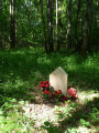
This signposted walk is marked with information boards: “In the footsteps of the Maquis Bourgogne”. This route invites you to follow in the footsteps of the Maquis fighters who set up camp in this part of the Othe Forest from January to August 1944. Indeed, two Maquis groups established themselves there and fought from that location. They belonged to different organisations but shared the same name: “Bourgogne”. The information boards allow you to discover what life was like for the Maquis fighters and Resistance members, and how they fought in the farms, hamlets and villages.

Reviews and comments

4 / 5
Based on 3 reviews

Reliability of the description
4 / 5
Ease of following the route
4 / 5
Route interest
4 / 5
MARTDomi
MARTDomi

Overall rating : 4.3 / 5

Date of your route : Sep 08, 2023
Reliability of the description : ★★★★★ Very good
Ease of following the route : ★★★★★ Very good
Route interest : ★★★☆☆ Average
Very busy route : No

A route that only takes in a few information boards. However, it is very well signposted.

Machine-translated

mic-clement
mic-clement

Overall rating : 3.3 / 5

Date of your route : Jun 15, 2020
Reliability of the description : ★★★☆☆ Average
Ease of following the route : ★★★☆☆ Average
Route interest : ★★★★☆ Good
Very busy route : No

The signposting was very patchy, and missing at a ‘junction’: no markings for 250 metres in any of the three possible directions; a poor choice – we ended up off the route (but it was still fun)

Machine-translated

Bernard 10
Bernard 10

Overall rating : 4.3 / 5

Date of your route : Mar 25, 2019
Reliability of the description : ★★★★☆ Good
Ease of following the route : ★★★★☆ Good
Route interest : ★★★★★ Very good

A lovely walk. Historically interesting. Well signposted.

Machine-translated

Other walks in the area

For more walks, use our search engine .

The GPS track and description are the property of this route's author. Please do not copy them without permission.