


Refine your search for walks in Vacherie de Longon
Vacherie de Longon walks


 Longon refuge via Mont Autcellier
 Visorando Member
 9.13 mi
 +3,153 ft
 -3,140 ft
 6h 55
6h 55
 Difficult
 Departure from Alpes-Maritimes
A challenging hike. Ascent through the superb larch forest of La Fracha. Most of the route is through forest, except for the climb to Autcellier and Pervoux.
Mont Gravières, setting off from Vignols
9.07 mi
+2,493 ft
-2,516 ft
6h 20
 Moderate
Departure from Roubion (Alpes-Maritimes)
Moderate
Departure from Roubion (Alpes-Maritimes)
Set in the Mercantour, this hike offers superb views throughout the ascent and even more so at the summit of Mont Gravières, with a breathtaking 360° panorama.
Crossing several streams is very pleasant, and the village of Vignols is rather unusual.
The walk is in open country for its entire length.
There are two options for this route: either a return trip via the same path, or a circular route descending to the Refuge de Longon.
The route map shown here is for the circular version; for those who ‘like to go off the beaten track’, the route will be a little rough around the edges on the descent to the refuge, as there are no official signposts. For those who prefer a conventional route: returning via the same route as the outward journey is recommended.
Roya - Roure
17.57 mi
+4,469 ft
-5,830 ft
12h 00
Difficult
Departure from Saint-Étienne-de-Tinée (Alpes-Maritimes)
Étape de la traversée des Alpes de Roya jusqu'à Roure. Randonnée allant de la Haute Tinée en passant par le Mercantour où l'on peut apercevoir des vautours. À l'approche du Col de Croussette un univers minéral nous attend puis un plateau quasi désertique pour finir par la douceur des pâturages de Roure.
From Roya to the Longon Refuge
 12.21 mi
+4,321 ft
-3,081 ft
9h 25
Difficult
Departure from Saint-Étienne-de-Tinée (Alpes-Maritimes)
12.21 mi
+4,321 ft
-3,081 ft
9h 25
Difficult
Departure from Saint-Étienne-de-Tinée (Alpes-Maritimes)
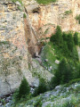
This eighteenth stage continues the traverse of the Mercantour Massif. From Roya, the GR®5 crosses the Vallon de Roya torrent, follows the Vallon de la Maïris upstream and then the Vallon de Sallevieille, before winding its way up to the Plan des Laces and then the Col de Crousette. From the pass, the path winds its way up the left-hand slope of the Vallon de la Culasse towards the Stèle Vallette, follows the ridge on the Vallon du Démant side, crosses the Baisse du Démant and descends to the Col du Refuge and then to the Col des Moulinés. It drops down to the bottom of the Vallon du Démant, crosses its torrent and, on the slope of the opposite side, meets the Vallon de la Gourgette. Above the hamlet of Vignols, it climbs beneath the ruin-like rocks of Les Chambrettes, where a colony of bearded vultures nests, and passes the small pass of Portes de Longon, then winds its way along a stream to reach the Refuge du Longon or Vacherie de Roure.
Auron – Longon dairy farm
 16.41 mi
+5,928 ft
-4,970 ft
10 hrs
16.41 mi
+5,928 ft
-4,970 ft
10 hrs
 Very difficult
Departure from Saint-Étienne-de-Tinée (Alpes-Maritimes)
Very difficult
Departure from Saint-Étienne-de-Tinée (Alpes-Maritimes)
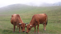
A long but beautiful stage combining the austere landscape of Mont Mounier with the green mountain pastures of Longon.Look up to watch the vultures.A gentle finish at the Vacherie de Longon, surrounded by animals.
Walks near Vacherie de Longon
From the Longon Refuge to Saint-Dalmas
 15.05 mi
+3,540 ft
-5,518 ft
10h 00
Difficult
Departure from Alpes-Maritimes
15.05 mi
+3,540 ft
-5,518 ft
10h 00
Difficult
Departure from Alpes-Maritimes
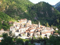
This nineteenth stage continues the long traverse of the Mercantour. From the Refuge de Longon, the path descends the Vallon du Longon diagonally across the slope to the hamlet of Rougios, before following the Fracha forest road and then taking a shortcut to the pretty Provençal village of Roure. Via a stony descent, it cuts across the hairpin bends of the M130 and M30 roads and reaches Saint-Sauveur-sur-Tinée, which it passes through before climbing up to the Chapelle Saint-Roch. Running along the hillside, it crosses the Vallon du Romarinier, passes through the hamlet of Roubinastre, crosses the Ravin de l’Esclosé and arrives at Rimplas. The GR®5 descends gently towards the small pass of Ragias and crosses the Vallon Gros, before climbing back up to the ridge on that side of the slope and then skirting the hamlet of La Bolline. From there, it climbs to the hamlet of La Roche and then ascends the ridge of the Vallon de Bramafam to reach Saint-Dalmas Valdeblore.
Roure - Saint Dalmas Valdeblore
9.54 mi
+3,261 ft
-2,657 ft
7h 15
Difficult
Departure from Alpes-Maritimes
Étape de la traversée des Alpes avec un départ de Roure jusqu'à Saint Dalmas de Valdeblore.
Randonnée allant de la vallée de la Tinée à l'arrière pays niçois.
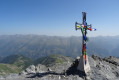
Mont Mounier as seen from the Montagne de l’Estrop
 10.63 mi
+2,703 ft
-5,919 ft
7 hrs
Very difficult
Departure from Péone (Alpes-Maritimes)
10.63 mi
+2,703 ft
-5,919 ft
7 hrs
Very difficult
Departure from Péone (Alpes-Maritimes)
This hike forms thesecond stage of the ascent of Mont Mounier.
Starting from the Montagne de l’Estrop, you’ll climb to the Col de Crousette for a beautiful view over the valley of the same name and the Haute-Tinée. You’ll then reach the Mont Mounier ridge, which you’ll follow to the summit.
The descent takes you through the hamlet of La Colle before climbing back up towards the Tête de Charnaye, then down again towards the altisurface, and finally the final descent to the Pont d’Aygue Blanche.
From the Aygue Blanche bridge to Montagne de l’Estrop
 3.69 mi
+3,209 ft
-0 ft
4h 30
Difficult
Departure from Péone (Alpes-Maritimes)
3.69 mi
+3,209 ft
-0 ft
4h 30
Difficult
Departure from Péone (Alpes-Maritimes)
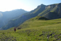
This hike is the first stage of a two-day circular route leading to the ascent of Mont Mounier.
Starting from the Pont d’Aygue Blanche near Péone, you’ll climb gradually towards the small plateau of the Montagne de l’Estrop, where you can camp in sheltered conditions. A stage through deciduous woodland and mountain pastures at the foot of the rocky ridge of the Montagne de l’Alp.
Isola 2000 – Rifugio Questa
7.19 mi
+4,163 ft
-3,159 ft
6h 55
Difficult
Departure from Isola (Alpes-Maritimes)
The first stage of a circular walk around Isola. The route starts at the top of the resort and finishes at Rifugio Questa, on the Italian side, passing by the Terre Rouge Lakes and Lake Tavels.
Saint-Dalmas de Valdeblore – Le Boréon
 12.91 mi
+4,491 ft
-3,720 ft
10 hrs
Very difficult
Departure from Valdeblore (Alpes-Maritimes)
12.91 mi
+4,491 ft
-3,720 ft
10 hrs
Very difficult
Departure from Valdeblore (Alpes-Maritimes)
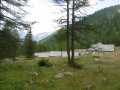
Second stage of the route and first stage on theGR®52. A long 21km stage taking in the Col de Veillos, numerous lakes, the Col du Barn, the Vacherie du Collet and the Col de Salèse, ending at a place called Le Boréon.
A spectacular stage thanks to its landscapes and views, but very difficult.
Saint-Dalmas de Valdeblore - Utelle
15.74 mi
+4,354 ft
-5,919 ft
11h 00
Difficult
Departure from Valdeblore (Alpes-Maritimes)
Étape de la traversée des Alpes de Saint-Dalmas de Valdeblore jusqu'à Utelle. Randonnée sur une ligne de crête offrant des panoramas extraordinaires sur l'arrière pays niçois.
From Saint-Dalmas to Utelle
 15.80 mi
+4,124 ft
-5,745 ft
10h 50
Difficult
Departure from Valdeblore (Alpes-Maritimes)
15.80 mi
+4,124 ft
-5,745 ft
10h 50
Difficult
Departure from Valdeblore (Alpes-Maritimes)
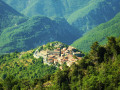
This twentieth stage marks the end of the crossing of the Mercantour Massif. From Saint-Dalmas, the GR®5 heads south to climb the steep slope towards the Cime de Colmiane, which it bypasses by heading for the Col du Varaire. It crosses the Bois Noir and reaches the Col des Deux Caïres, then the Caïre Gros. The route follows its ridge and, hugging the hillside, passes beneath Mont Chalancha, La Partissuola and the Cime de la Combe before descending to the small pass of Trous. Before the Col du Fort, the path descends to the Granges de la Brasque, crosses the upper part of the Riou du Figaret valley and arrives at the Col d’Andrion. Cutting across the hairpin bends of the M33, the GR®5 reaches the Col des Fournès and the Col de Gratteloup. Through rocky gaps, it runs alongside the Petit Brec d’Utelle and then the Brec d’Utelle. From there, the path descends towards the Crête de l’Albaréa and reaches the Col du Castel Ginesté. It crosses the slope below the ridges of the Têtes du Sac de Bécasse, Parabosquet and Les Pennes to reach the Utelle community lodge.
Rabuons Mountain Hut – Saint-Étienne de Tinée
4.93 mi
+164 ft
-4,642 ft
2h 25
Moderate
Departure from Saint-Étienne-de-Tinée (Alpes-Maritimes)
The final day is less demanding than the previous one, consisting entirely of a descent. It’s a chance to walk the ‘Chemin de l’Énergie’ one last time before a long descent to Saint-Étienne-de-Tinée.
Rabuons Refuge – Vens Refuge
 9.54 mi
+3,383 ft
-3,875 ft
7 hrs
Very difficult
Departure from Saint-Étienne-de-Tinée (Alpes-Maritimes)
9.54 mi
+3,383 ft
-3,875 ft
7 hrs
Very difficult
Departure from Saint-Étienne-de-Tinée (Alpes-Maritimes)
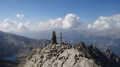
After a night at the Rabuons Mountain Hut, you’ll be ready to climb Mont Ténibre, the main highlight of this second stage. The route is challenging but you’ll be richly rewarded by the panoramic views that await you. To the south, you’ll recognise the Refuge de Rabuons and the lake; to the north and west, there are numerous lakes and the peaks on the border with Italy. After a more leisurely walk along the Chemin de l’Énergie, the scenery will become more pastoral as you approach the Lacs de Vens.
You are now in the Mercantour National Park; there are regulations to be observed, and failure to do so may result in a fine of up to €1,500 – please see the practical information.