Country:

 City:
City:


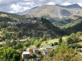
The walk starts in Vignols (see the ‘Practical Information’ section for details on access by car).
(S/E) From the car park, take the path that winds through the village and then crosses a bridge. At the start of this walk, the path is poorly marked as it runs alongside the valley, but the signposting is still easy to follow (yellow route); perhaps a previous flood has altered the terrain.
(1) At the junction, take the path on the right and you’ll then reach marker 279.
(2) Turn right, heading towards Les Portes du Longon. Cross several streams with ease, including the Gourgette.
(3) At the next junction, take the hairpin bend onto the path on the right, which leads on to the Portes du Longon plateau and marker 278.
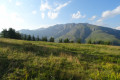
All along the plateau, you can spot numerous marmots and the surrounding landscape is unobstructed.
(4) Leave theGR®5, which heads off to the right, and take the path on the left towards the Col de la Valette. The path is regularly signposted with signs marked ‘PR®’. The climb continues up several successive mountain slopes, then passes close to larch trees.
Near a drinking trough, the path is on the left and reaches the Col de la Valette fairly quickly (it is possible to descend to Isola from the pass).
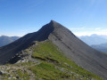
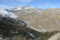
(5) From the pass, the path to the summit of Mont Gravières is clearly visible (signposted as “30 mins” to reach your destination). The path is fairly easy, alternating between scree and grassy sections.
(6) When you reach a building with a red roof, continue along the path and, after going round Mont Gravières, you’ll come to a cross, which already marks a high point, offering a stunning 360° view.
(7) The summit is a little further on, just a few metres away.
Please note: to reach the summit, you must cross and walk along a steep section of the ridge, which may be difficult for those prone to vertigo (although it does not offer any significant additional views).
There are two options for the return journey:
- You can return by following the same route back to the car park.
- To complete the circular route, there are no signposts from the summit for this descent, but the route through the fields poses no particular danger.
Head back down the side of Mont Gravières that you climbed, but do not go all the way to the pass. Return to the junction you passed earlier.
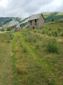
(6) When you reach a building with a red roof, cut across the field to the left. Keeping to the left, make your way back to the bed of a dry stream (watch out for stones and dead wood). You will then easily reach the mountain hut down in the valley.
(8) Then follow theGR®5to the right to reach marker 278, which you passed on the way up.
(4) Head down to Vignols via the reverse route of the outward journey to return to the starting point (S/E).

 Visorando Member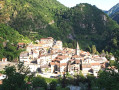
 Difficult
 Easy
Easy