Country:

 City:
City:


Yellow markings
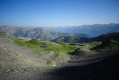
(S) From marker 92, follow the few yellow markings and cairns towards the Col de Crousette.
Please note: there is a tricky section at the first ravine. Do not hesitate to descend a few metres away from the markings and rejoin the path further on.
Head up the valley towards the pass to reach the Ravin de la Lavanche stream. You can refill your water bottles where the path crosses the stream.
Then head up the ravine on the other side of the stream, following the markings to the Col de Crousette, marker 93.
Red-and-white markings
(1) From the pass, take the GR® on the right towards Mont Mounier as far as the Stèle Vallette (a white marker). Then turn left to reach marker 48.
Yellow markings
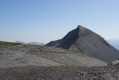
(2) Continue straight on along the ridge towards Mont Mounier. The climb is very gentle as far as Petit Mounier, then the path becomes more rugged and descends a few dozen metres towards a narrow ridge. The final ascent is a little trickier but does not present any major difficulties.
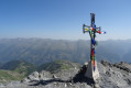
(3) At the summit, there is a stunning 360° panoramic view of the whole of the Mercantour, provided the weather is clear...
Then retrace your steps back to marker 48.
Red-and-white markings
(2) Then head down to the left towards the Col des Moulinès, following the GR®.
(4) The path climbs slightly after the Baisse du Démant before reaching marker 47.
Yellow Markings
(5) Turn right towards La Colle. The path descends gradually through a very rocky landscape. Markings are sparse, but numerous cairns indicate the way forward. After passing the Barre des Passes du Cloutet, the markings become more frequent and you will soon reach marker 44.
(6) Continue straight on towards La Colle until you reach marker 8.
(7) Turn right towards Péone, then immediately left to climb the Crête de l’Houesti. Just before entering the forest, there is a spring where you can top up your water bottles if needed.
Climb through the forest, then along the edge of the woodland to reach the Tête de Charnaye, marked by a large satellite dish.
(8) Continue along the ridge, descending along the edge of a surprising depression and continuing below the ridge. A little further on, take a path on the left down towards the helipad and the golf course.
Pass two junctions and join another signposted path just before the paragliding launch site.
(9) Turn right onto this path, which runs alongside the runway before passing just below it. Continue down a gentle slope through the forest to marker 83.
Red-and-white markings
(10) At marker 83, carry on straight ahead on the GR® towards Péone. Pass a small wayside shrine and, just after that, at marker 84, continue on the GR® heading down to the right.
Follow the red-and-white markings, crossing the road three times, then walk alongside it for a few dozen metres as you round a hairpin bend. Join the path on the left, pass another wayside shrine, cross the road one last time and finally follow it to the Pont d’Aygue Blanche (E).
 Visorando Member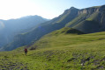
 Difficult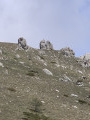
 Easy
Easy 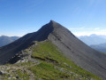
 Moderate
  Local authority