Country:

 City:
City:


Start from car park P1 on Route du Hameau, past the Pierre et Vacances holiday complex, at the foot of the Hôtel Diva, at marker 90.
(S) Walk to the end of the Route de l’Adrech de Barris and take the path that climbs to the left at marker 90A. Keep to the left until you reach marker 91, then head due east to follow the marshy area above the Belvédère ski lift. The path begins to climb up the hillside before the stream; this is the start of the Vallon de Terre Rouge.
(1) Continue along the path, cross the stream and reach a grassy clearing; the path splits into several branches – follow the sign for the Lacs de Terre Rouge (marker 92).
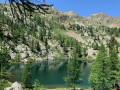
(2) When you reach the small lower lake, continue due north and walk along the northern shore of the larger of the two lakes, leaving marker 93 on your left; the path climbs up a scree slope between the summit of Tavels (south-east of the path) and Mont Malinvern (north). The climb becomes steeper at the Baisse de Druos (elevation 2,619).
(3) Continue by taking the hairpin bend on your right which leads to the summit of Tavels. Leave the Valscura lakes on your left, staying on the eastern slope of the summit of Tavels, and reach an area of large scree at the foot of a couloir leading to the Baisse de la Lause.
(4) Stay on the path heading due east to continue towards the Tête du Claus along a cairn-marked track that soon leads to the Brèche du Claus; for the time being, ignore the path on your right that descends towards Lake Tavels.
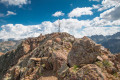
(5) The path cuts across the northern ridge of the Tête du Claus, offering a bird’s-eye view of Lac du Claus on the Italian side: many mouflons pass through this area; perhaps you’ll be lucky enough to spot one? There is no proper path, just a vague, sparsely marked trail that crosses areas of unstable scree and follows the south-eastern ridge fairly closely. This section is exposed and requires confidence – do not attempt it in strong winds or wet weather!
(6) The view from the Tête du Claus takes in the main peaks of the Mercantour, and the descent follows the same route as the ascent. There are numerous climbing routes up the southern or western slopes. Retrace your steps back to the Brèche du Claus.
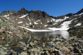
(5) Turn left (south) towards Lac Tavels, visible below, and descend – first via wide switchbacks winding down the scree, then along a ledge before dropping quite steeply down the rocky outcrops towards Lac Tavels. The landscape is very rocky until you reach the first larch trees by the lake.
(7) Go round Lake Tavels on the right, following its southern shore to enjoy the view over the valley. Head up the eastern bank, then take the well-marked path which follows a scree-covered valley heading north-east. It climbs fairly straight up towards the Pas des Portettes and reaches a narrow gully just before the pass. This whole section is a steep and stony climb.
(8) The Pas des Portettes offers a stunning view of Lake Tavels and Lake Portette; it is a windy and somewhat exposed pass. Descend north then north-east towards the mountain hut, which is visible from the pass.
After a short but rather gruelling descent – made treacherous at times by scree and rockfalls – you’ll reach the refuge, which enjoys a fabulous location on the shores of Lake Portette (E)!

 Visorando Member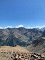
 Moderate
 Very difficult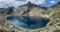
 Easy
Easy