From the Aygue Blanche bridge to Montagne de l’Estrop

This hike is the first stage of a two-day circular route leading to the ascent of Mont Mounier.
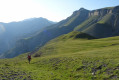
Starting from the Pont d’Aygue Blanche near Péone, you’ll climb gradually towards the small plateau of the Montagne de l’Estrop, where you can camp in sheltered conditions. A stage through deciduous woodland and mountain pastures at the foot of the rocky ridge of the Montagne de l’Alp.

This walk is part of a multi-day hike: Ascent of Mont Mounier from the Aygue Blanche bridge

Details

2248055
Creation:
Last update:
Last review:
  • Walking
    Activity: Walking
  • ↔
    Distance: 3.69 mi
  • ◔
    Average duration: 4h 30 
  • ▲
    Difficulty: Difficult

  • ⚐
    Back to start: No
  • ↗
    Ascent: + 3,209 ft
  • ↘
    Descent: - 0 ft

  • ▲
    Highest point: 7,336 ft
  • ▼
    Lowest point: 4,127 ft
  • ⚐ Country: France
  • ⚐
    Areas: Alps, Mercantour
  • ⚐ City: Péone (06470)
  • ⚑
    Start: N 44.114885° / E 6.922294°
  • ⚑
    End: N 44.139807° / E 6.940367°
  • ❏
    IGN map(s): Ref. 3540ET, 3640OT
  • Hour-by-hour weather

Photos

Description of the walk

Coming from Valberg, park just after the Aygue Blanche bridge on the left.

Yellow markings

(S) Cross the road to reach marker 85. Take the path that climbs up the right-hand bank of the Vallon d’Aygue Blanche. Continue to the end of this path at marker 91.
Carry on to the left along a narrow track. After two hairpin bends, you’ll come to a small wooden post with a yellow mark.

(1) Follow this marking as you climb the path on the right. The slope is a little steeper. Pass a few barns and a wayside shrine, then two isolated houses. Continue along this marked path to the hamlet of Septenne.

(2) At marker 90, head towards Péone via La Gombe by following the track on the left; then, after a few metres, take the path that climbs up to the right along the mountainside to marker 89.

(3) Head up to the right towards the Col de Crousette. After a long diagonal stretch, the path turns to the right. Here, you’ll find a water tap and a drinking trough should you need them.
After a second bend to the left, continue in the same direction, following the few yellow markings and cairns to reach the Crête d’Ajalet.

(4) Follow it towards the path that passes beneath a hut. Then take this track, which leads to the Montagne de l’Estrop at marker 92. (E)

Waypoints

  1. S : mi 0 - alt. 4,127 ft - Bridge of the - Aigue blanche (rivière)
  2. 1 : mi 0.79 - alt. 4,551 ft - Path on the right
  3. 2 : mi 1.85 - alt. 5,722 ft - Marker 90 – Septenne
  4. 3 : mi 2.42 - alt. 5,902 ft - Marker 89 – Towards Col de Crousette
  5. 4 : mi 3.14 - alt. 6,781 ft - Ajalet Ridge
  6. E : mi 3.69 - alt. 7,336 ft - Marker 92 – Montagne de l’Estrop

Notes

There are 2–3 water points or springs within the first third of the ascent.
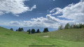
(E) On the left, you’ll find a grassy area ideal for a night’s bivouac.
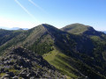
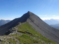
Bonus tip: If you follow the ridge to the right, you’ll reach the top of Montagne de l’Estrop, with a beautiful view of the south-western ridge of Mont Mounier.

Other walks in the area

For more walks, use our search engine .

The GPS track and description are the property of this route's author. Please do not copy them without permission.