


Refine your search for walks in Ubraye
Ubraye walks


 The summit of La Bernarde as seen from the village of Ubraye
 Visorando Member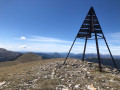
 11.29 mi
 +3,294 ft
 -3,317 ft
 8h 05
8h 05
 Difficult
 Departure from Ubraye (Alpes-de-Haute-Provence)
The ascent is gradual and straightforward. The highlight of the climb is reaching the ridges, followed by the Sommet de la Bernarde and its exceptional panoramic views of the Alpes de Hautes-Provence.
The Combe Renard circular route starting from Annot
2.67 mi
+922 ft
-912 ft
2h 00
 Easy
Departure from Annot (Alpes-de-Haute-Provence)
Easy
Departure from Annot (Alpes-de-Haute-Provence)
Follow the paths of La Colle Basse d’Annot to reach the Combe Renard Spring.
An easy hike featuring a steep climb at the start, followed by a flat forest path before beginning the descent.
(!) In winter, this section is very shaded and patches of ice may be present.
The Baou d'Annot
2.68 mi
+1,020 ft
-1,007 ft
2h 05
Easy
Departure from Annot (Alpes-de-Haute-Provence)
A short and lovely walk with a magical view of the village, oak and chestnut trees amidst sandstone boulders. Much of the route is through the cool forest.
Vérimande - Colle Basse d'Annot
8.00 mi
+2,316 ft
-2,257 ft
5h 40
 Moderate
Departure from Annot (Alpes-de-Haute-Provence)
Moderate
Departure from Annot (Alpes-de-Haute-Provence)
Discover the trails of the Colle Basse d'Annot on this route, which offers stunning views of the Baou and the Grès d'Annot. After a rewarding climb, you’ll follow the Vaïre at the end of the walk, with the chance to take a refreshing dip.
The Annot Sandstone
 3.58 mi
+1,394 ft
-1,378 ft
2h 50
Moderate
Departure from Annot (Alpes-de-Haute-Provence)
3.58 mi
+1,394 ft
-1,378 ft
2h 50
Moderate
Departure from Annot (Alpes-de-Haute-Provence)
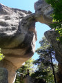
A very pretty, magical and interactive hike under oak trees, hundred-year-old chestnut trees and among huge sandstone boulders.
Most of the walk is in the cool forest.
The Grès d'Annot are world famous and are a listed and protected site.
Annot, land of chestnut trees and sandstone
 8.54 mi
+2,457 ft
-2,477 ft
6h 05
Moderate
Departure from Annot (Alpes-de-Haute-Provence)
8.54 mi
+2,457 ft
-2,477 ft
6h 05
Moderate
Departure from Annot (Alpes-de-Haute-Provence)
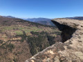
A very distinctive and unique forest.Rock formations that defy the laws of balance, dizzying cliffs and centuries-old chestnut trees. A hike that is a feast for the eyes.
Circular route from Soleilhas to Saint-Pierre Chapel
 9.06 mi
+1,811 ft
-1,814 ft
5h 45
Moderate
Departure from Soleilhas (Alpes-de-Haute-Provence)
9.06 mi
+1,811 ft
-1,814 ft
5h 45
Moderate
Departure from Soleilhas (Alpes-de-Haute-Provence)
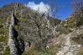
This hike on the edge of the Alpes-de-Haute-Provence offers a varied route through forests, rocky outcrops and even a riverbed. It is not particularly difficult, although some descents can be a little steep. It also gives you the opportunity to visit the pretty Saint-Pierre Chapel, tucked away in the woods.
Route de Tracastel and Clue de Saint-Auban
 4.19 mi
+1,394 ft
-1,398 ft
3h 10
Moderate
Departure from Saint-Auban (Alpes-Maritimes)
4.19 mi
+1,394 ft
-1,398 ft
3h 10
Moderate
Departure from Saint-Auban (Alpes-Maritimes)
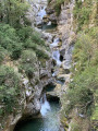
Remains of medieval Saint-Auban, breathtaking views of the mountains and a sublime finale at the edge of the Clue de Saint-Auban.
Please note that part of the route is by road.
Saint-Auban - Le Mas
 8.61 mi
+1,444 ft
-1,827 ft
5h 15
Moderate
Departure from Saint-Auban (Alpes-Maritimes)
8.61 mi
+1,444 ft
-1,827 ft
5h 15
Moderate
Departure from Saint-Auban (Alpes-Maritimes)
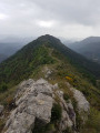
The final stage of the hike in the Haut-Estéron region; this route mainly follows tracks through the woodland before reaching the ridge of Mount Charamel, which is well worth the detour in its own right: the view is sublime. You then descend gently back down to the village of Le Mas.
Gueydan Bridge – Entrevaux via the summit of La Lette
 10.68 mi
+3,665 ft
-3,845 ft
8h 05
Difficult
Departure from Saint-Benoît (Alpes-de-Haute-Provence) (Alpes-de-Haute-Provence)
10.68 mi
+3,665 ft
-3,845 ft
8h 05
Difficult
Departure from Saint-Benoît (Alpes-de-Haute-Provence) (Alpes-de-Haute-Provence)
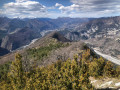
A beautiful, challenging route that keeps you on the ridgelines. The C-shaped configuration of the Var means that throughout this ascent you can admire the river’s banks on both the north and south sides. At the end of the hike, wander through the narrow streets lined with old walls in this magnificent village.
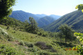
Saint-Jean du Désert as seen from Le Plan
 8.57 mi
+2,195 ft
-2,188 ft
5h 50
Moderate
Departure from Entrevaux (Alpes-de-Haute-Provence)
8.57 mi
+2,195 ft
-2,188 ft
5h 50
Moderate
Departure from Entrevaux (Alpes-de-Haute-Provence)
A lovely, mostly shaded walk, following theGR® 4 andGRP® trails of the Grande Traversée des Préalpes.
The Pic de Chamatte, starting from Vergons
 8.95 mi
+2,815 ft
-2,815 ft
6h 35
Difficult
Departure from Vergons (Alpes-de-Haute-Provence)
8.95 mi
+2,815 ft
-2,815 ft
6h 35
Difficult
Departure from Vergons (Alpes-de-Haute-Provence)
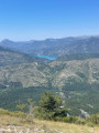
A very lovely walk leading to the Pic de Chamatte at an altitude of 1,879 metres. This walk may prove challenging due to the elevation gain for inexperienced walkers. However, there are no technical sections. Only the descent requires a sense of direction. The path, although marked on the map, is barely visible in places. From the summit, a magnificent 360° view awaits you, taking in the Mercantour, the Verdon massifs and Lac du Castillon.
The unmarked trails of the wooded ridges of the Haut-Estéron
 6.35 mi
+1,657 ft
-1,670 ft
4h 20
Moderate
Departure from Val-de-Chalvagne (Alpes-de-Haute-Provence)
6.35 mi
+1,657 ft
-1,670 ft
4h 20
Moderate
Departure from Val-de-Chalvagne (Alpes-de-Haute-Provence)
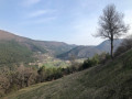
Discover a beautiful forest near Castellet Saint-Cassien. Following the ridges along unmarked paths offers a delightful way to explore this stunning Haut-Estéron National Forest.
Gars–Amirat–Briançonnet circular loop
 11.59 mi
+2,703 ft
-2,726 ft
7h 40
Difficult
Departure from Gars (Alpes-Maritimes)
11.59 mi
+2,703 ft
-2,726 ft
7h 40
Difficult
Departure from Gars (Alpes-Maritimes)
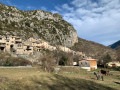
Far from the most popular trails in the Alpes-Maritimes, this walk takes you through a few small villages in the upper Estéron valley. The circular route described here also offers some lovely panoramic views of the Mercantour mountains and features a fairly varied landscape, ranging from woodland to farmland.
A long route with significant elevation gain but no technical difficulties.
Please note: there appears to be an issue regarding private property.However, there is an issue between the waymark (7) and (8). The path is now closed by the owner of the farm. You must continue via the Crête des Rochers des Côtes and then rejoin the path at the far end of the Rochers de Notre-Dame.
Circular Gars and Briançonnet loop
 6.08 mi
+1,250 ft
-1,276 ft
3h 55
Moderate
Departure from Gars (Alpes-Maritimes)
6.08 mi
+1,250 ft
-1,276 ft
3h 55
Moderate
Departure from Gars (Alpes-Maritimes)
Circular route from the village of Gars to Briançonnet. This hike takes you to the impressive Source de Gars, the birthplace of Célestin Freinet, pioneer of modern education. It is a varied route that passes through the village of Briançonnet and the ruins of its feudal castle, from where there is a beautiful view of the surrounding area. Both villages are well worth a visit for their rich heritage.
La Ferme Brûlée
 3.71 mi
+915 ft
-919 ft
2h 30
Easy
Departure from Demandolx (Alpes-de-Haute-Provence)
3.71 mi
+915 ft
-919 ft
2h 30
Easy
Departure from Demandolx (Alpes-de-Haute-Provence)
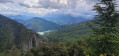
A short hike with beautiful views of the lakes of Chaudanne and Castillon, La Barre Rousse and the Crête du Teillon.
Le Teillon as seen from Peyroules
 8.72 mi
+2,949 ft
-2,956 ft
6h 35
Difficult
Departure from Peyroules (Alpes-de-Haute-Provence)
8.72 mi
+2,949 ft
-2,956 ft
6h 35
Difficult
Departure from Peyroules (Alpes-de-Haute-Provence)
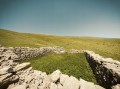
A route with a fairly steep climb, rewarding you, once at the summit, with a 360° view of the Southern Alps stretching all the way to the sea. Includes a visit to a chapel and the old village of Peyroules. Above 1,700 metres, there is no longer a clearly marked path; you’ll need to navigate using the GPX file, cairns and tracks on the ground.
Pic de l'Aiglo
 3.41 mi
+774 ft
-758 ft
2h 15
Easy
Departure from Le Mas (Alpes-Maritimes)
3.41 mi
+774 ft
-758 ft
2h 15
Easy
Departure from Le Mas (Alpes-Maritimes)
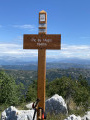
A very pleasant, easy family hike through pine forests and small meadows, ideal for a picnic in the mountains.
Pic de Fourneuby
 8.64 mi
+2,835 ft
-2,835 ft
6h 25
Moderate
Departure from Le Mas (Alpes-Maritimes)
8.64 mi
+2,835 ft
-2,835 ft
6h 25
Moderate
Departure from Le Mas (Alpes-Maritimes)
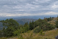
At an altitude of over 1,400 metres, this pleasant hike through the pine trees takes you on a journey of discovery through an enchanting environment. The Pic de Fourneuby overlooks the village of Le Mas and offers a 360° panorama of the foothills of the Alpes-Maritimes and neighbouring departments.